Australia Fly Guide
NSW · Tweed River

Doon Doon Creek

Imagery © Esri

info

Before you rely on this page

  • Access here has not been confirmed on the ground — treat every way in as unverified.

Doon Doon Creek is a small NSW creek with freshwater catfish recorded in it, and in our experience the reason to come is to put a fly in front of a fish few anglers target on purpose.

A dam wall cuts the creek in two. Above it sits Clarrie Hall Dam, the impoundment the creek feeds. Below it, the creek runs on as a stream to its junction with the Tweed River, the bigger river it flows into. The fishing described here is that lower stretch, from the wall down to the Tweed.

There is one trip worth planning, and it is the lower creek outside the closed months. The fish is the freshwater catfish; check where the access point on the access card sits against the dam wall, then work the deepest, slowest pools you can reach. The creek below the dam and its tributaries are closed to all fishing each year from August to October inclusive, which in practice means you plan your trips around the other nine months. In our experience catfish feed hardest in the warm months, so the early part of that window, through summer, is the time to go.

Do not plan a trip around the water above the dam wall. The closure covers only the stretch below it, and for the dam and anything above it you should take the rules from the current NSW guide.

Pack a 5 or 6 weight, a floating line with a long leader, and a handful of weighted dark flies, and read the current NSW guide and its closed-waters list before you drive out.

Water and habitat

The gradient and bank cover charts follow the creek's mapped line from its headwaters down into the dam, so read them as a picture of the creek above the wall, not of the stretch you fish below it.

In our experience a freshwater catfish is a bottom fish that likes still, deeper water with a soft or gravel floor. On a creek this size, look for the pools rather than the runs: the tail of a long pool where the current slackens, a deep hole beside a bank, or the quiet water behind a snag. Fast, shallow riffles are water to walk past.

Fish and forage

Freshwater catfish have been recorded in the creek. We would treat them as the target and anything else as a surprise.

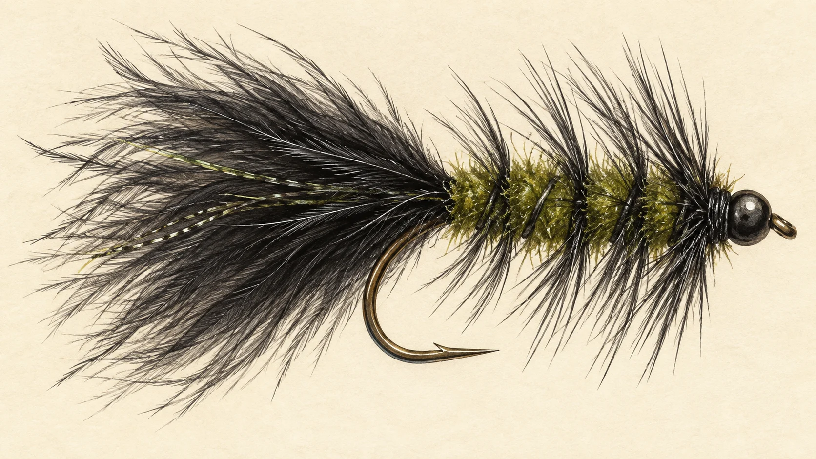
The fly selection is a guide's read. Catfish in our experience forage along the bottom, nosing through the silt and gravel for small creatures, so a fly has to get down and stay there. Carry weighted flies in dark colours, olive, brown and black, around size 6 to 10: a Woolly Bugger with a bead or cone, a simple shrimp or yabby pattern, and a heavy nymph or two.

When to fish it

The calendar starts with the closure. From August to October inclusive, the creek below the dam is closed to all fishing, so plan your trips for the rest of the year.

Within those months, in our experience catfish are most active in the warmer weather, from late spring through summer and into early autumn, and often feed best in low light, in the evening and after dark where that is allowed. In the cooler months they tend to slow down, and a trip then is a gamble. After heavy rain, give a small creek a few days to settle and clear before you bother.

How to fish it

This is slow fishing. A 5 or 6 weight rod and a floating line with a 9 to 12 foot leader will let you put a weighted fly on the bottom of most creek pools; if the pool is deep, add weight rather than change line.

Cast across and upstream into the head of a pool, let the fly sink until the leader stops moving, then crawl it back in short, slow pulls, pausing often. The take is usually a soft weight or a leader that stops, not a hit, so set on anything unusual. Work each pool thoroughly before you move, and fish the last hour of light when you can.

Access and safety

The access card names the access point. Treat it as a location, not a statement of permission, and respect any fence, sign or locked gate you meet on the ground.

As on any bush creek, tell someone where you are going and when you expect back, carry water and a small first-aid kit, and watch your footing on wet rock and soft banks. If you are fishing into the evening, take a headlamp and know your way back before the light goes.

Regulations

Under a NSW Department of Primary Industries and Regional Development closed-waters notice, Doon Doon Creek and its tributaries from the Clarrie Hall Dam wall downstream to the junction with the Tweed River are closed to fishing by all methods each year from August to October inclusive. Outside that period the notice imposes no closure. The notice does not reach the water above the dam wall. For licences, bag and size limits and the general rules on every part of the creek, read the current NSW Department of Primary Industries and Regional Development fishing guide and its closed-waters list before you fish.
1 named access site

These authority-listed points are separate from the mapped track intersections above. Some were inspected and some are public boat-ramp records; each row says which. A listing does not grant permission across private land, so check closures, signs and gates when you arrive.

  • Doon Doon Creek Inspected access site · Access mode not stated · Council Reserve

Sources: NSW Department of Primary Industries and Regional Development.

When things happen

The guide's calendar for this water

When things happen

The year on this water

A year at a glance; check current rules

  • Weighted flies on the bottom for catfish · Nov to Apr A guide's read, not a record. A dark, weighted Woolly Bugger crawled slowly along the bottom of the deeper pools is a fair first try for a catfish in the warmer months. Below the dam the creek is closed to all fishing from August to October inclusive.

What the record shows

Flows, river gradient, changing water levels, fish surveys and stocking

What the record shows

The fall of the river

Elevation along the river, source to end

Falls 100 m over 19 km, gravel bed for much of its length.

36 86 136 0 km from the source: 136 m · falling 5.6 m per km · bedrock, headwater 1 km from the source: 126 m · falling 7 m per km · gravel, occasional floodplain 2 km from the source: 110 m · falling 7.6 m per km · gravel, occasional floodplain 3 km from the source: 100 m · falling 7.8 m per km · gravel, occasional floodplain 4 km from the source: 91 m · falling 7.8 m per km · gravel, occasional floodplain 5 km from the source: 87 m · falling 6.3 m per km · gravel, occasional floodplain 6 km from the source: 79 m · falling 5.2 m per km · gravel, occasional floodplain 7 km from the source: 77 m · falling 4.5 m per km · gravel, occasional floodplain 8 km from the source: 72 m · falling 3.8 m per km · gravel, occasional floodplain 9 km from the source: 74 m · falling 3.5 m per km · gravel, occasional floodplain 10 km from the source: 61 m · falling 2.8 m per km · water storage 11 km from the source: 61 m · falling 1.8 m per km · water storage 12 km from the source: 63 m · falling 1 m per km · water storage 13 km from the source: 61 m · falling 0.6 m per km · water storage 14 km from the source: 62 m · falling 0.6 m per km · water storage 15 km from the source: 62 m · falling 2 m per km · water storage 16 km from the source: 63 m · falling 2.6 m per km · water storage 17 km from the source: 60 m · falling 3.4 m per km · water storage 18 km from the source: 49 m · falling 3.7 m per km · water storage 19 km from the source: 36 m · falling 2.9 m per km · water storage 0 km 5 km 10 km 14 km 19 km
bedrock · 5% gravel · 45% unstated · 50%
Headwater
136 m
Outlet
36 m
Typical drop
5.3 m/km
Steepest sampled stretch
7.8 m/km, near 4 km
Hover the profile for the reading at any kilometre.
Source: Geoscience Australia.
Source details and licence

Geoscience Australia — 1 second SRTM-derived DEM-H v1.0 (NCI tile store). Geoscience Australia, 1 second SRTM-derived DEM-H v1.0, © Commonwealth of Australia, CC BY 4.0. retrieved 2026-08-16.

Bed material: NSW Department of Climate Change, Energy, the Environment and Water (Water, Surface Water Science).
Source details and licence

NSW River Styles spatial dataset — geomorphic character and dominant bed material. NSW River Styles spatial dataset, © State Government of NSW and NSW Department of Climate Change, Energy, the Environment and Water 2023. retrieved 2026-08-21.

Gauge pins identify the monitoring stations. The slope shows how steeply the river falls; it does not show rapids or safe wading routes.

The banks, seen from space

Land cover in the 120 m beside the water, Landsat 2023 to 2024 to 2025

0 to 5 km: woody dense 47.5% 0 to 5 km: woody open 7.5% 0 to 5 km: herbaceous native 15.6% 0 to 5 km: cultivated 29.4% 5 to 10 km: woody dense 46.2% 5 to 10 km: woody open 22.5% 5 to 10 km: herbaceous native 16.9% 5 to 10 km: cultivated 14.4% 10 to 15 km: woody dense 56.1% 10 to 15 km: herbaceous native 6.5% 10 to 15 km: cultivated 37.4% 15 to 19.5 km: woody dense 68.7% 15 to 19.5 km: woody open 7.5% 15 to 19.5 km: woody sparse 1.3% 15 to 19.5 km: herbaceous native 7.5% 15 to 19.5 km: cultivated 15% 0 km 10 km
dense forest open woodland scattered trees and scrub native grass and heath farmed or cleared bare ground lake
Along the river itself about 63% of the bank is under trees, 13% is native grass or heath and 24% is farmed. The most wooded stretch is 15 to 19.5 km from the source; the most open is 0 to 5 km. A satellite reads the canopy, not the ground beneath it, so treat this as a read of the country, not a survey of every bank.
Source: Geoscience Australia / Digital Earth Australia.
Source details and licence

DEA Land Cover (Landsat) — Level 4 classification, continental mosaics. © Commonwealth of Australia (Geoscience Australia). DEA Land Cover (Landsat), Digital Earth Australia. retrieved 2026-08-19.

Conditions

What the gauges say

Check the water operator or jurisdiction authority for current conditions, and read the water yourself when you arrive.

Questions anglers ask

Can I fish Doon Doon Creek all year?

Not below the dam. From the Clarrie Hall Dam wall down to the Tweed River junction, the creek and its tributaries are closed to fishing by every method each year from August to October inclusive. Outside those months that notice imposes no closure, but check the current NSW guide for the general rules before you go.

What will I catch?

Freshwater catfish have been recorded in the creek, so they are the fish to plan around. Treat anything else you hook as a bonus.

Where do I start?

Check where the access point on the access card sits against the dam wall, since the closure applies below it, then fish the nearest deep, slow pool. Treat that point as a location only, and read any fence or sign on the ground.

Can I catch a catfish on fly?

You can, but it is slow, patient fishing. In our experience a weighted fly moved very slowly along the bottom of a quiet pool, late in the day, gives you the best chance.

Behind this page