Australia Fly Guide
NSW · Upper Murray River

Geehi River

Imagery © Esri

info

Before you rely on this page

  • Access here has not been confirmed on the ground — treat every way in as unverified.

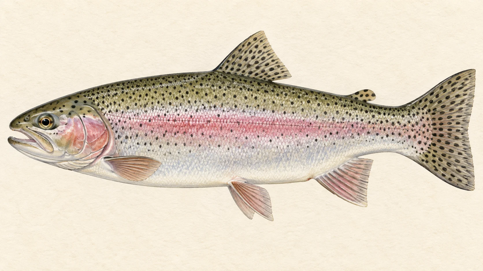
The Geehi is a rainbow trout river in the NSW high country, and by FlyLife's account there are no angler tracks along it. The reason to make the walk is rainbow trout in two very different moods.

As that account describes it, the river splits into two parts at the junction where Valentine Creek comes in. Above it is small pocket water, high up. Below it, extra flow from two side creeks turns the river into bigger, more turbulent runs. So there are two trips, and they fish differently.

Start below the junction. FlyLife's writer describes these runs as turbulent but very fishable, with a green tinge that recalls a New Zealand river. Rainbow trout are the fish. Go in summer, which the same account treats as the only sensible season, and plan to be on the water for the late afternoon. No water-specific rule was found, which in practice means you check the current NSW fishing guide for the licence and any closed season before you walk in, rather than assuming either way.

The second trip is the pocket water above the junction, for a day when you want small fish on a light rod in tight country. The account describes much of it as flanked by dead trees, so a good bet is to expect open banks and little shade. It is a summer trip too, and in our experience a slower one: getting around each pocket is most of the work, and fish in water that size tend to run smaller. Do not make the drive for the headwaters alone; fish them as the second day, once the lower river has shown you how the trout here behave.

Pick the lower runs for your first day, pack light because you will carry it all through scrub, bring a box of caddis dries, and check the gauge card before you set off.

Water and habitat

Two kinds of water, divided by the Valentine Creek junction. FlyLife's account describes the upper river as high, small pocket water; in our experience that means small plunges and short tails behind boulders, the kind of stream you fish one rock at a time. Where the trees along it are dead, the banks give little cover, so expect the fish to rely on broken water and depth for safety and to see you coming across open ground.

Below the junction, the same account says, Back Flat and Valentine creeks add their flow and the river widens into more turbulent runs. In our experience trout in water like this sit on the soft edges of the current: the seam where fast water meets slow, the cushion in front of a boulder, the slack behind it, and the tail where a run shallows before the next drop. The gradient and flow charts show the shape of the river better than words can.

Fish and forage

The fish are rainbow trout. FlyLife's writer ties the best activity to caddis and stoneflies on the wing late in the day, so those two insects set the fly box. A caddis dry, a stonefly dry that floats in rough water, and a nymph to hang under it cover most of what you need. Rainbows in fast pocket water rarely get long to decide, so an accurate, drag-free drift matters more than an exact imitation.

When to fish it

Summer. FlyLife's account treats it as a summer-only option, given the high country and the trackless scrub it describes. Within the day, the late afternoon is the time FlyLife's writer names, when caddis and stoneflies are flying. Fish the middle of the day with a nymph under a dry if you must, but save your energy and your best water for the evening. Outside summer we have no good read on it, and in our experience high streams like this are a poor bet in cold weather.

How to fish it

Travel light, because you will carry everything through scrub. A 2 or 3 weight suits the pocket water up high; a 4 weight gives you a little more control in the bigger runs below the junction. Use a floating line and a leader of around 9 feet tapered to 5X. Short casts, high rod, as little line on the water as you can manage.

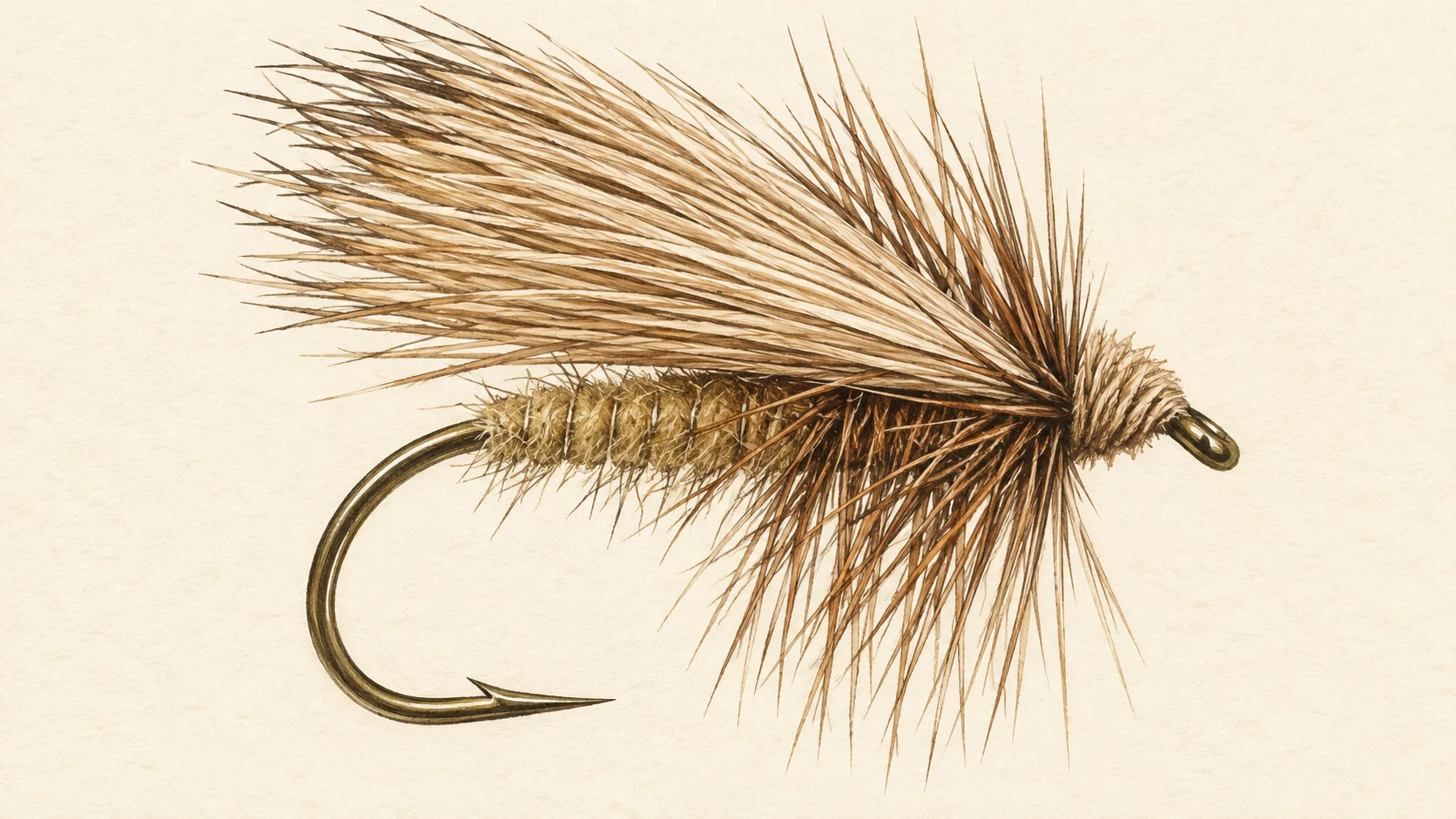
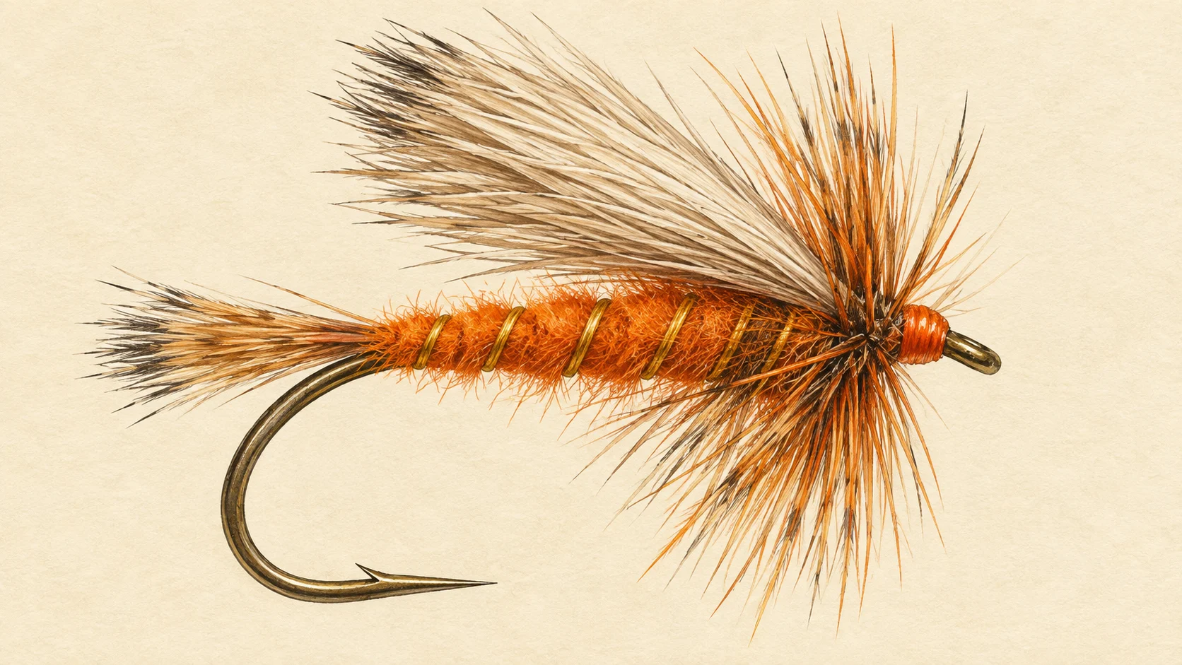
Fish upstream. Put the fly into the head of each pocket and let it ride through the seam, then move on; two or three good drifts tell you whether a fish is home. On top, an Elk Hair Caddis in size 14 to 16 for the late-afternoon caddis, and a Stimulator in size 10 to 14 as a stonefly stand-in that stays up in turbulent water. Under the Stimulator, a bead-head Hare's Ear in size 14 to 16 on a short dropper covers the fish that will not come up. As the light fades and the caddis fly, try skating the caddis dry across the tail of a run.

Access and safety

The access card names the entry points. Treat them as locations, not a statement of permission, and confirm on the ground. FlyLife's writer describes no angler tracks along the river, with the choice being to push through waist-high alpine heath and scrub or to boulder-hop close to the water. That account also recommends a deliberate approach to wading.

As on any trackless bush river, tell someone your route and when you expect to be out, carry water and a first-aid kit, and give yourself enough daylight to get back through the scrub. Wade slowly, test each step on the boulders, and stay out of the heavier runs below the junction if the gauge card shows the river up.

Regulations

No rule specific to the Geehi River was found. Check the current NSW Department of Primary Industries and Regional Development recreational fishing guide for the licence, the bag and size limits for trout and any closed season before you fish, and take those from the guide.
6 named access sites

These authority-listed points are separate from the mapped track intersections above. Some were inspected and some are public boat-ramp records; each row says which. A listing does not grant permission across private land, so check closures, signs and gates when you arrive.

Sources: NSW Department of Primary Industries and Regional Development; Transport for NSW.

When things happen

The guide's calendar for this water

When things happen

The year on this water

A year at a glance; check current rules

  • Caddis and stoneflies on the wing · Dec to Mar FlyLife's account puts the best trout activity in the late afternoon, when caddis and stoneflies are flying. Plan the walk so you are on good water for the last few hours of light.
  • Elk Hair Caddis in the evening · Dec to Mar A size 14 to 16 Elk Hair Caddis skated or dead-drifted through the pockets and seams as the light goes. A good bet whenever caddis are in the air.
  • Stimulator through the runs · Dec to Mar A size 10 to 14 Stimulator stands in for a stonefly and floats well in the broken water below the Valentine Creek junction. Hang a small nymph under it in the middle of the day.
  • Bead-head nymph in the pockets · Dec to Mar A size 14 to 16 bead-head Hare's Ear fished short behind a boulder is the fallback when nothing is on top.

What the record shows

Flows, river gradient, changing water levels, fish surveys and stocking

What the record shows

The river's year

Daily flow at Geehi River above Geehi Reservoir, every year 1963 to 2026

0.5 1 2 5 10 20 typical range high-flow mark Jan Feb Mar Apr May Jun Jul Aug Sep Oct Nov Dec m³/s
63 years of the gauge, week by week. The dark band is the middle half of all years, the pale band nine years in ten, the line the median. The shaded strip is the typical range: the band the river sits in about half of all days. In a typical year the river sits in it from late March to mid August, and runs higher than that from mid August to mid November. Whether a given day is one to wade is a call made at the bank, not a reading off this chart. Median flow peaks in early October and bottoms out in mid March.
Source: Bureau of Meteorology.
Source details and licence

Bureau of Meteorology — Water Data Online series catalogue (Snowy/Monaro stations). Bureau of Meteorology, © Commonwealth of Australia. Licensed from the Commonwealth of Australia under a Creative Commons Attribution 4.0 International licence. retrieved 2026-08-12.

How often it runs this high

16,526 days at Geehi River above Geehi Reservoir, 1963 to 2026

0.5 1 2 5 10 20 50 typical range 1.018 to 5.064 m³/s high-flow mark 10.776 m³/s 0% of days 25% of days 50% of days 75% of days 100% of days m³/s
Read it left to right: the river runs above the flow on the left edge almost never, and above the flow on the right edge almost always. Half of all days sit below 3.3 m³/s. The shaded band is the typical range, where it sits about half the time; it runs higher than that one day in three and above the high-flow mark about one day in seven. These are frequency bands drawn from the record, not a measured limit — judge the water when you get there.
Source: Bureau of Meteorology.
Source details and licence

Bureau of Meteorology — Water Data Online series catalogue (Snowy/Monaro stations). Bureau of Meteorology, © Commonwealth of Australia. Licensed from the Commonwealth of Australia under a Creative Commons Attribution 4.0 International licence. retrieved 2026-08-12.

The fall of the river

Elevation along the river, source to end

Falls 1455 m over 52 km, bedrock bed, confined gorges for much of its length.

434 1,161 1,889 gauge 401560 0 km from the source: 1889 m · falling 9.9 m per km · bedrock, headwater 1 km from the source: 1810 m · falling 14.4 m per km · bedrock, headwater 2 km from the source: 1791 m · falling 12.8 m per km · fine-grained, discontinuous floodplain 3 km from the source: 1783 m · falling 11.5 m per km · fine-grained, discontinuous floodplain 4 km from the source: 1778 m · falling 11.1 m per km · fine-grained, discontinuous floodplain 5 km from the source: 1772 m · falling 7.3 m per km · fine-grained, discontinuous floodplain 6 km from the source: 1770 m · falling 9.2 m per km · bedrock, gorge 7 km from the source: 1758 m · falling 12.9 m per km · fine-grained, discontinuous floodplain 8 km from the source: 1752 m · falling 17.8 m per km · fine-grained, discontinuous floodplain 9 km from the source: 1736 m · falling 24 m per km · bedrock, gorge 10 km from the source: 1693 m · falling 30.6 m per km · bedrock, gorge 11 km from the source: 1663 m · falling 35.5 m per km · bedrock, gorge 12 km from the source: 1630 m · falling 39.5 m per km · bedrock, gorge 13 km from the source: 1584 m · falling 40.4 m per km · bedrock, gorge 14 km from the source: 1527 m · falling 38.5 m per km · bedrock, gorge 15 km from the source: 1488 m · falling 37 m per km · bedrock, gorge 16 km from the source: 1456 m · falling 36.6 m per km · bedrock, gorge 17 km from the source: 1444 m · falling 36.7 m per km · bedrock, gorge 18 km from the source: 1413 m · falling 37.5 m per km · bedrock, gorge 19 km from the source: 1351 m · falling 37.8 m per km · bedrock, gorge 20 km from the source: 1289 m · falling 34.5 m per km · bedrock, gorge 21 km from the source: 1267 m · falling 29.9 m per km · bedrock, gorge 22 km from the source: 1257 m · falling 26.1 m per km · bedrock, gorge 23 km from the source: 1232 m · falling 23.8 m per km · gravel, occasional floodplain 24 km from the source: 1218 m · falling 23.5 m per km · bedrock, gorge 25 km from the source: 1194 m · falling 25 m per km · bedrock, gorge 26 km from the source: 1156 m · falling 26.8 m per km · bedrock, gorge 27 km from the source: 1121 m · falling 26.9 m per km · bedrock, gorge 28 km from the source: 1106 m · falling 26.4 m per km · water storage 29 km from the source: 1091 m · falling 26.5 m per km · water storage 30 km from the source: 1047 m · falling 26 m per km · bedrock, gorge 31 km from the source: 1018 m · falling 25.3 m per km · bedrock, gorge 32 km from the source: 1004 m · falling 26.5 m per km · bedrock, gorge 33 km from the source: 977 m · falling 27.1 m per km · bedrock, gorge 34 km from the source: 954 m · falling 30.3 m per km · bedrock, gorge 35 km from the source: 924 m · falling 36.5 m per km · bedrock, gorge 36 km from the source: 876 m · falling 42 m per km · bedrock, gorge 37 km from the source: 863 m · falling 45.9 m per km · bedrock, gorge 38 km from the source: 776 m · falling 48 m per km · bedrock, gorge 39 km from the source: 707 m · falling 44.4 m per km · bedrock, gorge 40 km from the source: 673 m · falling 38.3 m per km · bedrock, gorge 41 km from the source: 657 m · falling 33.8 m per km · bedrock, gorge 42 km from the source: 619 m · falling 28.6 m per km · bedrock, gorge 43 km from the source: 601 m · falling 25.3 m per km · bedrock, gorge 44 km from the source: 579 m · falling 25 m per km · bedrock, gorge 45 km from the source: 543 m · falling 24.5 m per km · bedrock, gorge 46 km from the source: 519 m · falling 22.4 m per km · bedrock, gorge 47 km from the source: 510 m · falling 20.8 m per km · bedrock, gorge 48 km from the source: 478 m · falling 18.5 m per km · bedrock, gorge 49 km from the source: 459 m · falling 14.1 m per km · gravel 50 km from the source: 448 m · falling 10.5 m per km · gravel 51 km from the source: 441 m · falling 8.8 m per km · gravel 52 km from the source: 434 m · falling 5.6 m per km · gravel 0 km 13 km 26 km 39 km 52 km
bedrock · 75% gravel · 9% fine-grained · 11% unstated · 4%
Headwater
1889 m
Outlet
434 m
Typical drop
28 m/km
Steepest sampled stretch
48 m/km, near 38 km
Hover the profile for the reading at any kilometre.
Source: Geoscience Australia.
Source details and licence

Geoscience Australia — 1 second SRTM-derived DEM-H v1.0 (NCI tile store). Geoscience Australia, 1 second SRTM-derived DEM-H v1.0, © Commonwealth of Australia, CC BY 4.0. retrieved 2026-08-16.

Bed material: NSW Department of Climate Change, Energy, the Environment and Water (Water, Surface Water Science).
Source details and licence

NSW River Styles spatial dataset — geomorphic character and dominant bed material. NSW River Styles spatial dataset, © State Government of NSW and NSW Department of Climate Change, Energy, the Environment and Water 2023. retrieved 2026-08-21.

Gauge pins identify the monitoring stations. The slope shows how steeply the river falls; it does not show rapids or safe wading routes.

The banks, seen from space

Land cover in the 120 m beside the water, Landsat 2023 to 2024 to 2025

0 to 5 km: woody dense 7.5% 0 to 5 km: woody open 91.9% 0 to 5 km: cultivated 0.6% 5 to 10 km: woody dense 3.8% 5 to 10 km: woody open 93.1% 5 to 10 km: herbaceous native 3.1% 10 to 15 km: woody dense 16.3% 10 to 15 km: woody open 83.1% 10 to 15 km: woody sparse 0.6% 15 to 20 km: woody dense 27.5% 15 to 20 km: woody open 66.9% 15 to 20 km: woody sparse 5.6% 20 to 25 km: woody dense 56.9% 20 to 25 km: woody open 43.1% 25 to 30 km: woody dense 57.3% 25 to 30 km: woody open 32.7% 25 to 30 km: herbaceous native 3.6% 25 to 30 km: cultivated 6.4% 30 to 35 km: woody dense 72.5% 30 to 35 km: woody open 27.5% 35 to 40 km: woody dense 84.9% 35 to 40 km: woody open 13.8% 35 to 40 km: cultivated 1.3% 40 to 45 km: woody dense 71.3% 40 to 45 km: woody open 28.7% 45 to 50 km: woody dense 65.6% 45 to 50 km: woody open 34.4% 50 to 52.5 km: woody dense 51% 50 to 52.5 km: woody open 49% 0 km 10 km 20 km 30 km 40 km 50 km
dense forest open woodland scattered trees and scrub native grass and heath farmed or cleared bare ground lake
Along the river itself about 99% of the bank is under trees, 1% is native grass or heath and 1% is farmed. The most wooded stretch is 15 to 20 km from the source; the most open is 25 to 30 km.
Source: Geoscience Australia / Digital Earth Australia.
Source details and licence

DEA Land Cover (Landsat) — Level 4 classification, continental mosaics. © Commonwealth of Australia (Geoscience Australia). DEA Land Cover (Landsat), Digital Earth Australia. retrieved 2026-08-19.

How well this water has been surveyed

9 capture records, 1 decade of 1 on file

0 2 4 6 8 10 2010s: 8 capture records 2010s: 1 capture record 2010s
electrofishing (backpack), 8 records trapping, 1 record
Capture records by decade — electrofishing, netting, trapping and rotenone surveys only; a sighting, an eDNA water sample or a stocking release is not a capture and is not counted here. A record is not an abundance estimate, and a decade with no bar is a decade with no capture survey on file, not evidence the water was empty.
Source: Atlas of Living Australia.
Source details and licence

Atlas of Living Australia — freshwater fish occurrence records (open licences, with coordinates). Occurrence records from the Atlas of Living Australia and its contributing datasets, including the Victorian Biodiversity Atlas, NSW BioNet Atlas, Sustainable Rivers Audit, Murray-Darling Basin fish monitoring programs, OZCAM museum collections and iNaturalist Australia. Each record carries its own licence and originating dataset. retrieved 2026-08-13.

Conditions

What the gauges say

Geehi River above Geehi Reservoir

River flow

No reading shown: The organisation supplying this gauge (Snowy Hydro Limited) has not licensed its readings for republication (licence restricted).

Gauge height

No reading shown: The organisation supplying this gauge (Snowy Hydro Limited) has not licensed its readings for republication (licence restricted).

Readings from the Bureau of Meteorology's Water Data Online, © Commonwealth of Australia, licensed CC BY 4.0. Nothing here is a forecast. Check the gauge before you rely on it.

Weather

What the sky is doing

Live weather for Geehi River above Geehi Reservoir loads here. If it does not, check the Bureau of Meteorology forecast before you go.

Weather data by Open-Meteo.com

Questions anglers ask

Is there a track along the river?

FlyLife's writer says there is not. The account describes pushing through waist-high heath and scrub or boulder-hopping along the edge. Plan the day around that pace.

When should I go?

Summer. The same account treats the river as a summer-only option, and names the late afternoon, with caddis and stoneflies flying, as the best time to have a fly on the water.

Do I need a licence, and is there a closed season?

No water-specific rule was found for the Geehi River. Check the current NSW Department of Primary Industries and Regional Development fishing guide for the licence, limits and any closed season before you fish, and take those from the guide.
What rod should I bring?

A 2 or 3 weight for the pocket water up high, which is what FlyLife's writer suggests. If you plan to fish the bigger runs lower down, a 4 weight handles the heavier current better in our experience.

Behind this page