Australia Fly Guide
NSW · Hunter River

Pages River

Imagery © Esri

info

Before you rely on this page

  • Access here has not been confirmed on the ground — treat every way in as unverified.

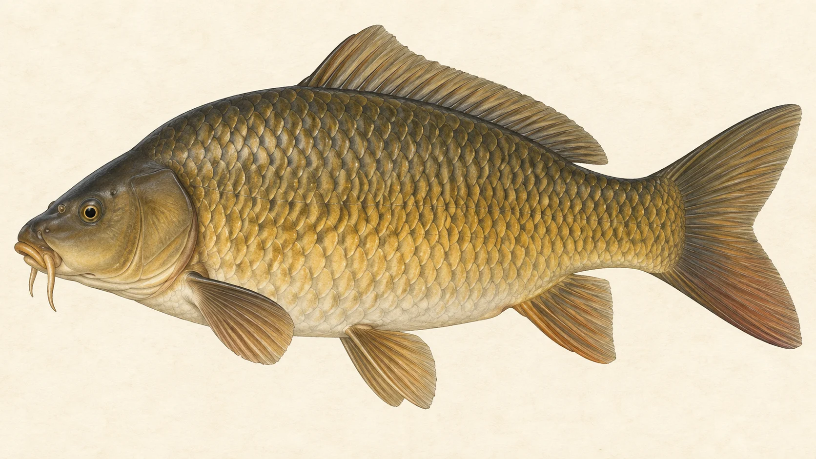
The Pages River is a NSW river that runs into the Hunter, and the reason to bring a fly rod is carp: they are the obvious fly target on its recorded fish list, and a carp that tips down on a nymph in slow, clear water will test your casting and your nerve.

Picture it as a single tributary whose bottom end is its junction with the Hunter River. The decision is which access point to start from, and the access card lists them. The flow chart shows how the river usually runs through the year, and in our experience it tells you more about planning a day than any map.

The easiest trip, and the one to start with, is a warm-weather carp session. Pick an access point, then walk the banks looking before you cast: tails in the shallows, fish cruising a slow edge, puffs of mud where something is feeding. No water-specific rule was found for the Pages, which in practice means your season, limits and licence come straight from the current NSW fishing guide, so read it first.

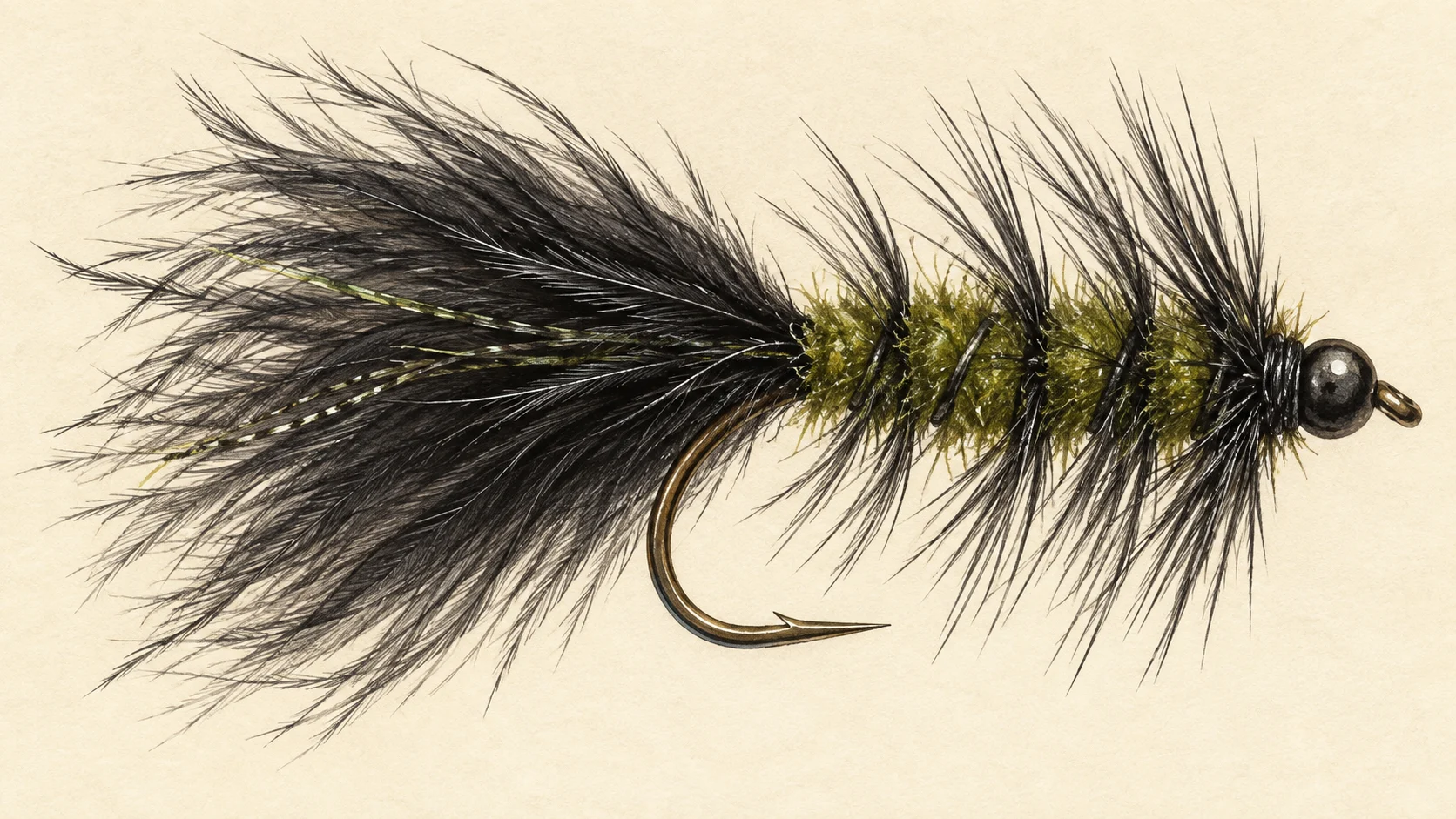
The second trip is slower and less certain: freshwater catfish. They have been recorded in the river, and in our experience they feed along the bottom of the deeper, quieter pools, often late in the day. A small dark fly crawled along the bottom there is a fair gamble, and if you hook one, check the NSW guide on what you may keep, and put it back if in any doubt.

Longfin eels, goldfish, Cox's gudgeon, Australian smelt and eastern gambusia make up the rest of the list. None is a fly target, though the small ones tell you what the bigger fish are eating.

Pack a 6 weight, a handful of small weighted nymphs and a few small dark streamers, check the flow chart and the live conditions card, and read the NSW fishing guide before you leave home.

Water and habitat

The Pages gathers its water and delivers it to the Hunter River. The flow chart shows its usual pattern across the year, and the chart beside it breaks that flow down week by week, which is a fair guide to when the river is low and clear or up after rain.

In our experience, carp in a river like this sit wherever the current eases: the slow margins of pools, flats below a bend, soft water behind a snag or a fallen tree. They feed with their heads down, so the water you want to look into is shallow, slow and clear enough to show a tail or a cloud of mud. Catfish are a deeper-water fish by habit, so the bottom of the bigger, quieter pools is where to try for one.

Fish and forage

Fish records for the Pages list seven species. European carp are the main fly target, and goldfish, their smaller cousins, turn up too. Freshwater catfish are the native worth hoping for. Longfin eels live in the river but are not a fly fish. Cox's gudgeon, Australian smelt and eastern gambusia are the small fish.

For the fly box, that means two kinds of food. Carp and catfish both feed mostly on the bottom, on small insects, snails, shrimp and whatever they root out of the mud, so small weighted nymphs in dull, muddy colours and olives are the core. The small fish give you a reason to carry a slim, dark streamer as well. The survey chart shows how lightly the river has been sampled, so read the list as a starting point rather than every fish that lives there.

When to fish it

In our experience, carp fishing on a NSW river is a warm-weather game. From late spring through summer and into early autumn, carp feed more openly and move into shallow water where you can see them. Mornings and still, bright days make spotting easier; late afternoon into dusk is the better window for a catfish. In the cold months carp slow down and hold deeper, and sight-fishing gets hard. Whatever the month, check the flow chart and the live conditions card before you leave. After heavy rain, give the river time to drop and clear, because you cannot fish to a carp you cannot see.

How to fish it

Walk slowly, keep low and look before you cast. A 6 weight rod, a floating line and a leader of about 9 feet down to 3X or 4X tippet will handle a carp without spooking it, and has enough backbone for a catfish.

When you find a feeding carp, drop a small weighted nymph, size 10 to 14, a little ahead of it and let it sink into its path. Carp pick food up gently, so watch the fish rather than the line: if it tips down or stops over the fly, lift. A cast that lands on a fish's head scatters it; a short, soft cast from behind and to one side works better. In the deeper pools where you cannot see into the water, a small dark Woolly Bugger crawled slowly along the bottom is a reasonable way to search, and it is the fly most likely to find you a catfish.

Access and safety

The access card names the access points. Treat them as locations, not a statement of permission, and respect any fence or sign you meet on the ground.

As on any bush river, tell someone where you are going and when you expect to be back, carry water and a small first-aid kit, and watch your footing on muddy or undercut banks. Keep an eye on the weather: a river can rise quickly after rain upstream, so check the live conditions card and never wade a crossing you are unsure of.

Regulations

No water-specific rule was found for the Pages River. Before you fish, read the current NSW Department of Primary Industries and Regional Development recreational fishing guide, including what it says about licences, bag and size limits, protected species, closed seasons and closed waters, and take the rules from it.
8 named access sites

These authority-listed points are separate from the mapped track intersections above. Some were inspected and some are public boat-ramp records; each row says which. A listing does not grant permission across private land, so check closures, signs and gates when you arrive.

  • Allan Bridge Inspected access site · 2WD · Public Road
  • Glenbawn Road Authority-listed access site · 2WD · Public Road
  • Gundy Bridge Authority-listed access site · 2WD · Public Road
  • Gundy Oval Authority-listed access site · 2WD · Council reserve
  • Gundy Rec Ground Authority-listed access site · 2WD · Council Reserve
  • Haydons Lane Authority-listed access site · 2WD · Public Road
  • Leighton Road Authority-listed access site · 2WD · Public Road
  • Miranee Road Authority-listed access site · 2WD · Public Road

Sources: NSW Department of Primary Industries and Regional Development.

When things happen

The guide's calendar for this water

When things happen

The year on this water

A year at a glance; check current rules

  • Sight-fishing carp in the warm months · Nov to Mar A guide's read, not a record. Carp tend to feed most openly in warm weather, so look for tailing and cruising fish on the slow, shallow edges and put a small weighted nymph in front of them.
  • Small fish along the edges · Jan to Dec Australian smelt, Cox's gudgeon and small goldfish have been recorded in the river. A small, dark streamer fished slowly covers them.
  • Read the flow before you drive · Jan to Dec The flow chart shows how the river usually runs across the year. Check the live conditions card on the day, and give the river time to drop and clear after heavy rain.

What the record shows

Flows, river gradient, changing water levels, fish surveys and stocking

What the record shows

The river's year

Daily flow at Pages River U/s Kewell Creek, every year 2004 to 2026

0.05 0.1 0.2 0.5 1 2 5 high-flow mark Jan Feb Mar Apr May Jun Jul Aug Sep Oct Nov Dec m³/s
22 years of the gauge, week by week. The dark band is the middle half of all years, the pale band nine years in ten, the line the median. Median flow peaks in late July and bottoms out in mid March.
Source: Bureau of Meteorology.
Source details and licence

Bureau of Meteorology — Water Data Online series catalogue (Snowy/Monaro stations). Bureau of Meteorology, © Commonwealth of Australia. Licensed from the Commonwealth of Australia under a Creative Commons Attribution 4.0 International licence. retrieved 2026-08-12.

How often it runs this high

7,875 days at Pages River U/s Kewell Creek, 2004 to 2026

0.05 0.1 0.2 0.5 1 2 5 10 20 high-flow mark 1.114 m³/s 0% of days 25% of days 50% of days 75% of days 100% of days m³/s
Read it left to right: the river runs above the flow on the left edge almost never, and above the flow on the right edge almost always. Half of all days sit below 0.1 m³/s.
Source: Bureau of Meteorology.
Source details and licence

Bureau of Meteorology — Water Data Online series catalogue (Snowy/Monaro stations). Bureau of Meteorology, © Commonwealth of Australia. Licensed from the Commonwealth of Australia under a Creative Commons Attribution 4.0 International licence. retrieved 2026-08-12.

How well this water has been surveyed

1 capture records, 1 decade of 1 on file

0 1 2010s: 1 capture record 2010s
electrofishing (backpack), 1 record
Capture records by decade — electrofishing, netting, trapping and rotenone surveys only; a sighting, an eDNA water sample or a stocking release is not a capture and is not counted here. A record is not an abundance estimate, and a decade with no bar is a decade with no capture survey on file, not evidence the water was empty.
Source: Atlas of Living Australia.
Source details and licence

Atlas of Living Australia — freshwater fish occurrence records (open licences, with coordinates). Occurrence records from the Atlas of Living Australia and its contributing datasets, including the Victorian Biodiversity Atlas, NSW BioNet Atlas, Sustainable Rivers Audit, Murray-Darling Basin fish monitoring programs, OZCAM museum collections and iNaturalist Australia. Each record carries its own licence and originating dataset. retrieved 2026-08-13.

Conditions

What the gauges say

Pages River at Gundy Recorder

River flow

No reading shown: No reading has been captured for this gauge yet, so none is shown.

Gauge height

No reading shown: No reading has been captured for this gauge yet, so none is shown.

Pages River at Blandford (Bickham)

River flow

No reading shown: No reading has been captured for this gauge yet, so none is shown.

Gauge height

No reading shown: No reading has been captured for this gauge yet, so none is shown.

Pages River U/s Kewell Creek

River flow

No reading shown: No reading has been captured for this gauge yet, so none is shown.

Gauge height

No reading shown: No reading has been captured for this gauge yet, so none is shown.

Readings from the Bureau of Meteorology's Water Data Online, © Commonwealth of Australia, licensed CC BY 4.0. Nothing here is a forecast. Check the gauge before you rely on it.

Weather

What the sky is doing

Live weather for Pages River U/s Kewell Creek loads here. If it does not, check the Bureau of Meteorology forecast before you go.

Weather data by Open-Meteo.com

Questions anglers ask

What will I catch on a fly?

Fish records list European carp, freshwater catfish, longfin eels, goldfish, Cox's gudgeon, Australian smelt and eastern gambusia in the river. Carp are the fish to plan a fly trip around. A catfish is a possible bonus on a fly crawled along the bottom. The rest are small fish or eels, and not what you came for.

Is there a closed season or a bag limit?

No water-specific rule was found for the Pages. Read the current NSW Department of Primary Industries and Regional Development fishing guide before you fish, and take any season, bag and size limits, protected species and licence requirements from it.

Where do I get in?

The access card names the access points. Treat them as locations only, and respect any fence or sign you meet on the ground.

When is it worth the drive?

In our experience, warm settled weather with clear water. Check the flow chart and the live conditions card before you go, and leave it for another day if the river is up and coloured.

Behind this page