Australia Fly Guide
NSW · Hawkesbury River

Hollanders River

Imagery © Esri

info

Before you rely on this page

  • Access here has not been confirmed on the ground — treat every way in as unverified.

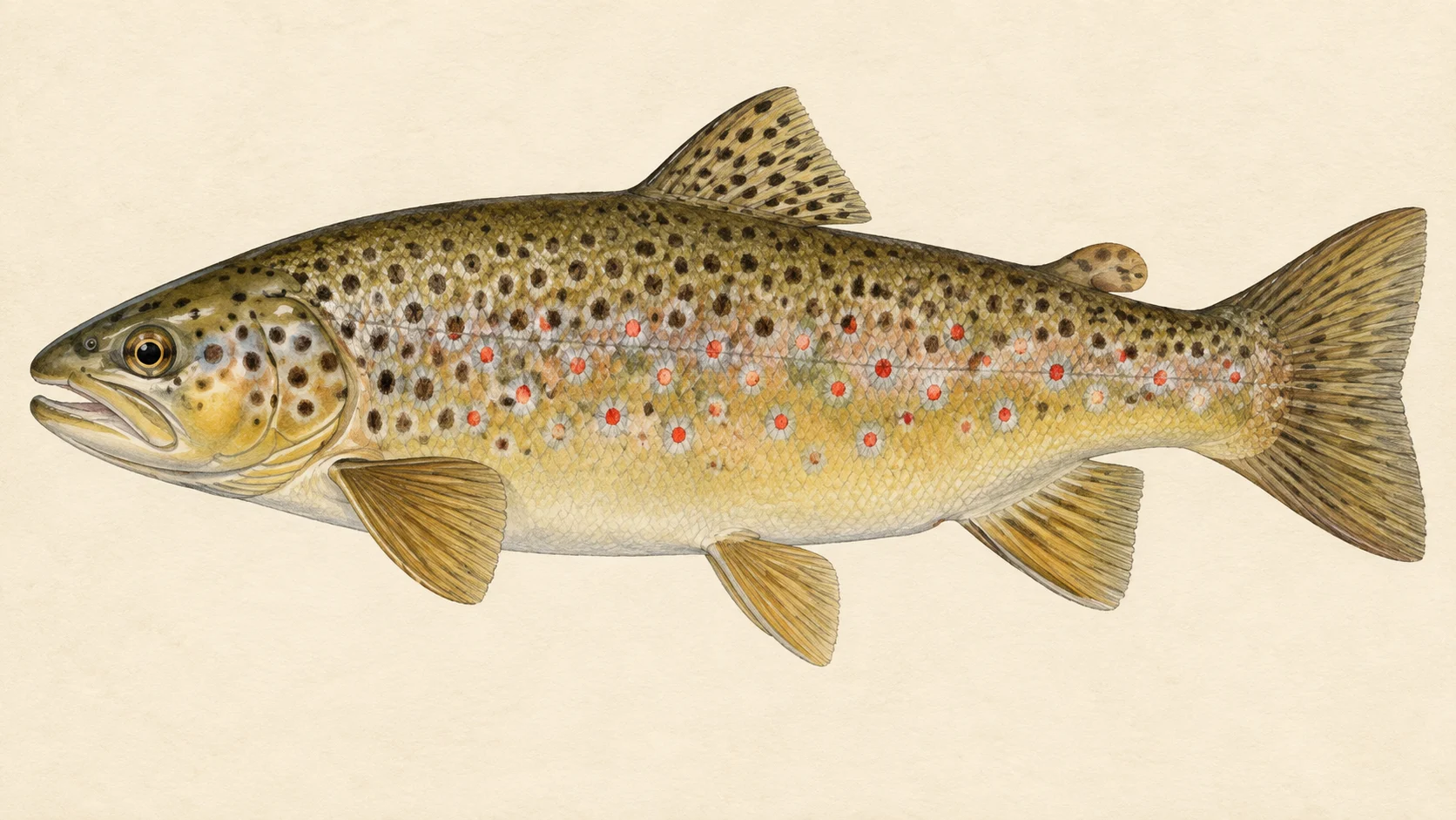
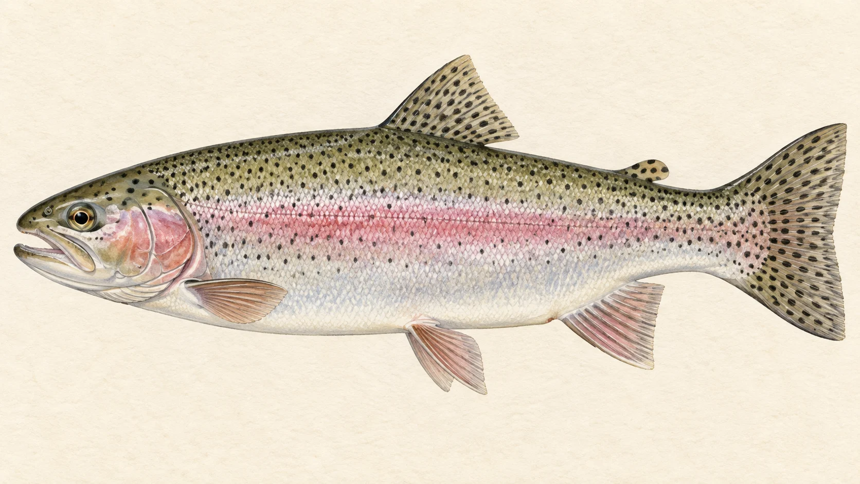
The Hollanders River is small, remote trout water on the edge of Kanangra-Boyd National Park, and the reason to make the effort is simple: it is described as holding many small brown and rainbow trout, and in our experience few people go to the trouble of reaching water this remote.

Think of it as a headwater stream with one clear end. It runs down to a junction with another small river, the Tuglow, and at that meeting the two become the Kowmung. Everything above that junction is the Hollanders.

There is really one trip here, and it is a hard one. The described way in leaves Kanangra Walls Road on a fire trail whose gate may be locked, follows it along the tops, then drops down a spur to the river. Access is described as very limited because the country is rough and remote. Go in the warmer months, when small trout look up, and plan the whole day around the walk out rather than the fishing.

No water-specific rule was found for the Hollanders, so check the current NSW DPIRD freshwater guide for season, bag and licence before you commit to the drive.

If a spur descent for small wild fish sounds like your kind of day, read the access notes below and check current park conditions before you set out.

Water and habitat

This is headwater country: a narrow stream in national park country, gathering itself before it meets the Tuglow. The gradient chart shows how the bed falls along its length. On a stream like this, expect a run of short pools, pocket water behind boulders and shallow riffles rather than long glides. Trout sit at the heads of pools where the current delivers food, tucked against the seam beside the fast water, and under any overhanging bank that gives them shade.

The bank cover chart gives a sense of how closed-in the stream is. Where the timber comes down to the water, expect tight casting and fish that hold close to cover.

Fish and forage

The river is described as holding many small brown and rainbow trout, and brown trout have been recorded here. Fish in a stream this size are opportunists. In our experience they take mayfly and caddis nymphs through the day and anything that falls off the bank in summer: beetles, ants and the occasional grasshopper. That makes fly choice easy. A general-purpose dry and a small nymph cover almost everything, and you rarely need to match a hatch exactly.

When to fish it

The warm months are the obvious window, roughly late spring through early autumn, when small trout feed on the surface and the days are long enough for the walk in and out. Early and late in that window, cooler water tends to keep fish on nymphs through the middle of the day. Whatever the month, check the current NSW DPIRD freshwater guide before you plan a trip for any season that applies.

As on any small mountain stream, stay off it after heavy rain: water like this can rise and colour fast, and a spur descent is no place to be caught by a change in weather.

How to fish it

Travel light and fish upstream. A 7 to 8 foot rod for a 3 or 4 weight line is plenty, with a short leader tapering to 5X or 6X. Wade slowly and keep low, because small-stream fish spook at a shadow before they see a fly.

A good bet is a dry-dropper: a size 12 to 14 high-floating dry with a size 16 beadhead nymph hung a short way below. Put it on the seam at the head of each pool, then the pocket behind every decent rock, and move on after a few casts. In our experience, fish in lightly fished water rarely need a second look. When nothing rises, lose the dry and drift the nymph alone through the deeper water. In summer, a small foam beetle dropped tight under the overhanging banks is worth a try.

Access and safety

The route described by local writers runs from Kanangra Walls Road onto the Mount Emperor Fire Trail. That trail becomes the Ben Lomond Fire Trail, and from there you go down Hughes Spur to the river. The fire trail gate may be locked. Access overall is described as very limited because of the rough, remote terrain. The access card names the sites that are known. None of this is permission to use a particular track; check current closures and conditions with NSW National Parks before you set out.

As on any remote bush river, tell someone your route and your return time, carry water, a map and a way to call for help, and leave enough daylight and energy for the climb back up the spur.

Regulations

No water-specific rule was found for the Hollanders River. Before you fish, check the current NSW Department of Primary Industries and Regional Development freshwater fishing guide for the trout season, bag and size limits, gear rules and the licence you need.
2 named access sites

These authority-listed points are separate from the mapped track intersections above. Some were inspected and some are public boat-ramp records; each row says which. A listing does not grant permission across private land, so check closures, signs and gates when you arrive.

  • Bastard Point Authority-listed access site · 4WD · State Forest
  • Lanes Yards Inspected access site · 4WD · Public Reserve

Sources: NSW Department of Primary Industries and Regional Development.

When things happen

The guide's calendar for this water

When things happen

The year on this water

A year at a glance; check current rules

  • Dry-dropper through the warm months · Nov to Mar A guide's read, not a record. On a narrow headwater, a buoyant dry with a small beadhead under it covers every pocket without a fly change.
  • Small nymphs on cool days · Sep to May A guide's read, not a record. When nothing shows on top, a lightly weighted size 14 to 16 nymph through the heads of the pools is a good bet on any small trout stream.
  • Terrestrials under the timber · Dec to Mar A guide's read, not a record. On shaded bush water, beetles and ants falling from the bank vegetation are often what a summer fish is waiting for.

What the record shows

Flows, river gradient, changing water levels, fish surveys and stocking

What the record shows

The fall of the river

Elevation along the river, source to end

Falls 401 m over 24 km, bedrock bed, confined gorges for much of its length.

941 1,141 1,342 0 km from the source: 1342 m · falling 19.2 m per km 1 km from the source: 1277 m · falling 25.9 m per km · bedrock, headwater 2 km from the source: 1230 m · falling 27.3 m per km · bedrock, headwater 3 km from the source: 1202 m · falling 29.6 m per km · bedrock, headwater 4 km from the source: 1173 m · falling 31.6 m per km · gravel, occasional floodplain 5 km from the source: 1145 m · falling 27.9 m per km · bedrock, gorge 6 km from the source: 1119 m · falling 24.8 m per km · bedrock, gorge 7 km from the source: 1082 m · falling 22.3 m per km · bedrock, gorge 8 km from the source: 1073 m · falling 19.3 m per km · bedrock, gorge 9 km from the source: 1050 m · falling 16.6 m per km · gravel, occasional floodplain 10 km from the source: 1048 m · falling 15.1 m per km · bedrock, gorge 11 km from the source: 1023 m · falling 13.8 m per km · bedrock, gorge 12 km from the source: 1013 m · falling 12.7 m per km · gravel, occasional floodplain 13 km from the source: 1004 m · falling 11.4 m per km · gravel, occasional floodplain 14 km from the source: 984 m · falling 9.9 m per km · gravel, occasional floodplain 15 km from the source: 976 m · falling 7.1 m per km · gravel, occasional floodplain 16 km from the source: 976 m · falling 5.7 m per km · gravel, occasional floodplain 17 km from the source: 970 m · falling 4.6 m per km · bedrock, gorge 18 km from the source: 967 m · falling 3.8 m per km · bedrock, gorge 19 km from the source: 968 m · falling 4.2 m per km · bedrock, gorge 20 km from the source: 958 m · falling 4.7 m per km · bedrock, gorge 21 km from the source: 955 m · falling 4.2 m per km · bedrock, gorge 22 km from the source: 948 m · falling 3.8 m per km · bedrock, gorge 23 km from the source: 943 m · falling 3.5 m per km · bedrock, gorge 24 km from the source: 941 m · falling 2.5 m per km · bedrock, gorge 0 km 6 km 12 km 18 km 24 km
bedrock · 68% gravel · 28% not surveyed · 4%
Headwater
1342 m
Outlet
941 m
Typical drop
16.7 m/km
Steepest sampled stretch
31.6 m/km, near 4 km
Hover the profile for the reading at any kilometre.
Source: Geoscience Australia.
Source details and licence

Geoscience Australia — 1 second SRTM-derived DEM-H v1.0 (NCI tile store). Geoscience Australia, 1 second SRTM-derived DEM-H v1.0, © Commonwealth of Australia, CC BY 4.0. retrieved 2026-08-16.

Bed material: NSW Department of Climate Change, Energy, the Environment and Water (Water, Surface Water Science).
Source details and licence

NSW River Styles spatial dataset — geomorphic character and dominant bed material. NSW River Styles spatial dataset, © State Government of NSW and NSW Department of Climate Change, Energy, the Environment and Water 2023. retrieved 2026-08-21.

Gauge pins identify the monitoring stations. The slope shows how steeply the river falls; it does not show rapids or safe wading routes.

The banks, seen from space

Land cover in the 120 m beside the water, Landsat 2023 to 2024 to 2025

0 to 5 km: woody dense 42.5% 0 to 5 km: woody open 53.1% 0 to 5 km: herbaceous native 4.4% 5 to 10 km: woody dense 13.1% 5 to 10 km: woody open 85.6% 5 to 10 km: herbaceous native 1.3% 10 to 15 km: woody dense 4.4% 10 to 15 km: woody open 55.6% 10 to 15 km: herbaceous native 0.6% 10 to 15 km: cultivated 39.4% 15 to 20 km: woody open 90% 15 to 20 km: herbaceous native 4.4% 15 to 20 km: cultivated 5.6% 20 to 24 km: woody dense 4.2% 20 to 24 km: woody open 90.9% 20 to 24 km: woody sparse 4.9% 0 km 10 km 20 km
dense forest open woodland scattered trees and scrub native grass and heath farmed or cleared bare ground lake
Along the river itself about 89% of the bank is under trees, 2% is native grass or heath and 9% is farmed. The most wooded stretch is 20 to 24 km from the source; the most open is 10 to 15 km.
Source: Geoscience Australia / Digital Earth Australia.
Source details and licence

DEA Land Cover (Landsat) — Level 4 classification, continental mosaics. © Commonwealth of Australia (Geoscience Australia). DEA Land Cover (Landsat), Digital Earth Australia. retrieved 2026-08-19.

How well this water has been surveyed

1 capture records, 1 decade of 1 on file

0 1 2010s: 1 capture record 2010s
trapping, 1 record
Capture records by decade — electrofishing, netting, trapping and rotenone surveys only; a sighting, an eDNA water sample or a stocking release is not a capture and is not counted here. A record is not an abundance estimate, and a decade with no bar is a decade with no capture survey on file, not evidence the water was empty.
Source: Atlas of Living Australia.
Source details and licence

Atlas of Living Australia — freshwater fish occurrence records (open licences, with coordinates). Occurrence records from the Atlas of Living Australia and its contributing datasets, including the Victorian Biodiversity Atlas, NSW BioNet Atlas, Sustainable Rivers Audit, Murray-Darling Basin fish monitoring programs, OZCAM museum collections and iNaturalist Australia. Each record carries its own licence and originating dataset. retrieved 2026-08-13.

Conditions

What the gauges say

Check the water operator or jurisdiction authority for current conditions, and read the water yourself when you arrive.

Questions anglers ask

Is the Hollanders River worth the effort?

If you like small fish in wild country, yes. It is described as holding many small brown and rainbow trout. Come for a day of quick fishing on a little stream in remote country, not for a trophy.

How do I get down to the river?

The way in described by local writers leaves Kanangra Walls Road onto the Mount Emperor Fire Trail, which becomes the Ben Lomond Fire Trail, and then drops down Hughes Spur to the water. The gate on the fire trail may be locked. That is a description of a route, not permission to use it, so check current conditions with NSW National Parks before you go.

What are the fishing rules?

No water-specific rule was found for the Hollanders. Check the current NSW DPIRD freshwater fishing guide for season, bag, size and licence before you fish.

What fly should I start with?

A guide's suggestion: a size 14 buoyant dry, such as a Royal Wulff or a small foam hopper, with a size 16 beadhead nymph a short way under it. Change only if the fish tell you to.

Behind this page