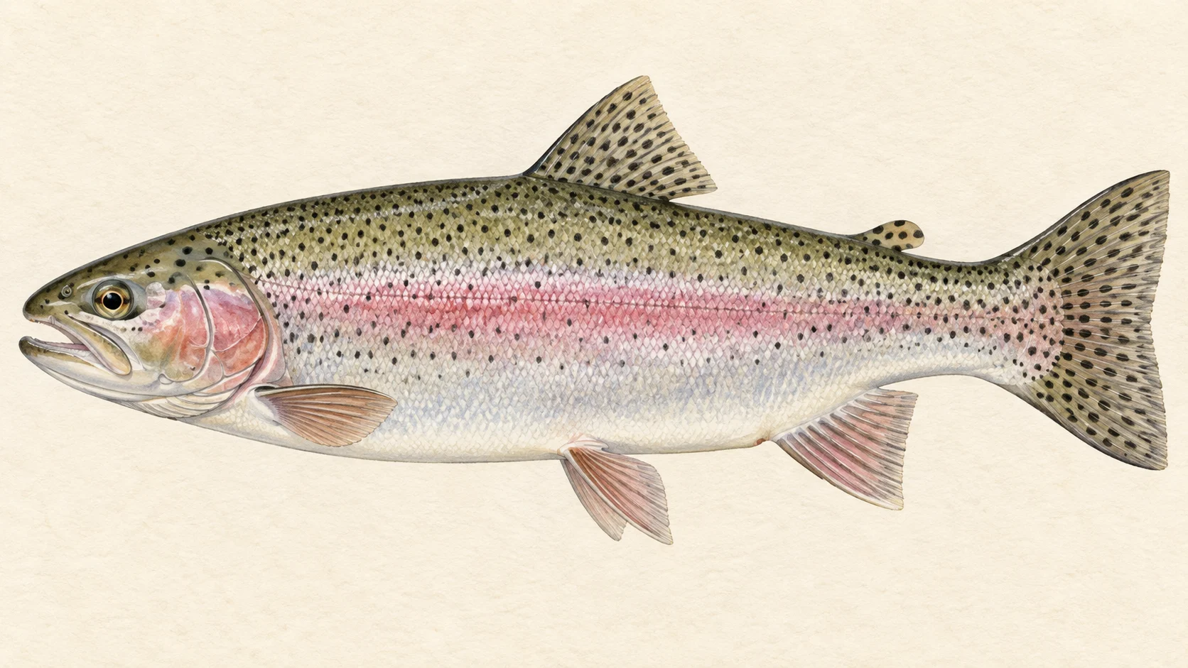
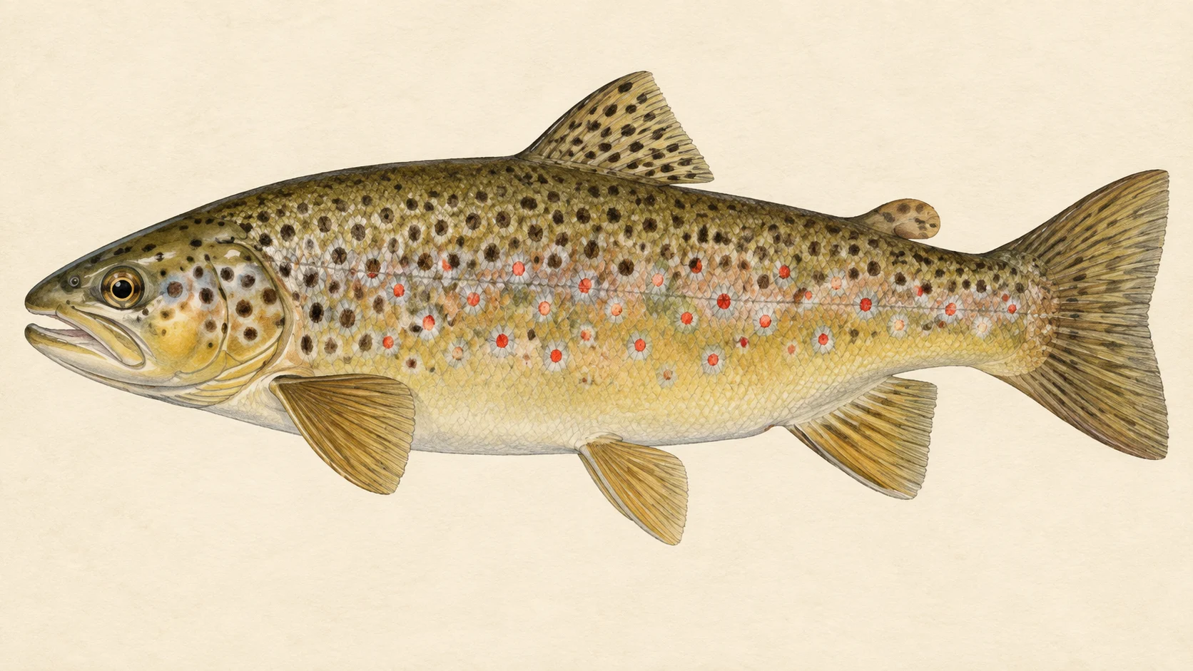
The Jenolan River is a wilderness trout stream in the Blue Mountains that you walk into, and the reason to make that walk is a run of rainbow trout that pushes up out of the Coxs River from late winter into spring. Resident brown and rainbow trout are there the rest of the year, and the hard access keeps almost everyone else away.
Two things shape the river for an angler, and neither is a road. At the bottom it joins the Coxs River, and that junction is both your way in and the door the running fish come through. On the river itself the NSW closed-waters notices list a closed water where all fishing is prohibited, and the notice draws its boundary. Outside that, the Jenolan is one long freestone mountain stream in a gorge, with no vehicle track along it.
The one trip most people can manage is the lower river and the junction. The usual route starts in the Megalong Valley, follows two creeks down to the Coxs and then turns upstream, with river crossing after river crossing. The junction pool often fishes well, and it is where you will fish first and last. Give yourself a full day each way and treat it as an overnight trip.
The trip worth planning around is the run. From late winter the rainbows move up from the Coxs, and a cold front with a rise in the river spreads them through the Jenolan rather than leaving them bunched in the lower pools. Fish small bead-head nymphs and Globugs through the runs and pool heads.
Summer is the resident fish. The river fishes as a classic freestone stream, terrestrial fishing can be excellent with beetles, hoppers and ants on the water, and the browns that go over three pounds are met each season. Residents run about half a pound to a pound.
The rules matter here. A standing closed water on the Jenolan is listed in the NSW closed-waters notices; its extent is in the notice, and you must stay out of it. Whether the Jenolan is classified trout water, and so closed through winter, is for the current NSW fishing guide to settle before you walk in.
Read the notice and the guide, pack for a night out, and go in for the run.
Water and habitat
The Jenolan runs through the Greater Blue Mountains World Heritage Area and it is not a river you drive to. It rises in the caves country and falls through a gorge to meet the Coxs River, and there is no road along any of it. The gradient chart shows the drop; read it as a long freestone descent with pools set between runs and rapids rather than one steep fall.
The water is a classic freestone mountain stream. Through spring, summer and autumn it fishes like one: broken runs into pools, boulder pockets, and tails where fish hold in the evening. The pools matter more during the run, when fresh rainbows stack in them before spreading out, and one deep pool below a high bank is where the magazine writers found a good rainbow sitting on the tail.
The bank cover chart shows how little of this river runs through open country. It is forested gorge almost end to end, which keeps the water cool and the fish pressure low, and which also means fallen timber and overhanging scrub on most pools.
The river's connection to the Coxs is its defining feature. The run of rainbows originates in Warragamba Dam, moves up the Coxs, and filters into the tributaries in turn: the Kowmung and the Kanangra first, the Jenolan last. Once the fish are in the Jenolan there is nowhere for them to fall back to. The dam is some thirty kilometres away, so an early cold snap that passes quickly does not send them down again; they simply spread out through the river.
Fish and forage
Rainbow trout were stocked here in 1899 to draw tourists to the Jenolan Caves, and the river now holds self-sustaining populations of both rainbows and brown trout. Rainbows are the recorded fish here; browns come from the magazine writers' accounts and are met each season.
Resident fish run about half a pound to a pound. Browns over three pounds are caught each season and they are the largest fish the river produces in its own right. The running rainbows from the Coxs are a different proposition: fresh fish in numbers, and the reason to walk in from late winter.
Mountain galaxias are recorded here too. They are the native minnow of these mountain streams and worth remembering if a fish refuses everything else in a pool.
The forage that drives the fly choice is terrestrial in the warm months. Beetles, hoppers and ants are the main surface food when the weather is warm, and caddis and mayflies bring fish up when conditions suit. Below the surface the fishing is nymphs, small and weighted, through the year. Pick your flies from that: a small bead-head for the residents, an egg pattern for the run, and a dry for a summer afternoon.
When to fish it
Late winter into spring is the run. Spawning rainbows leave the Coxs and move up the Jenolan, and the fishing is best after a cold front raises the flow and drops the water temperature, because that spreads the fish through the river instead of leaving them concentrated in schools near the junction. Watch the weather in August and September and walk in behind a front.
Through spring, summer and autumn the river fishes as a freestone mountain stream for its resident browns and rainbows. Terrestrial fishing can be excellent in the warmer months, and caddis and mayflies give regular surface fishing when the conditions are right. Small bead-head nymphs are consistent producers at any time of year, so a nymph is never the wrong first fly.
Winter carries the closure question. Whether the Jenolan is classified trout water, and so closed through winter and from which date, is for the current NSW fishing guide, so check it before you plan a cold-weather trip. Fish the run only where and when the guide says you may.
How to fish it
Most of the fishing is nymphing fast water, so build the rig for it. Fish a four- or five-weight with a floating line, a long leader and a small bead-head nymph in size 14 to 16: a Pheasant Tail, a hot-spot or pink-bead variant, or a Hare and Copper. Those patterns, along with a Prince, account for many of the running fish. Fish them through the pool heads and the runs, and add a second, heavier nymph when the water is up.
During the run, carry Globugs in size 12 to 14 and a Squirmy Worm in size 12. Egg patterns fished dead-drift through the runs and along the pool tails take fresh rainbows that ignore an imitation. Approach a pool from below and from a high bank where you can, because the running fish sit on the tails in clear water and you can spot them before you cast.
In summer switch to dries. A Royal Wulff or a Stimulator in size 12 to 16 covers beetle and hopper time, a parachute hopper in 12 to 14 for the grassier pools, and a CDC sedge in 14 to 16 or an F-Fly in 16 to 18 when the caddis and mayflies are on. Fish the dry alone first; hang a small nymph under it if nothing looks up.
Fish the Jenolan and Coxs junction on the way in and on the way out. It often fishes well and it is a small rainbow or two for very little extra effort at the end of a long day.
Access and safety
There is no road along the river and no drive-in access. The route the magazine writers describe starts near Carlons Farm in the Megalong Valley, drops down Carlons Creek to Breakfast Creek, follows that to the Coxs River, and then goes upstream to the Jenolan. From the creek junction their account gives another ninety minutes to the Coxs with river crossing after river crossing, and the Jenolan is further again. That is their route, not a statement that any part of it is open to you; check the current national park access and any track closures before you go.
Treat it as a substantial bushwalk through rugged country and pack accordingly: an overnight kit, water treatment, a map and a way to call for help that does not rely on a phone signal. The walk is the reason the fishing pressure is so low, and it is also the thing that will hurt you if you get it wrong.
The river crossings are the hazard. Both the Coxs and the Jenolan rise quickly after rain, and a crossing that was ankle-deep on the way in can be unsafe on the way out. There is no gauge reading to go by, so read the sky and the water yourself, and give the river a day if it is high and coloured. Do not plan the walk in behind heavy rain even though a rise is what spreads the running fish.
Regulations
One thing is settled enough to state: the NSW closed-waters notices list a standing closed water on the Jenolan River in which all fishing is prohibited by any method. Its exact extent is set out in the notice and in the current NSW freshwater fishing guide, and that is where you must read it. The neighbouring Coxs River page covers that water's own rules.
Whether the Jenolan is classified trout water, and so whether the river is closed through winter, is unsettled and is for the current NSW fishing guide to settle. No water-specific rule beyond the closure was found. Before you walk in, read the current NSW fishing rules and regulations, the freshwater bag and size limits and the general freshwater closures, and confirm the fishing fee.