Australia Fly Guide
NSW · Snowy River

Bombala River

Imagery © Esri

info

Before you rely on this page

  • Access here has not been confirmed on the ground — treat every way in as unverified.

The Bombala River is a trout stream, and the reason to drive to it is simple: NSW has released both brown and rainbow trout into it across recent seasons.

Read it as one river rather than a set of named reaches. It runs down to join the Delegate River, and the gradient chart shows how it falls along the way. Plan the day around one choice: which access point to start from, and how far you are willing to walk from it.

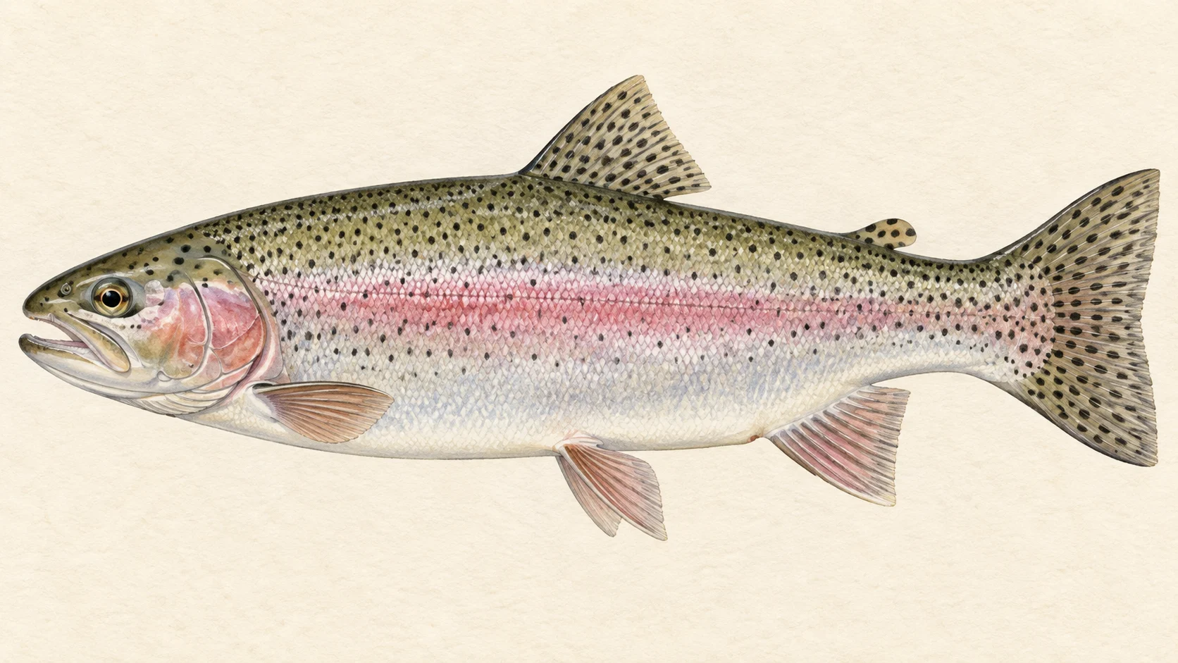
The first trip, and the easiest, is rainbows in spring. Choose a point from the access card, find the nearest broken water, and drift a weighted nymph through the heads of the runs. Stocked rainbows tend to sit in the faster, oxygenated water and take readily, so in our experience this is where a first visit should start. Before you go, read the current NSW fishing guide, because that guide, not the river's reputation, decides whether the trout season is open and what you may keep.

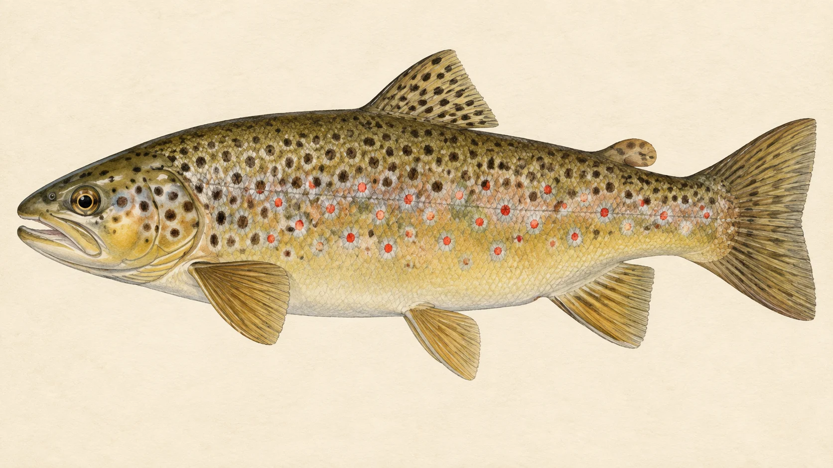
The second trip is for browns in autumn. As the days cool, walk further from the access point, slow down, and fish the deeper pools and undercut edges with a small streamer. Browns are warier than rainbows and punish a careless approach, so stay low and cast from well back. Give each deep pool a few careful casts from the tail before you step into it, because the fish you want is often lying in the slow water right at your feet.

Summer sits between the two. On mild afternoons a dry fly along grassy banks is worth an hour; on a hot, bright day we would rather fish early and late, or wait.

Pack a 4 or 5 weight, a box of nymphs, a few dries and a handful of small streamers, and open the NSW fishing guide before you leave home.

Water and habitat

A trout stream running to a bigger river. The gradient chart shows its profile and the bank cover chart shows what lines its edges. In our experience trout in a stream like this hold where current meets cover: the head of a pool, a seam beside faster water, an undercut bank, a fallen log. Rainbows lean towards the quicker water; browns towards the slower, shaded edges.

The flow charts show how the river rises and falls through the year. In our experience, when a stream like this runs low in summer, the fish drop back into the deeper, better-oxygenated water.

Fish and forage

NSW stocking records list brown trout and rainbow trout released into the river across recent seasons, and the stocking chart shows when. For the fishing, that points to mostly young fish, still growing, and in our experience a stocked stream can also hold the odd older brown that has survived a few seasons. How well stocked fish hold on in a given stream varies, so fish the likely water rather than assuming every pool has a trout in it.

What they eat is the usual stream-trout diet in our experience: mayfly and caddis nymphs through the year, and grasshoppers and beetles off the banks in summer. A fly box built on those two ideas covers most days.

When to fish it

In our experience spring is the best start, as the water warms and the insects get moving. Rainbows are usually first to respond. Through summer the fishing narrows to mornings, evenings and cooler days, with terrestrial dries along the grassy edges. Autumn brings the browns back into play, and a streamer through the deeper pools is a good bet in March and April.

Whether you may fish the river through winter is a question for the NSW fishing guide, not for this calendar. Check it before you plan a cold-weather trip.

How to fish it

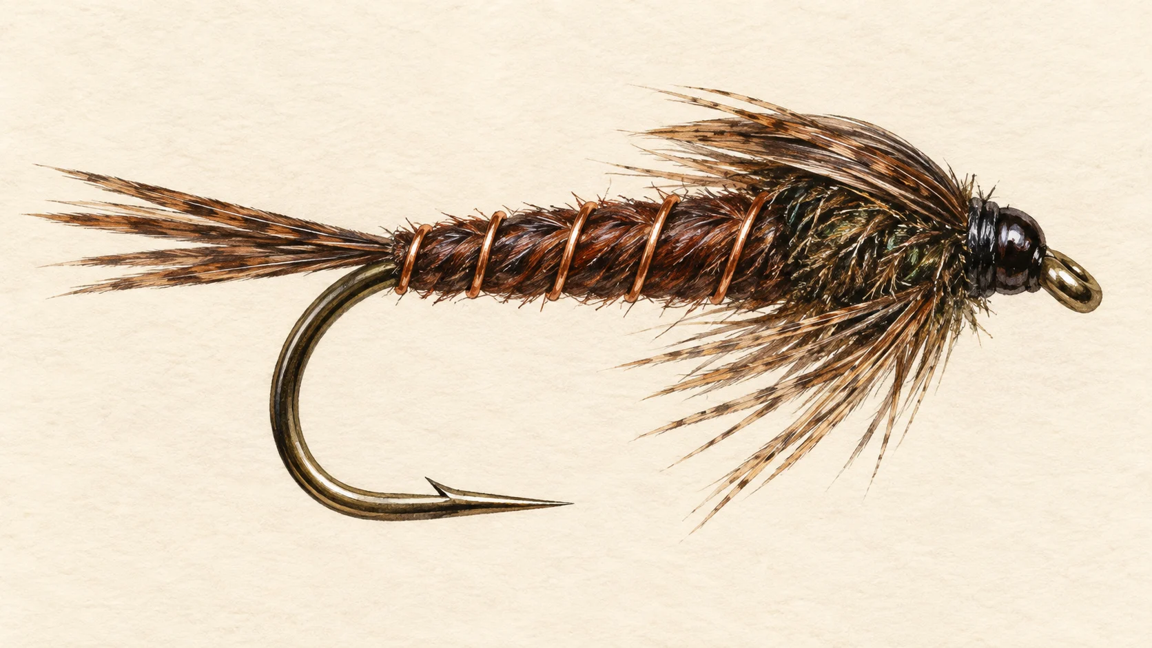
A 4 or 5 weight with a floating line covers the Bombala. Start with a size 14 to 16 Pheasant Tail or Hare's Ear under a small indicator, drifted through the heads of runs and along seams. Fish your way upstream so the fish see the fly before they see you.

When fish are rising, switch to a size 12 to 14 Royal Wulff or a small hopper, and put it tight to the grass. For browns in autumn, a size 8 to 10 Woolly Bugger in olive or black, cast across a pool and stripped back in short pulls, will cover water quickly.

Keep your leader long and fine for the dries, and step up the tippet for the streamer, where a heavy take is likelier.

Access and safety

The access card names the access points. Treat them as locations, not a statement of permission, and respect any fence, gate or sign you meet on the ground.

As on any country stream, tell someone where you are going and when you expect to be back, carry water and sun protection in summer, and watch your footing on slick rock and soft banks. Streams can rise quickly after rain upstream, so never wade a crossing you are unsure of.

Regulations

No water-specific rule was found for the Bombala River. Before you fish, read the current NSW Department of Primary Industries and Regional Development recreational fishing guide, including its closed-waters list, and take any trout season, bag or size limit, and the licence requirement, from that guide.
40 named access sites

These authority-listed points are separate from the mapped track intersections above. Some were inspected and some are public boat-ramp records; each row says which. A listing does not grant permission across private land, so check closures, signs and gates when you arrive.

  • Apex Park Authority-listed access site · Access mode not stated · Public Reserve
  • Apex Park Authority-listed access site · Access mode not stated · Public Reserve
  • Apex Park Authority-listed access site · Access mode not stated · Public Reserve
  • Bombala Crossing Authority-listed access site · Access mode not stated · Public Road
  • Bright St End Authority-listed access site · Access mode not stated · Public Road
  • Broardview Road Crossing Authority-listed access site · Access mode not stated · Public Road
  • Cambalong Junction Authority-listed access site · Access mode not stated · Bed of river
  • Cambalong Road Authority-listed access site · Access mode not stated · Public Road
  • Cambalong Road Sth Authority-listed access site · Access mode not stated · Public Road
  • Cardwell St End Authority-listed access site · Access mode not stated · Public Reserve
  • Creewah Council Reserve Authority-listed access site · Access mode not stated · Council Reserve
  • Creewah Roadcrossing Authority-listed access site · Access mode not stated · Public Road
  • Creewah Roadside Authority-listed access site · Access mode not stated · Public Road
  • Doyles Brook Reserve Authority-listed access site · Access mode not stated · Public Reserve
  • Front Of Bibbenluke Common Authority-listed access site · Access mode not stated · Public Land
  • Glen Allen Reserve Authority-listed access site · Access mode not stated · TSR
  • Gunnago Park Authority-listed access site · Access mode not stated · Public Reserve
  • Jonas St Authority-listed access site · Access mode not stated · Public Road
  • Mahratta St Authority-listed access site · Access mode not stated · Public Reserve
  • Monaro Hwy Authority-listed access site · Access mode not stated · TSR
  • Monaro Hwy Bridge Authority-listed access site · Access mode not stated · Public Reserve
  • Moore Springs Authority-listed access site · Access mode not stated · State Land
  • Moorna Roadcrossing Authority-listed access site · Access mode not stated · Public Road
  • Narrowness Creek Authority-listed access site · Access mode not stated · Public Road
  • New Line Road Authority-listed access site · Access mode not stated · Public Road
  • Peardons Tsr Authority-listed access site · Access mode not stated · TSR
  • Peardons Water Tsr Authority-listed access site · Access mode not stated · TSR
  • Platypus Reserve Authority-listed access site · Access mode not stated · Public Reserve
  • Public Reserve 7002 Authority-listed access site · Access mode not stated · Public Reserve
  • Sandy Crossing Authority-listed access site · Access mode not stated · Public Road
  • Saucy Creek Authority-listed access site · Access mode not stated · Public Reserve
  • Stephen St Reserve Authority-listed access site · Access mode not stated · Public Reserve
  • Swimming Pool Authority-listed access site · Access mode not stated · Public Reserve
  • Tea Tree Creek Authority-listed access site · Access mode not stated · Bed of river
  • Thoko River Authority-listed access site · Access mode not stated · TSR
  • Tony Thonhill Park Authority-listed access site · Access mode not stated · Public Reserve
  • Town Bridge Authority-listed access site · Access mode not stated · Public Reserve
  • Undowah St End Authority-listed access site · Access mode not stated · Public Road
  • Willoway Crossing Authority-listed access site · Access mode not stated · Public Road
  • Willowbank Authority-listed access site · Access mode not stated · State Land

Sources: NSW Department of Primary Industries and Regional Development.

When things happen

The guide's calendar for this water

When things happen

The year on this water

A year at a glance; check current rules

  • Nymphs through the runs in spring · Oct to Dec A guide's read, not a record. In our experience a size 14 to 16 Pheasant Tail or Hare's Ear drifted through the heads of runs is the most reliable way to find a stocked trout early in the warm half of the year.
  • Dries and terrestrials in summer · Dec to Mar A guide's read. On warm afternoons a size 12 to 14 Royal Wulff or a small hopper pattern along grassy edges is a good bet.
  • Grasshoppers and beetles on the banks · Dec to Mar In our experience land insects blown onto the water from grassy banks are a big part of a stream trout's summer diet. Take it as general trout-country judgement.
  • Small streamers in autumn · Mar to May A guide's read. A size 8 to 10 olive or black Woolly Bugger swung through deeper pools can move a bigger brown as the weather cools.

What the record shows

Flows, river gradient, changing water levels, fish surveys and stocking

What the record shows

The river's year

Daily flow at Bombala River at Bombala Town, every year 1995 to 2026

0.05 0.1 0.2 0.5 1 2 5 10 typical range high-flow mark Jan Feb Mar Apr May Jun Jul Aug Sep Oct Nov Dec m³/s
31 years of the gauge, week by week. The dark band is the middle half of all years, the pale band nine years in ten, the line the median. The shaded strip is the typical range: the band the river sits in about half of all days. In a typical year the river sits in it from late July through the turn of the year to mid June, and runs higher than that from late June to mid July. Whether a given day is one to wade is a call made at the bank, not a reading off this chart. Median flow peaks in mid July and bottoms out in late January.
Source: Bureau of Meteorology.
Source details and licence

Bureau of Meteorology — Water Data Online series catalogue (Snowy/Monaro stations). Bureau of Meteorology, © Commonwealth of Australia. Licensed from the Commonwealth of Australia under a Creative Commons Attribution 4.0 International licence. retrieved 2026-08-12.

How often it runs this high

11,280 days at Bombala River at Bombala Town, 1995 to 2026

0.05 0.1 0.2 0.5 1 2 5 10 20 50 typical range 0.029 to 0.547 m³/s high-flow mark 1.668 m³/s 0% of days 25% of days 50% of days 75% of days 100% of days m³/s
Read it left to right: the river runs above the flow on the left edge almost never, and above the flow on the right edge almost always. Half of all days sit below 0.3 m³/s. The shaded band is the typical range, where it sits about half the time; it runs higher than that one day in three and above the high-flow mark about one day in seven. These are frequency bands drawn from the record, not a measured limit — judge the water when you get there.
Source: Bureau of Meteorology.
Source details and licence

Bureau of Meteorology — Water Data Online series catalogue (Snowy/Monaro stations). Bureau of Meteorology, © Commonwealth of Australia. Licensed from the Commonwealth of Australia under a Creative Commons Attribution 4.0 International licence. retrieved 2026-08-12.

The fall of the river

Elevation along the river, source to end

Falls 474 m over 96 km, sand bed, floodplain pockets for much of its length.

627 864 1,101 gauge 222019 0 km from the source: 1101 m · falling 26.8 m per km · fine-grained, valley fill 1 km from the source: 1099 m · falling 28 m per km · fine-grained, valley fill 2 km from the source: 1097 m · falling 30.6 m per km · gravel, occasional floodplain 3 km from the source: 975 m · falling 34.7 m per km · gravel, occasional floodplain 4 km from the source: 955 m · falling 35.2 m per km · gravel, occasional floodplain 5 km from the source: 948 m · falling 33.2 m per km · gravel, occasional floodplain 6 km from the source: 907 m · falling 29.9 m per km · gravel, occasional floodplain 7 km from the source: 859 m · falling 22.8 m per km · gravel, occasional floodplain 8 km from the source: 852 m · falling 19.3 m per km · gravel, occasional floodplain 9 km from the source: 842 m · falling 15.9 m per km · gravel, occasional floodplain 10 km from the source: 824 m · falling 11.7 m per km · gravel, occasional floodplain 11 km from the source: 811 m · falling 8.2 m per km · gravel, occasional floodplain 12 km from the source: 807 m · falling 6.8 m per km · gravel, occasional floodplain 13 km from the source: 807 m · falling 5.8 m per km · gravel, occasional floodplain 14 km from the source: 802 m · falling 5.2 m per km · gravel, occasional floodplain 15 km from the source: 798 m · falling 5.1 m per km · gravel, occasional floodplain 16 km from the source: 787 m · falling 5.5 m per km · gravel, occasional floodplain 17 km from the source: 782 m · falling 5.2 m per km · sand, discontinuous floodplain 18 km from the source: 780 m · falling 4.7 m per km · sand, discontinuous floodplain 19 km from the source: 776 m · falling 4.3 m per km · sand, discontinuous floodplain 20 km from the source: 767 m · falling 3.2 m per km · sand, discontinuous floodplain 21 km from the source: 766 m · falling 2.4 m per km · sand, discontinuous floodplain 22 km from the source: 766 m · falling 1.9 m per km · sand, discontinuous floodplain 23 km from the source: 763 m · falling 1.5 m per km · sand, discontinuous floodplain 24 km from the source: 766 m · falling 1.4 m per km · sand, occasional floodplain 25 km from the source: 763 m · falling 1.7 m per km · sand, occasional floodplain 26 km from the source: 759 m · falling 2.3 m per km · sand, discontinuous floodplain 27 km from the source: 756 m · falling 2.8 m per km · sand, occasional floodplain 28 km from the source: 755 m · falling 3.2 m per km · sand, occasional floodplain 29 km from the source: 756 m · falling 3.5 m per km · sand, occasional floodplain 30 km from the source: 744 m · falling 3.4 m per km · sand, discontinuous floodplain 31 km from the source: 739 m · falling 2.7 m per km · sand, discontinuous floodplain 32 km from the source: 741 m · falling 2.1 m per km · sand, discontinuous floodplain 33 km from the source: 740 m · falling 1.7 m per km · sand, discontinuous floodplain 34 km from the source: 739 m · falling 1.1 m per km · sand, discontinuous floodplain 35 km from the source: 737 m · falling 1.1 m per km · sand, discontinuous floodplain 36 km from the source: 735 m · falling 1.2 m per km · sand, discontinuous floodplain 37 km from the source: 735 m · falling 1.2 m per km · sand, discontinuous floodplain 38 km from the source: 735 m · falling 1.3 m per km · sand, discontinuous floodplain 39 km from the source: 732 m · falling 1.4 m per km · sand, discontinuous floodplain 40 km from the source: 732 m · falling 1.1 m per km · sand, discontinuous floodplain 41 km from the source: 729 m · falling 0.9 m per km · sand, discontinuous floodplain 42 km from the source: 728 m · falling 0.8 m per km · sand, discontinuous floodplain 43 km from the source: 727 m · falling 0.5 m per km · sand, discontinuous floodplain 44 km from the source: 732 m · falling 0.8 m per km · sand, discontinuous floodplain 45 km from the source: 730 m · falling 1.1 m per km · sand, discontinuous floodplain 46 km from the source: 723 m · falling 1.2 m per km · sand, discontinuous floodplain 47 km from the source: 726 m · falling 1.2 m per km · sand, discontinuous floodplain 48 km from the source: 720 m · falling 1.2 m per km · sand, discontinuous floodplain 49 km from the source: 725 m · falling 0.9 m per km · sand, discontinuous floodplain 50 km from the source: 722 m · falling 0.9 m per km · sand, discontinuous floodplain 51 km from the source: 720 m · falling 0.9 m per km · sand, discontinuous floodplain 52 km from the source: 719 m · falling 0.4 m per km · sand, discontinuous floodplain 53 km from the source: 719 m · falling 0.3 m per km · sand, discontinuous floodplain 54 km from the source: 719 m · falling 0 m per km · sand, discontinuous floodplain 55 km from the source: 719 m · falling 0 m per km · sand, discontinuous floodplain 56 km from the source: 722 m · falling 0.5 m per km · sand, discontinuous floodplain 57 km from the source: 721 m · falling 1.2 m per km · sand, discontinuous floodplain 58 km from the source: 717 m · falling 1.9 m per km · sand, discontinuous floodplain 59 km from the source: 716 m · falling 2.3 m per km · sand, discontinuous floodplain 60 km from the source: 711 m · falling 2.5 m per km · sand, discontinuous floodplain 61 km from the source: 710 m · falling 2.5 m per km · sand, discontinuous floodplain 62 km from the source: 707 m · falling 2.4 m per km · sand, discontinuous floodplain 63 km from the source: 706 m · falling 2.3 m per km · sand, discontinuous floodplain 64 km from the source: 705 m · falling 2.1 m per km · sand, discontinuous floodplain 65 km from the source: 700 m · falling 2 m per km · sand, discontinuous floodplain 66 km from the source: 697 m · falling 1.4 m per km · sand, discontinuous floodplain 67 km from the source: 697 m · falling 1.2 m per km · sand, discontinuous floodplain 68 km from the source: 697 m · falling 1.2 m per km · sand, discontinuous floodplain 69 km from the source: 695 m · falling 1.3 m per km · sand, discontinuous floodplain 70 km from the source: 700 m · falling 2 m per km · sand, discontinuous floodplain 71 km from the source: 692 m · falling 2.7 m per km · sand, occasional floodplain 72 km from the source: 689 m · falling 3 m per km · sand, occasional floodplain 73 km from the source: 685 m · falling 3.2 m per km · sand, occasional floodplain 74 km from the source: 682 m · falling 3.1 m per km · sand, discontinuous floodplain 75 km from the source: 679 m · falling 2.6 m per km · sand, discontinuous floodplain 76 km from the source: 677 m · falling 2.4 m per km · sand, discontinuous floodplain 77 km from the source: 674 m · falling 2 m per km · sand, discontinuous floodplain 78 km from the source: 673 m · falling 1.8 m per km · sand, discontinuous floodplain 79 km from the source: 672 m · falling 1.8 m per km · sand, discontinuous floodplain 80 km from the source: 668 m · falling 2 m per km · sand, discontinuous floodplain 81 km from the source: 670 m · falling 2.2 m per km · sand, discontinuous floodplain 82 km from the source: 667 m · falling 2.5 m per km · sand, occasional floodplain 83 km from the source: 664 m · falling 2.7 m per km · sand, occasional floodplain 84 km from the source: 657 m · falling 2.4 m per km · gravel, discontinuous floodplain 85 km from the source: 657 m · falling 2.2 m per km · gravel, discontinuous floodplain 86 km from the source: 655 m · falling 1.9 m per km · gravel, discontinuous floodplain 87 km from the source: 655 m · falling 1.8 m per km · gravel, discontinuous floodplain 88 km from the source: 654 m · falling 1.7 m per km · gravel, discontinuous floodplain 89 km from the source: 650 m · falling 1.9 m per km · gravel, discontinuous floodplain 90 km from the source: 647 m · falling 2.3 m per km · gravel, discontinuous floodplain 91 km from the source: 646 m · falling 2.8 m per km · gravel, occasional floodplain 92 km from the source: 646 m · falling 3.3 m per km · gravel, occasional floodplain 93 km from the source: 642 m · falling 3.4 m per km · gravel, occasional floodplain 94 km from the source: 633 m · falling 3.3 m per km · gravel, occasional floodplain 95 km from the source: 629 m · falling 3.2 m per km · gravel, occasional floodplain 96 km from the source: 627 m · falling 2.9 m per km · gravel, occasional floodplain 0 km 24 km 48 km 72 km 96 km
gravel · 29% sand · 69% fine-grained · 2%
Headwater
1101 m
Outlet
627 m
Typical drop
4.9 m/km
Steepest sampled stretch
35.2 m/km, near 4 km
Hover the profile for the reading at any kilometre.
Source: Geoscience Australia.
Source details and licence

Geoscience Australia — 1 second SRTM-derived DEM-H v1.0 (NCI tile store). Geoscience Australia, 1 second SRTM-derived DEM-H v1.0, © Commonwealth of Australia, CC BY 4.0. retrieved 2026-08-16.

Bed material: NSW Department of Climate Change, Energy, the Environment and Water (Water, Surface Water Science).
Source details and licence

NSW River Styles spatial dataset — geomorphic character and dominant bed material. NSW River Styles spatial dataset, © State Government of NSW and NSW Department of Climate Change, Energy, the Environment and Water 2023. retrieved 2026-08-21.

Gauge pins identify the monitoring stations. The slope shows how steeply the river falls; it does not show rapids or safe wading routes.

The banks, seen from space

Land cover in the 120 m beside the water, Landsat 2023 to 2024 to 2025

0 to 5 km: woody dense 28.7% 0 to 5 km: woody open 56.3% 0 to 5 km: herbaceous native 11.9% 0 to 5 km: cultivated 3.1% 5 to 10 km: woody open 100% 10 to 15 km: woody open 100% 15 to 20 km: woody open 83.7% 15 to 20 km: woody sparse 4.4% 15 to 20 km: herbaceous native 9.4% 15 to 20 km: cultivated 2.5% 20 to 25 km: woody open 54.3% 20 to 25 km: herbaceous native 19.4% 20 to 25 km: cultivated 26.3% 25 to 30 km: woody open 75.6% 25 to 30 km: woody sparse 7.5% 25 to 30 km: herbaceous native 7.5% 25 to 30 km: cultivated 9.4% 30 to 35 km: woody open 13.1% 30 to 35 km: woody sparse 1.9% 30 to 35 km: herbaceous native 27.5% 30 to 35 km: cultivated 57.5% 35 to 40 km: woody open 2.5% 35 to 40 km: woody sparse 0.6% 35 to 40 km: herbaceous native 51.3% 35 to 40 km: cultivated 45.6% 40 to 45 km: woody open 14.4% 40 to 45 km: woody sparse 0.6% 40 to 45 km: herbaceous native 63.7% 40 to 45 km: cultivated 21.3% 45 to 50 km: woody open 12.5% 45 to 50 km: herbaceous native 45% 45 to 50 km: cultivated 42.5% 50 to 55 km: woody open 10% 50 to 55 km: herbaceous native 56.2% 50 to 55 km: cultivated 33.8% 55 to 60 km: woody open 10.6% 55 to 60 km: woody sparse 3.8% 55 to 60 km: herbaceous native 70.5% 55 to 60 km: cultivated 13.8% 55 to 60 km: bare 1.3% 60 to 65 km: woody open 32.5% 60 to 65 km: woody sparse 4.4% 60 to 65 km: herbaceous native 54.3% 60 to 65 km: cultivated 8.8% 65 to 70 km: woody open 27.5% 65 to 70 km: woody sparse 3.8% 65 to 70 km: herbaceous native 38.7% 65 to 70 km: cultivated 28.7% 65 to 70 km: artificial 1.3% 70 to 75 km: woody open 30.9% 70 to 75 km: woody sparse 3.9% 70 to 75 km: herbaceous native 47.4% 70 to 75 km: cultivated 17.8% 75 to 80 km: woody dense 1.3% 75 to 80 km: woody open 26.3% 75 to 80 km: woody sparse 6.9% 75 to 80 km: herbaceous native 63% 75 to 80 km: cultivated 2.5% 80 to 85 km: woody open 16% 80 to 85 km: woody sparse 8.7% 80 to 85 km: herbaceous native 73.3% 80 to 85 km: cultivated 2% 85 to 90 km: woody open 30.4% 85 to 90 km: woody sparse 2.5% 85 to 90 km: herbaceous native 58.2% 85 to 90 km: cultivated 8.9% 90 to 95 km: woody dense 0.6% 90 to 95 km: woody open 81.2% 90 to 95 km: woody sparse 4.4% 90 to 95 km: herbaceous native 11.3% 90 to 95 km: cultivated 2.5% 95 to 96 km: woody open 87.5% 95 to 96 km: herbaceous native 10% 95 to 96 km: cultivated 2.5% 0 km 20 km 40 km 60 km 80 km
dense forest open woodland scattered trees and scrub native grass and heath farmed or cleared bare ground lake
Along the river itself about 46% of the bank is under trees, 37% is native grass or heath and 17% is farmed. The most wooded stretch is 5 to 10 km from the source; the most open is 35 to 40 km. A satellite reads the canopy, not the ground beneath it, so treat this as a read of the country, not a survey of every bank.
Source: Geoscience Australia / Digital Earth Australia.
Source details and licence

DEA Land Cover (Landsat) — Level 4 classification, continental mosaics. © Commonwealth of Australia (Geoscience Australia). DEA Land Cover (Landsat), Digital Earth Australia. retrieved 2026-08-19.

Stocking on record

17,000 fish in 25 records, 2020 to 2026

0 2k 4k 6k 2020: 1,000 rainbow trout in 1 record 2020: 1,500 brown trout in 3 records 2021: 2,000 rainbow trout in 2 records 2022: 4,500 rainbow trout in 2 records 2022: 1,500 brown trout in 3 records 2023: 1,200 rainbow trout in 2 records 2023: 1,450 brown trout in 3 records 2024: 1,500 rainbow trout in 2 records 2024: 600 brown trout in 3 records 2025: 1,000 rainbow trout in 1 record 2026: 750 brown trout in 3 records 2020 2021 2022 2023 2024 2025 2026
Rainbow Trout, 11,200 across 10 records Brown Trout, 5,800 across 15 records
Stocked in 7 of the 7 years from 2020 to 2026. These are site-by-year totals, which can combine more than one release. A record is not a promise that stocking continues, and not evidence of what is in the water now.
Source: NSW Department of Primary Industries and Regional Development (Fisheries).
Source details and licence

NSW Fish Stocking — ArcGIS site markers and linked histories. retrieved 2026-08-29.

Conditions

What the gauges say

Bombala River at Bombala Town

River flow

No reading shown: No reading has been captured for this gauge yet, so none is shown.

Gauge height

No reading shown: No reading has been captured for this gauge yet, so none is shown.

Readings from the Bureau of Meteorology's Water Data Online, © Commonwealth of Australia, licensed CC BY 4.0. Nothing here is a forecast. Check the gauge before you rely on it.

Weather

What the sky is doing

Live weather for Bombala River at Bombala Town loads here. If it does not, check the Bureau of Meteorology forecast before you go.

Weather data by Open-Meteo.com

Questions anglers ask

What will I catch?

NSW stocking records list both brown and rainbow trout released into the Bombala over recent seasons. Those are the fish to plan around. Expect stocked fish of modest size, and count a bigger, older brown as a real result.

When should I go?

In our experience spring and autumn are the best of it, with summer dry-fly fishing on mild days. Check the current NSW fishing guide for any trout season that applies before you plan the trip.

Where do I start?

Pick a point from the access card and fish the nearest run and pool water you can reach. Treat those points as locations only, and respect fences and signs on the ground.

Are there special rules here?

No water-specific rule was found for the Bombala River. Read the current NSW Department of Primary Industries and Regional Development recreational fishing guide, including its closed-waters list, before you fish, and take any season, bag or size limit from it.

Behind this page