Australia Fly Guide
NSW · Macquarie-Bogan Rivers

Fish River

Imagery © Esri

info

Before you rely on this page

  • Access here has not been confirmed on the ground — treat every way in as unverified.

The Fish River is the trout stream of the Oberon and Tarana country on the central tablelands, and the reason to drive to it is a brown trout of forty centimetres or better in the reaches above Tarana. It was once known as a big-fish river. Drought, silt, willows and water taken by the Fish River Scheme have reduced it since, and good fish are still in it.

Think of the river in two parts, split at the village of Tarana. Above Tarana the river runs north out of the hills through state forest, and cold water released from Oberon Dam keeps that reach steady; two smaller streams join it there and the water is mostly brown trout. At Tarana the river turns west, running through a granite gorge at Evans Crown near the village, and then slows through willowed, weedy farm country toward O'Connell, where it meets another river to form the Macquarie. That lower farmland water is mostly rainbows.

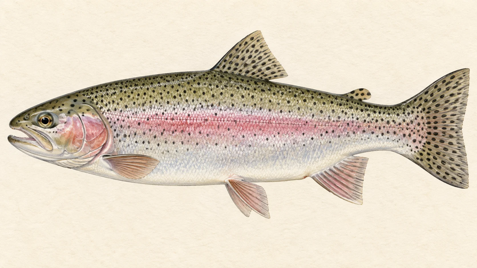
The easiest trip is the lower river. A picnic area on Mutton Falls Road between Tarana and O'Connell gives you easy access, camping, and rainbows that average about twenty-five centimetres and take a dry or a small nymph readily. The park beside the bridge at O'Connell is the other simple option, with willows, sand and weed making it a little harder to fish. Start here.

The second trip is the gorge. A reserve near Tarana gives you a walk down a fence line to granite rapids and sandy pools. The gorge sits at the hinge between the brown trout water above Tarana and the rainbow water below, and the accounts do not say which fish has the better of it there, so go in ready for either. It is a longer day, and a rougher one.

The third trip is the forest reaches above Tarana, reached by fire trails that are often rough and sometimes closed for logging, so plan to walk or ride a bike from the road. In the warmer months it is dry-fly water; in the cooler months fish a bead-head nymph through the rapids.

No water-specific rule was found for the Fish, and NSW trout streams commonly carry a classification that closes them through winter, so check the current NSW fishing guide before you go. A local website also reports a no-fishing zone directly below the Oberon Dam wall; that is not the fishing department's word, so confirm it in the closed-waters notices before you fish near the dam.

Read the current NSW rules, then start at the picnic water below Tarana.

Water and habitat

The Fish rises as a string of small pools in Vulcan State Forest at close to 1,300 metres, runs north into Oberon Dam, and continues north out of it. Two streams, the Duckmaloi River and Bindo Creek, join it upstream of Hampton State Forest. At Tarana it picks up Solitary Creek and turns west toward O'Connell, and below O'Connell, at around 700 metres, it joins the Campbells River to form the Macquarie. Everything below the wall is Murray-Darling water heading west.

Oberon Dam has stood since 1959, and its releases matter more than its size. The magazine writers who fish the reach below the Duckmaloi junction describe it as very consistent because the water coming out of the dam is cold. That is the reach to think of in a hot, dry summer when the gorge and the lower river are warm and low. The gradient chart shows how the river drops from the forest to the flats.

The gorge itself is granite. Rapids run between sandy pools, and fish sit at the heads and tails of the pools and in the pocket water between boulders. Downstream the river flattens, the banks go to willow and the pools fill with sand and weed. Fish there hold under the tree roots and along the edges of the weed beds, and they are harder to reach than they are to find.

The bank cover chart shows how much of the river runs through cleared and farmed country. Where the willows are thick they shade the water and hold the banks, and they also make casting a chore. Silt from the paddocks is one of the things that has reduced this river since its big-fish days.

When the dam spills, lake fish are pushed over the wall into the lower river. The magazine writers describe one such spill as sending thousands of them down, so a wet year that fills Oberon can put an unusual number of fish into the water below it for a season or two.

Fish and forage

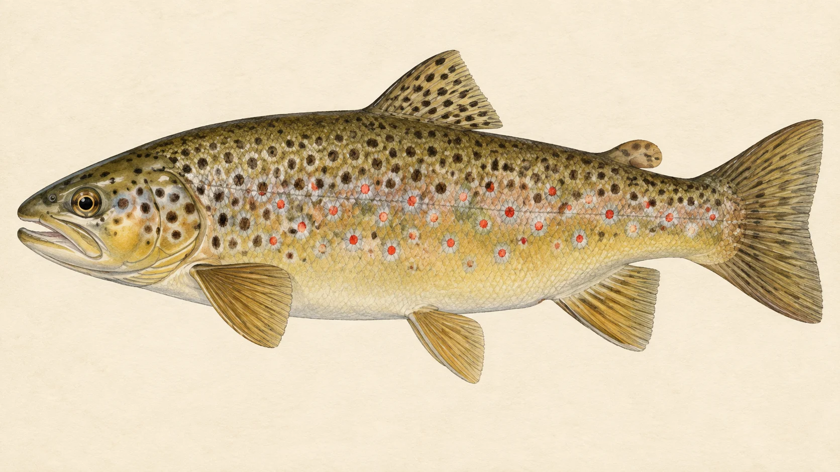
Brown trout are the fish of the upper river. Above Tarana, browns of forty to fifty centimetres are not uncommon, which is a good river brown anywhere in New South Wales. They are wary fish in clear water and they hold in the deeper pools and under cover.

Rainbow trout are the numbers fish of the lower river. They are mostly small, around twenty-five centimetres on average, and energetic, and they take a fly with less suspicion than the browns. Both trout are recorded here, as the survey chart shows.

Mountain galaxias are recorded too, and so is eastern gambusia, the small introduced mosquito fish. The galaxias are the native baitfish of these streams and a small dark streamer or a black Woolly Bugger stripped through a pool copies them well enough. Redfin and goldfish are recorded with less certainty. None of those changes what you tie on.

Little has been written about the forage here, so this is a guide's read. A tableland trout stream with grassy banks and willows feeds its fish on terrestrials from late spring, mayflies and caddis in the riffles, and whatever small fish and yabbies live in the pools. Carry an ant, a beetle, a hopper, a few plain nymphs and one streamer and you have it covered.

When to fish it

The local writers name flies for the warmer and cooler months rather than a best season, so take what follows as a guide's judgement.

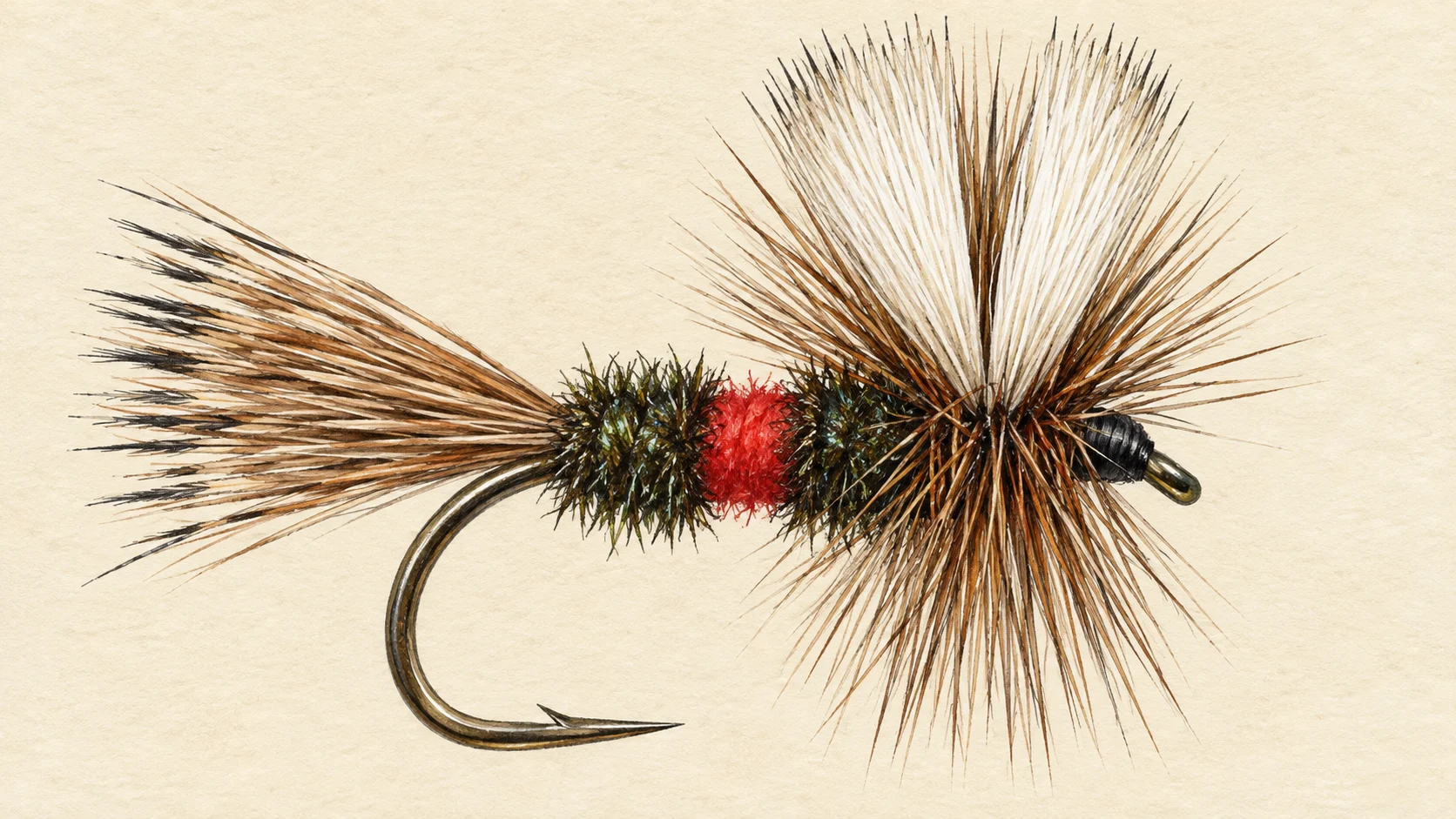
Late spring through summer is dry-fly time in the forest reaches. Ants, beetles and small moths are on the water, and a Royal Wulff or an ant pattern drifted through the pocket water will bring fish up. On the lower river the hoppers start in earnest in late summer, and the willowed water around O'Connell is where to drift one.

The cold releases from Oberon Dam should keep the reach below the Duckmaloi junction fishable through the hottest weeks, when the gorge and the farmland water are warm. If you are choosing a reach in February, choose that one.

Autumn is the pick for the browns above Tarana. Fish nymphs through the rapids as the water cools and expect the bigger fish to be on the move. Whether the river closes through winter is a matter for the NSW fishing guide; check it before you plan a cold-weather trip.

How to fish it

For the forest reaches around Black Hole Bend, fish a four- or five-weight with a floating line. In the warm months tie on a Royal Wulff, an ant or a white moth pattern and work the pocket water and the heads of the pools upstream. In the cooler months switch to a bead-head nymph under a small indicator and fish it through the rapids, adding weight until you are ticking the bottom; nymphing this kind of broken water is more about depth than pattern. A black Woolly Bugger swung and stripped through the pools works at any time of year, and it is the fly to try when nothing is showing.

In the gorge at Tarana, fish the seams where the rapids enter the sandy pools and the tails where the water gathers before the next drop. Fish it as brown trout water until the river tells you otherwise: stay low, wade only where you must, and make the first cast count.

On the lower river around O'Connell, the fishing is under trees and over weed. Drift a hopper or a small dry tight along the willow edge and let it ride over the weed beds. A short, accurate cast beats a long one here, and a side cast under the branches will reach fish a straight overhead cast cannot.

Wet-wade in summer and carry a wading staff for the granite. Barbless hooks make releasing a small rainbow quick, and keeping a big brown in the water while you unhook it gives it the best chance.

Access and safety

The access card shows the ways in along the river. What follows is how the local website's writers reach the water; it is not a statement that any route is open to you, and much of the river runs through private land.

The simplest entry is Flat Rock picnic area, a public reserve on Mutton Falls Road between Tarana and O'Connell, with easy access and camping. The park beside the bridge at O'Connell is the other straightforward spot. Evans Crown reserve near Tarana takes more effort: drive past the hilltop car park, park near the small national-park sign at the bottom, cross the fence into the reserve and walk the fence line downhill, keeping to the north side of the river. The website warns you to stay off private land there.

Hampton State Forest and the Black Hole Bend crown reserve are best entered from Cuthill Road off the Rydal to Hampton road, then by fire trails down the ridges and spurs. Those roads are often rough and are sometimes closed for logging, so expect to walk or ride from the road. Wicketty War Road gets you closer to the river than Cuthill Road, but a locked gate now stops vehicles; the website says to contact the landowner before using it.

The gorge is granite, and wet granite is slippery on any river, so move as you would on any rock stream. If you have to cross, do not do it with the river up. There is no live gauge to check here, so look at the river itself before you commit to the walk down. Check for logging closures in the state forest before you drive in, check fire bans as you would for any bush water, and tell someone where you are going, as you would on any walk-in stream.

Regulations

No water-specific rule was found for the Fish. Trout streams in New South Wales commonly carry a classification that sets a winter closure, size and bag limits, and the Fish River may be one of them; whether it is, and what applies where, is a question for the fishing department.

A local fishing website reports that fishing is not permitted for a distance below the Oberon Dam wall. That is not from the fishing department or the water authority, so treat the water right below the wall as off limits until you have confirmed the current closed-waters notices.

Before you fish, read the current NSW fishing rules and regulations, the freshwater bag and size limits and the general freshwater closures, and confirm the fishing fee.
25 named access sites

These authority-listed points are separate from the mapped track intersections above. Some were inspected and some are public boat-ramp records; each row says which. A listing does not grant permission across private land, so check closures, signs and gates when you arrive.

Sources: NSW Department of Primary Industries and Regional Development.

When things happen

The guide's calendar for this water

When things happen

The year on this water

A year at a glance; check current rules

  • Dries in the forest reaches · Nov to Mar Through the warmer months the water around Black Hole Bend is dry-fly water. A Royal Wulff, an ant or a small white moth pattern covers most of it.
  • Nymphs in the rapids · Apr to Sep In the cooler months fish a bead-head nymph under an indicator through the faster runs. A black Woolly Bugger is a fair searching fly at any time of year.
  • Grasshoppers on the lower river · Dec to Mar The willowed, weedy water around O'Connell is hopper country in late summer. Drift a hopper along the edge of the trees and over the weed beds.

What the record shows

Flows, river gradient, changing water levels, fish surveys and stocking

What the record shows

The fall of the river

Elevation along the river, source to end

Falls 549 m over 135 km, fine-grained bed, floodplain pockets for much of its length.

668 943 1,217 0 km from the source: 1217 m · falling 6.9 m per km 1 km from the source: 1194 m · falling 9 m per km 2 km from the source: 1176 m · falling 9.3 m per km · fine-grained, valley fill 3 km from the source: 1164 m · falling 9 m per km · fine-grained, valley fill 4 km from the source: 1158 m · falling 8.8 m per km · fine-grained, valley fill 5 km from the source: 1151 m · falling 6.9 m per km · fine-grained, valley fill 6 km from the source: 1143 m · falling 5.6 m per km · fine-grained, valley fill 7 km from the source: 1141 m · falling 5 m per km · fine-grained, discontinuous floodplain 8 km from the source: 1139 m · falling 4.8 m per km · fine-grained, discontinuous floodplain 9 km from the source: 1131 m · falling 4.5 m per km · fine-grained, discontinuous floodplain 10 km from the source: 1127 m · falling 4.3 m per km · fine-grained, discontinuous floodplain 11 km from the source: 1121 m · falling 4 m per km · fine-grained, discontinuous floodplain 12 km from the source: 1118 m · falling 3.8 m per km · fine-grained, discontinuous floodplain 13 km from the source: 1117 m · falling 3.5 m per km · fine-grained, discontinuous floodplain 14 km from the source: 1111 m · falling 3.1 m per km · fine-grained, discontinuous floodplain 15 km from the source: 1111 m · falling 2.9 m per km · fine-grained, discontinuous floodplain 16 km from the source: 1103 m · falling 3 m per km · fine-grained, discontinuous floodplain 17 km from the source: 1102 m · falling 3.3 m per km · fine-grained, discontinuous floodplain 18 km from the source: 1106 m · falling 3.9 m per km · fine-grained, discontinuous floodplain 19 km from the source: 1099 m · falling 5.1 m per km · sand, valley fill 20 km from the source: 1090 m · falling 5.5 m per km · sand, valley fill 21 km from the source: 1081 m · falling 5.6 m per km · fine-grained, discontinuous floodplain 22 km from the source: 1078 m · falling 5.2 m per km · fine-grained, discontinuous floodplain 23 km from the source: 1071 m · falling 4.1 m per km · fine-grained, discontinuous floodplain 24 km from the source: 1069 m · falling 2.8 m per km · fine-grained, discontinuous floodplain 25 km from the source: 1067 m · falling 1.7 m per km · fine-grained, discontinuous floodplain 26 km from the source: 1066 m · falling 0.9 m per km · water storage 27 km from the source: 1066 m · falling 0.3 m per km · water storage 28 km from the source: 1067 m · falling 0 m per km · water storage 29 km from the source: 1067 m · falling 0 m per km · water storage 30 km from the source: 1067 m · falling 0.9 m per km · water storage 31 km from the source: 1066 m · falling 2.2 m per km · water storage 32 km from the source: 1067 m · falling 3.8 m per km · water storage 33 km from the source: 1065 m · falling 5.2 m per km · fine-grained, discontinuous floodplain 34 km from the source: 1049 m · falling 5.7 m per km · fine-grained, discontinuous floodplain 35 km from the source: 1042 m · falling 5.3 m per km · fine-grained, discontinuous floodplain 36 km from the source: 1035 m · falling 4.4 m per km · fine-grained, discontinuous floodplain 37 km from the source: 1038 m · falling 3.6 m per km · fine-grained, discontinuous floodplain 38 km from the source: 1036 m · falling 3.1 m per km · fine-grained, discontinuous floodplain 39 km from the source: 1032 m · falling 3 m per km · fine-grained, discontinuous floodplain 40 km from the source: 1029 m · falling 3 m per km · fine-grained, discontinuous floodplain 41 km from the source: 1022 m · falling 3.1 m per km · fine-grained, discontinuous floodplain 42 km from the source: 1021 m · falling 3.8 m per km · fine-grained, discontinuous floodplain 43 km from the source: 1019 m · falling 5.6 m per km · fine-grained, discontinuous floodplain 44 km from the source: 1020 m · falling 7.8 m per km · fine-grained, discontinuous floodplain 45 km from the source: 1013 m · falling 10.5 m per km · fine-grained, discontinuous floodplain 46 km from the source: 991 m · falling 12.3 m per km · fine-grained, discontinuous floodplain 47 km from the source: 969 m · falling 12.5 m per km · fine-grained, discontinuous floodplain 48 km from the source: 963 m · falling 11.7 m per km · fine-grained, discontinuous floodplain 49 km from the source: 950 m · falling 10.3 m per km · fine-grained, discontinuous floodplain 50 km from the source: 946 m · falling 8.6 m per km · fine-grained, discontinuous floodplain 51 km from the source: 934 m · falling 7.5 m per km · fine-grained, discontinuous floodplain 52 km from the source: 928 m · falling 6.7 m per km · fine-grained, discontinuous floodplain 53 km from the source: 922 m · falling 5.8 m per km · bedrock, gorge 54 km from the source: 916 m · falling 5.3 m per km · bedrock, gorge 55 km from the source: 912 m · falling 4.9 m per km · bedrock, gorge 56 km from the source: 909 m · falling 4.9 m per km · bedrock, gorge 57 km from the source: 904 m · falling 5 m per km · bedrock, gorge 58 km from the source: 900 m · falling 5.5 m per km · bedrock, gorge 59 km from the source: 889 m · falling 5.6 m per km · bedrock, gorge 60 km from the source: 886 m · falling 5.3 m per km · bedrock, gorge 61 km from the source: 883 m · falling 5.1 m per km · bedrock, gorge 62 km from the source: 874 m · falling 4.5 m per km · bedrock, gorge 63 km from the source: 871 m · falling 4 m per km · bedrock, gorge 64 km from the source: 870 m · falling 4.2 m per km · bedrock, gorge 65 km from the source: 864 m · falling 4.4 m per km · bedrock, gorge 66 km from the source: 863 m · falling 4.8 m per km · bedrock, gorge 67 km from the source: 855 m · falling 5.4 m per km · bedrock, gorge 68 km from the source: 847 m · falling 5.6 m per km · gravel, discontinuous floodplain 69 km from the source: 843 m · falling 5.2 m per km · gravel, discontinuous floodplain 70 km from the source: 838 m · falling 4.8 m per km · gravel, discontinuous floodplain 71 km from the source: 832 m · falling 3.9 m per km · gravel, discontinuous floodplain 72 km from the source: 828 m · falling 3 m per km · gravel, discontinuous floodplain 73 km from the source: 829 m · falling 2.7 m per km · gravel, discontinuous floodplain 74 km from the source: 824 m · falling 2.5 m per km · gravel, discontinuous floodplain 75 km from the source: 825 m · falling 2.7 m per km · gravel, discontinuous floodplain 76 km from the source: 821 m · falling 3 m per km · gravel, discontinuous floodplain 77 km from the source: 817 m · falling 3.2 m per km · bedrock, gorge 78 km from the source: 813 m · falling 3.2 m per km · bedrock, gorge 79 km from the source: 808 m · falling 3.1 m per km · bedrock, gorge 80 km from the source: 808 m · falling 3 m per km · sand, valley fill 81 km from the source: 806 m · falling 3 m per km · bedrock, gorge 82 km from the source: 801 m · falling 3.1 m per km · bedrock, gorge 83 km from the source: 799 m · falling 3.2 m per km · bedrock, gorge 84 km from the source: 794 m · falling 3.4 m per km · bedrock, gorge 85 km from the source: 793 m · falling 3.4 m per km · gravel, discontinuous floodplain 86 km from the source: 787 m · falling 3.3 m per km · gravel, discontinuous floodplain 87 km from the source: 784 m · falling 3.4 m per km · gravel, discontinuous floodplain 88 km from the source: 782 m · falling 3.4 m per km · bedrock, gorge 89 km from the source: 779 m · falling 3.4 m per km · bedrock, gorge 90 km from the source: 776 m · falling 3.4 m per km · bedrock, gorge 91 km from the source: 770 m · falling 3.2 m per km · gravel, discontinuous floodplain 92 km from the source: 767 m · falling 2.8 m per km · gravel, discontinuous floodplain 93 km from the source: 765 m · falling 2.4 m per km · gravel, discontinuous floodplain 94 km from the source: 764 m · falling 2 m per km · gravel, discontinuous floodplain 95 km from the source: 763 m · falling 1.8 m per km · gravel, discontinuous floodplain 96 km from the source: 760 m · falling 1.9 m per km · gravel, discontinuous floodplain 97 km from the source: 758 m · falling 2 m per km · gravel, discontinuous floodplain 98 km from the source: 758 m · falling 2.3 m per km · gravel, discontinuous floodplain 99 km from the source: 752 m · falling 2.4 m per km · gravel, discontinuous floodplain 100 km from the source: 751 m · falling 2.5 m per km · gravel, discontinuous floodplain 101 km from the source: 750 m · falling 2.7 m per km · bedrock, gorge 102 km from the source: 746 m · falling 2.9 m per km · bedrock, gorge 103 km from the source: 744 m · falling 3.1 m per km · bedrock, gorge 104 km from the source: 739 m · falling 3.4 m per km · gravel, discontinuous floodplain 105 km from the source: 736 m · falling 3.8 m per km · bedrock, gorge 106 km from the source: 734 m · falling 4.1 m per km · bedrock, gorge 107 km from the source: 729 m · falling 4.4 m per km · gravel, occasional floodplain 108 km from the source: 723 m · falling 4.5 m per km · gravel, occasional floodplain 109 km from the source: 716 m · falling 4.3 m per km · gravel, occasional floodplain 110 km from the source: 714 m · falling 3.8 m per km · sand, discontinuous floodplain 111 km from the source: 710 m · falling 3.3 m per km · sand, discontinuous floodplain 112 km from the source: 708 m · falling 2.8 m per km · sand, discontinuous floodplain 113 km from the source: 705 m · falling 2.3 m per km · sand, discontinuous floodplain 114 km from the source: 703 m · falling 2.1 m per km · sand, discontinuous floodplain 115 km from the source: 700 m · falling 1.9 m per km · sand, discontinuous floodplain 116 km from the source: 700 m · falling 1.8 m per km · sand, discontinuous floodplain 117 km from the source: 699 m · falling 1.8 m per km · sand, discontinuous floodplain 118 km from the source: 696 m · falling 1.9 m per km · sand, discontinuous floodplain 119 km from the source: 693 m · falling 1.8 m per km · sand, discontinuous floodplain 120 km from the source: 692 m · falling 1.7 m per km · sand, discontinuous floodplain 121 km from the source: 690 m · falling 1.5 m per km · sand, discontinuous floodplain 122 km from the source: 689 m · falling 1.4 m per km · sand, discontinuous floodplain 123 km from the source: 689 m · falling 1.4 m per km · sand, discontinuous floodplain 124 km from the source: 687 m · falling 1.7 m per km · sand, discontinuous floodplain 125 km from the source: 687 m · falling 2.1 m per km · sand, discontinuous floodplain 126 km from the source: 681 m · falling 2.4 m per km · sand, discontinuous floodplain 127 km from the source: 681 m · falling 2.3 m per km · sand, discontinuous floodplain 128 km from the source: 677 m · falling 2.2 m per km · sand, discontinuous floodplain 129 km from the source: 673 m · falling 1.9 m per km · sand, discontinuous floodplain 130 km from the source: 674 m · falling 1.2 m per km · sand, discontinuous floodplain 131 km from the source: 673 m · falling 1.1 m per km · sand, discontinuous floodplain 132 km from the source: 671 m · falling 0.7 m per km · sand 133 km from the source: 670 m · falling 0.4 m per km · sand, discontinuous floodplain 134 km from the source: 673 m · falling 0.6 m per km · sand, discontinuous floodplain 135 km from the source: 668 m · falling 0.3 m per km · sand, discontinuous floodplain 0 km 34 km 68 km 101 km 135 km
bedrock · 22% gravel · 19% sand · 21% fine-grained · 31% unstated · 5% not surveyed · 1%
Headwater
1217 m
Outlet
668 m
Typical drop
4.1 m/km
Steepest sampled stretch
12.5 m/km, near 47 km
Hover the profile for the reading at any kilometre.
Source: Geoscience Australia.
Source details and licence

Geoscience Australia — 1 second SRTM-derived DEM-H v1.0 (NCI tile store). Geoscience Australia, 1 second SRTM-derived DEM-H v1.0, © Commonwealth of Australia, CC BY 4.0. retrieved 2026-08-16.

Bed material: NSW Department of Climate Change, Energy, the Environment and Water (Water, Surface Water Science).
Source details and licence

NSW River Styles spatial dataset — geomorphic character and dominant bed material. NSW River Styles spatial dataset, © State Government of NSW and NSW Department of Climate Change, Energy, the Environment and Water 2023. retrieved 2026-08-21.

Gauge pins identify the monitoring stations. The slope shows how steeply the river falls; it does not show rapids or safe wading routes.

The banks, seen from space

Land cover in the 120 m beside the water, Landsat 2023 to 2024 to 2025

0 to 10 km: woody dense 15.3% 0 to 10 km: woody open 26.6% 0 to 10 km: herbaceous native 31.5% 0 to 10 km: cultivated 26.6% 10 to 20 km: woody dense 0.3% 10 to 20 km: woody open 15.9% 10 to 20 km: herbaceous native 17.2% 10 to 20 km: cultivated 66.6% 20 to 30 km: woody dense 3.6% 20 to 30 km: woody open 16% 20 to 30 km: woody sparse 2.1% 20 to 30 km: herbaceous native 7.5% 20 to 30 km: cultivated 70.8% 30 to 40 km: woody dense 0.7% 30 to 40 km: woody open 21.7% 30 to 40 km: herbaceous native 18.1% 30 to 40 km: cultivated 59.5% 40 to 50 km: woody dense 0.9% 40 to 50 km: woody open 23.4% 40 to 50 km: herbaceous native 19.1% 40 to 50 km: cultivated 56.6% 50 to 60 km: woody dense 7.8% 50 to 60 km: woody open 28.1% 50 to 60 km: herbaceous native 19.1% 50 to 60 km: cultivated 45% 60 to 70 km: woody dense 19.4% 60 to 70 km: woody open 71.9% 60 to 70 km: woody sparse 0.3% 60 to 70 km: herbaceous native 5.9% 60 to 70 km: cultivated 2.5% 70 to 80 km: woody dense 1.9% 70 to 80 km: woody open 29.4% 70 to 80 km: woody sparse 0.6% 70 to 80 km: herbaceous native 24.4% 70 to 80 km: cultivated 43.7% 80 to 90 km: woody dense 2.5% 80 to 90 km: woody open 40.3% 80 to 90 km: herbaceous native 20.6% 80 to 90 km: cultivated 36.6% 90 to 100 km: woody dense 0.9% 90 to 100 km: woody open 35% 90 to 100 km: woody sparse 0.6% 90 to 100 km: herbaceous native 14.1% 90 to 100 km: cultivated 49.4% 100 to 110 km: woody dense 0.9% 100 to 110 km: woody open 53.8% 100 to 110 km: woody sparse 1.9% 100 to 110 km: herbaceous native 28.1% 100 to 110 km: cultivated 15.3% 110 to 120 km: woody dense 0.3% 110 to 120 km: woody open 33.1% 110 to 120 km: herbaceous native 22.2% 110 to 120 km: cultivated 44.4% 120 to 130 km: woody dense 1.9% 120 to 130 km: woody open 29.7% 120 to 130 km: herbaceous native 19.1% 120 to 130 km: cultivated 49.3% 130 to 135.5 km: woody open 16.1% 130 to 135.5 km: herbaceous native 34.9% 130 to 135.5 km: cultivated 49% 0 km 20 km 40 km 60 km 80 km 100 km 120 km
dense forest open woodland scattered trees and scrub native grass and heath farmed or cleared bare ground lake
Along the river itself about 37% of the bank is under trees, 20% is native grass or heath and 43% is farmed. The most wooded stretch is 60 to 70 km from the source; the most open is 130 to 135.5 km. A satellite reads the canopy, not the ground beneath it, so treat this as a read of the country, not a survey of every bank.
Source: Geoscience Australia / Digital Earth Australia.
Source details and licence

DEA Land Cover (Landsat) — Level 4 classification, continental mosaics. © Commonwealth of Australia (Geoscience Australia). DEA Land Cover (Landsat), Digital Earth Australia. retrieved 2026-08-19.

How well this water has been surveyed

22 capture records, 1 decade of 1 on file

0 5 10 15 20 25 2000s: 21 capture records 2000s: 1 capture record 2000s
electrofishing (backpack), 21 records trapping, 1 record
Capture records by decade — electrofishing, netting, trapping and rotenone surveys only; a sighting, an eDNA water sample or a stocking release is not a capture and is not counted here. A record is not an abundance estimate, and a decade with no bar is a decade with no capture survey on file, not evidence the water was empty.
Source: Atlas of Living Australia.
Source details and licence

Atlas of Living Australia — freshwater fish occurrence records (open licences, with coordinates). Occurrence records from the Atlas of Living Australia and its contributing datasets, including the Victorian Biodiversity Atlas, NSW BioNet Atlas, Sustainable Rivers Audit, Murray-Darling Basin fish monitoring programs, OZCAM museum collections and iNaturalist Australia. Each record carries its own licence and originating dataset. retrieved 2026-08-13.

Conditions

What the gauges say

Check the water operator or jurisdiction authority for current conditions, and read the water yourself when you arrive.

Questions anglers ask

Where should I start on a first visit to the Fish River?

Start at Flat Rock picnic area on Mutton Falls Road, between Tarana and O'Connell. The access is simple, people camp there, and the water holds rainbow trout that will take a dry fly or a small nymph without much fuss. Save the gorge and the forest reaches above Tarana for later trips once you know the river.

Are the big brown trout still there?

Some are. The river was once known for big trout, and drought, silt, willows and water taken by the Fish River Scheme have reduced it since. In the upper river above Tarana browns of forty to fifty centimetres are still not unusual. The lower river is mostly small, energetic rainbows averaging around twenty-five centimetres.

Can I fish right below Oberon Dam?

Treat the water immediately below the dam wall as off limits until you have checked. A local fishing website reports a no-fishing zone directly downstream of the wall, but that is not the fishing department's word. Confirm it in the current NSW closed-waters notices before you fish anywhere near the dam.

Is there a closed season?

No water-specific rule was found for the Fish, and trout streams in NSW commonly carry a classification that brings a winter closure with it. Read the current NSW freshwater fishing guide before you go and fish only when it says you may.

Do I need permission to get to the river?

The picnic area, the state forest and the reserves are public land as the local website describes them; check the land manager's rules for the reserves before you go. Much of the rest of the river runs through farmland, and the local website itself warns you to stay off private land at Evans Crown and to ask the landowner before using the Wicketty War Road approach. A track on a map is not permission to walk it.

Behind this page