Australia Fly Guide
NSW · Snowy River

Gungarlin River

Imagery © Esri

info

Before you rely on this page

  • Access here has not been confirmed on the ground — treat every way in as unverified.

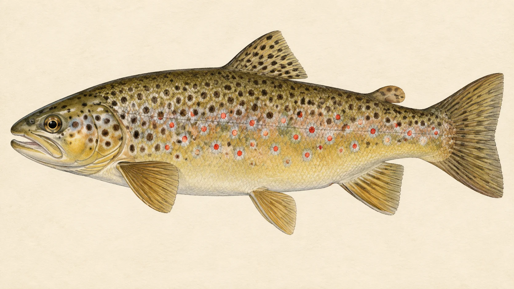
The Gungarlin River is a trout stream that feeds the Snowy River in New South Wales, and the reason to come is brown trout, released here over several seasons.

Picture it as a single tributary rather than a river of separate parts: it runs down its valley and joins the Snowy. The gradient chart shows how steeply it falls along the way. Steeper sections tend to mean pocket water and short runs; flatter ground gives longer glides and pools where a trout can sit out of the current.

The first trip, and the one we would start with, is a summer walk for brown trout with a dry and a nymph under it. No water-specific rule was found for the Gungarlin, which in practice means you check the current NSW guide for the trout season before you set out rather than assuming it is open. Pick a spot from the access card, walk upstream, and fish every run that looks deep enough to hide a fish.

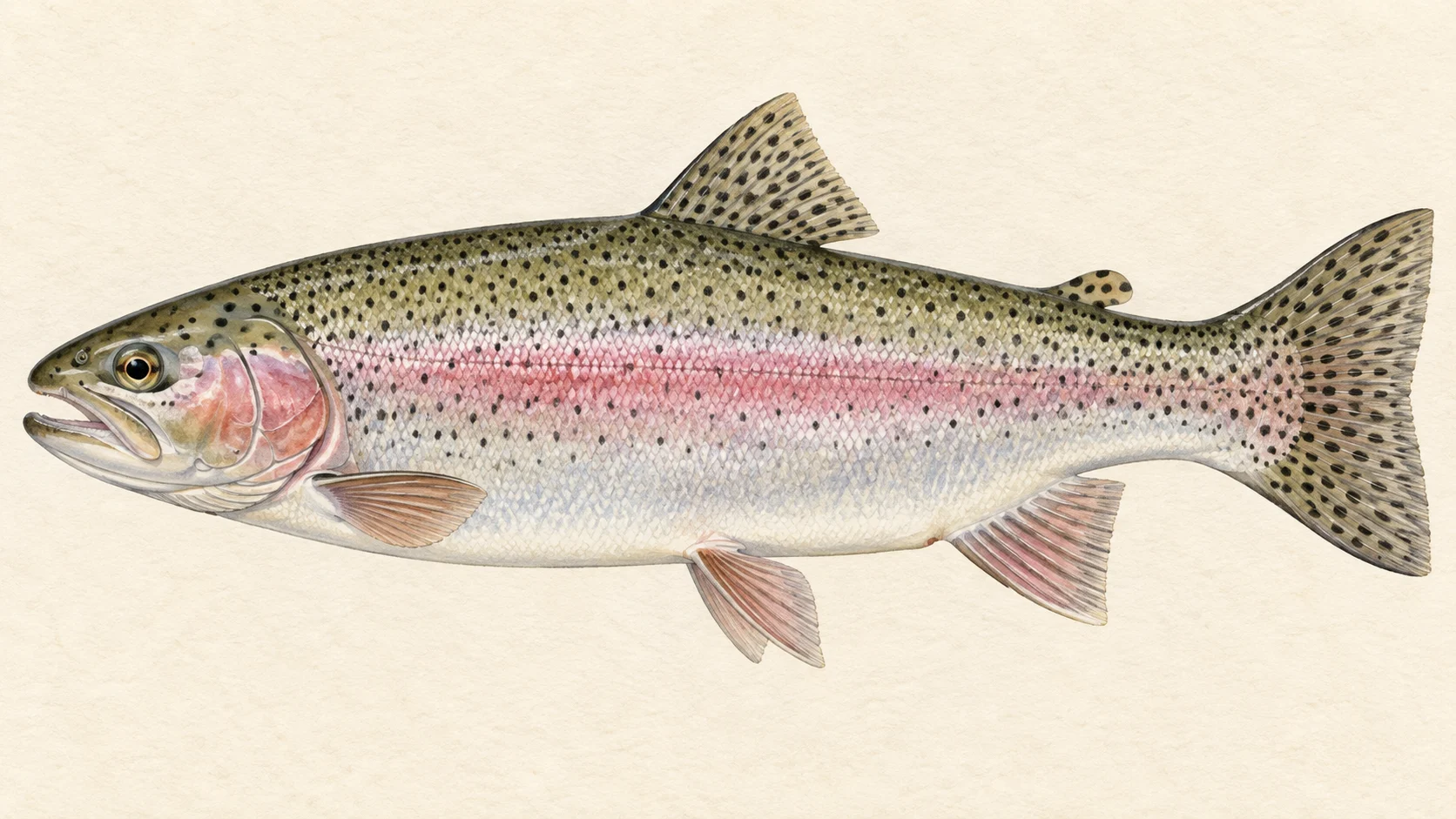
The second is an autumn visit when the water cools and, in our experience, browns become more willing to chase. Swing a small streamer through the deeper pools and the tails of the runs. Rainbows appear in the stocking history too, but only from an earlier season, so treat any you meet as a bonus rather than the plan.

Keep expectations honest. In our experience a stocked tributary like this gives its best to an angler who moves quietly, casts once or twice to each likely spot and keeps walking, rather than one who parks at the first pool and waits for a rise that may not come.

Check the NSW guide, choose a site from the access card, and plan on a day of walking and casting.

Water and habitat

The Gungarlin is a tributary of the Snowy. The gradient chart shows where it steepens and where it eases, and the bank cover chart shows how much of the corridor is shaded by trees or open to grass and sky.

On a small river like this, trout hold where the food line and a bit of shelter meet: the seam at the head of a pool, the slower water behind a boulder, an undercut bank with shade over it. Where the banks are open, expect fish to be spookier and to sit deeper through the middle of a bright day. Where they are wooded, look for fish tight under overhanging branches.

Fish and forage

The stocking chart shows brown trout released across several seasons and rainbow trout in an earlier one. Stocking tells you what has been put in, not how many survive, so read it as a reason to fish here rather than a head count.

Stream trout eat what drifts to them: mayfly and caddis nymphs off the bottom, emerging insects in the film, and beetles, ants and hoppers falling from the banks in summer. A first-visit box can stay small. Carry a few Hare's Ear and Pheasant Tail nymphs in sizes 12 to 16, a Royal Wulff or Stimulator to float them, an Elk Hair Caddis for the evening, and a couple of small dark Woolly Buggers.

When to fish it

Check the current NSW guide for the trout season first; no water-specific rule was found here.

Within whatever window the rules allow, and as a guide's read rather than a record, spring is nymph time: the water is cool and fish sit near the bottom of the runs. Summer usually brings the easiest dry-fly fishing on a stream like this, with terrestrials on warm afternoons and, on many trout streams, caddis toward dark. In late summer, fish early and late, when the light is off the water. Autumn is our pick for browns, which tend to feed harder and chase a swung fly as the water cools.

How to fish it

A 3- to 5-weight rod with a floating line suits a stream this size. Fish upstream so you approach trout from behind, and keep low on open banks.

Our default is a dry-dropper: a buoyant dry with a small beadhead nymph on a short dropper, cast into the head of each run and let drift back past you. Make a few casts, then move on. In deeper pools, try nymphing a heavier fly along the bottom, or swing a streamer across and down in autumn. If you see a fish rising, drop the nymph and fish a single dry on a fine tippet.

Access and safety

The access card names the sites, drawn from NSW DPIRD's angler access listings. Those describe where people reach the water; they are not a promise of permission across any land beside it, so respect fences and signs and ask where you are unsure.

As on any bush river, wear boots with grip for wet rock, carry water and a layer, tell someone where you are going, and walk back before the light goes.

Regulations

No water-specific rule was found for the Gungarlin River. Before you fish, check the current NSW Department of Primary Industries and Regional Development freshwater fishing guide for the trout season, bag and size limits, licence requirements and its closed-waters listings.
11 named access sites

These authority-listed points are separate from the mapped track intersections above. Some were inspected and some are public boat-ramp records; each row says which. A listing does not grant permission across private land, so check closures, signs and gates when you arrive.

  • Botherum Hut Inspected access site · Access mode not stated · National Park
  • Botherum Trail Inspected access site · Foot access · National Park
  • Diversion Dam Authority-listed access site · 2WD · National Park
  • Farmer Daves Inspected access site · Foot access · Freehold with permission
  • Island Bend Ft Inspected access site · 4WD medium · National Park
  • Kalkite Gap Inspected access site · Foot access · Public Road
  • Nimmo Rd Inspected access site · Access mode not stated · TSR
  • Nimmo Road Inspected access site · 2WD · TSR
  • Old Bridge Inspected access site · Access mode not stated · TSR
  • Snowy Plain Inspected access site · 4WD medium · TSR
  • Snowy Plain Reserve Inspected access site · Foot access · Public Reserve

Sources: NSW Department of Primary Industries and Regional Development.

When things happen

The guide's calendar for this water

When things happen

The year on this water

A year at a glance; check current rules

  • Spring nymphs in the runs · Oct to Nov A guide's read, not a record. Early in the season a weighted Hare's Ear or Pheasant Tail through the heads of the runs is a good bet on a small trout stream. Check the current NSW guide for when trout streams are open.
  • Summer dry and dropper · Dec to Feb A guide's judgement. A buoyant dry such as a Royal Wulff with a small nymph under it covers both the surface and the bottom of shallow runs.
  • Terrestrials on warm afternoons · Dec to Mar On warm, breezy days beetles, ants and hoppers fall off the banks. Trout under a bank edge often take a small terrestrial pattern.
  • Autumn browns on the move · Mar to Apr A guide's read. As the water cools, a small dark Woolly Bugger swung through the deeper pools can move a brown that ignores a dry.

What the record shows

Flows, river gradient, changing water levels, fish surveys and stocking

What the record shows

The fall of the river

Elevation along the river, source to end

Falls 454 m over 36 km, gravel bed, floodplain pockets for much of its length.

1,111 1,338 1,565 0 km from the source: 1565 m · falling 13.7 m per km · fine-grained, valley fill 1 km from the source: 1484 m · falling 18.8 m per km · fine-grained, valley fill 2 km from the source: 1459 m · falling 17.7 m per km · fine-grained, valley fill 3 km from the source: 1439 m · falling 16.7 m per km · gravel 4 km from the source: 1430 m · falling 16.3 m per km · gravel 5 km from the source: 1421 m · falling 11.7 m per km · gravel 6 km from the source: 1411 m · falling 10.3 m per km · gravel, discontinuous floodplain 7 km from the source: 1400 m · falling 9.4 m per km · gravel, discontinuous floodplain 8 km from the source: 1388 m · falling 8.6 m per km · gravel, discontinuous floodplain 9 km from the source: 1378 m · falling 7.5 m per km · fine-grained, discontinuous floodplain 10 km from the source: 1375 m · falling 6.9 m per km · gravel, discontinuous floodplain 11 km from the source: 1370 m · falling 6.5 m per km · gravel, discontinuous floodplain 12 km from the source: 1366 m · falling 6.4 m per km · gravel, discontinuous floodplain 13 km from the source: 1359 m · falling 6.3 m per km · gravel, discontinuous floodplain 14 km from the source: 1345 m · falling 5.9 m per km · gravel, discontinuous floodplain 15 km from the source: 1342 m · falling 4.8 m per km · gravel, discontinuous floodplain 16 km from the source: 1338 m · falling 3.7 m per km · gravel, discontinuous floodplain 17 km from the source: 1339 m · falling 3.1 m per km · gravel, discontinuous floodplain 18 km from the source: 1333 m · falling 2.6 m per km · gravel, discontinuous floodplain 19 km from the source: 1335 m · falling 2.9 m per km · gravel, discontinuous floodplain 20 km from the source: 1332 m · falling 3.2 m per km · gravel, discontinuous floodplain 21 km from the source: 1322 m · falling 3.2 m per km · gravel 22 km from the source: 1323 m · falling 3 m per km · gravel 23 km from the source: 1317 m · falling 2.9 m per km · gravel 24 km from the source: 1319 m · falling 2.8 m per km · gravel, discontinuous floodplain 25 km from the source: 1315 m · falling 3.2 m per km · gravel, discontinuous floodplain 26 km from the source: 1310 m · falling 3.8 m per km · gravel, discontinuous floodplain 27 km from the source: 1309 m · falling 4.2 m per km · gravel, discontinuous floodplain 28 km from the source: 1304 m · falling 4.8 m per km · gravel, occasional floodplain 29 km from the source: 1294 m · falling 4.9 m per km · gravel, discontinuous floodplain 30 km from the source: 1292 m · falling 6.3 m per km · gravel, discontinuous floodplain 31 km from the source: 1287 m · falling 11.1 m per km · gravel, discontinuous floodplain 32 km from the source: 1285 m · falling 18.7 m per km · gravel, discontinuous floodplain 33 km from the source: 1277 m · falling 21.5 m per km · bedrock, gorge 34 km from the source: 1242 m · falling 25.3 m per km · bedrock, gorge 35 km from the source: 1173 m · falling 25.8 m per km · bedrock, gorge 36 km from the source: 1111 m · falling 21.1 m per km · bedrock, gorge 0 km 9 km 18 km 27 km 36 km
bedrock · 11% gravel · 78% fine-grained · 11%
Headwater
1565 m
Outlet
1111 m
Typical drop
12.6 m/km
Steepest sampled stretch
25.8 m/km, near 35 km
Hover the profile for the reading at any kilometre.
Source: Geoscience Australia.
Source details and licence

Geoscience Australia — 1 second SRTM-derived DEM-H v1.0 (NCI tile store). Geoscience Australia, 1 second SRTM-derived DEM-H v1.0, © Commonwealth of Australia, CC BY 4.0. retrieved 2026-08-16.

Bed material: NSW Department of Climate Change, Energy, the Environment and Water (Water, Surface Water Science).
Source details and licence

NSW River Styles spatial dataset — geomorphic character and dominant bed material. NSW River Styles spatial dataset, © State Government of NSW and NSW Department of Climate Change, Energy, the Environment and Water 2023. retrieved 2026-08-21.

Gauge pins identify the monitoring stations. The slope shows how steeply the river falls; it does not show rapids or safe wading routes.

The banks, seen from space

Land cover in the 120 m beside the water, Landsat 2023 to 2024 to 2025

0 to 5 km: woody open 89.9% 0 to 5 km: woody sparse 1.9% 0 to 5 km: herbaceous native 6.9% 0 to 5 km: cultivated 1.3% 5 to 10 km: woody open 78.8% 5 to 10 km: woody sparse 0.6% 5 to 10 km: herbaceous native 20.6% 10 to 15 km: woody open 53.7% 10 to 15 km: woody sparse 0.6% 10 to 15 km: herbaceous native 41.9% 10 to 15 km: cultivated 3.8% 15 to 20 km: woody open 25% 15 to 20 km: woody sparse 1.9% 15 to 20 km: herbaceous native 60% 15 to 20 km: cultivated 13.1% 20 to 25 km: woody open 22.5% 20 to 25 km: woody sparse 1.9% 20 to 25 km: herbaceous native 69.3% 20 to 25 km: cultivated 6.3% 25 to 30 km: woody open 62.4% 25 to 30 km: woody sparse 1.3% 25 to 30 km: herbaceous native 35% 25 to 30 km: cultivated 1.3% 30 to 35 km: woody dense 1.3% 30 to 35 km: woody open 64.3% 30 to 35 km: woody sparse 3.1% 30 to 35 km: herbaceous native 31.3% 35 to 36.5 km: woody dense 7.8% 35 to 36.5 km: woody open 87.5% 35 to 36.5 km: woody sparse 4.7% 0 km 10 km 20 km 30 km
dense forest open woodland scattered trees and scrub native grass and heath farmed or cleared bare ground lake
Along the river itself about 61% of the bank is under trees, 36% is native grass or heath and 4% is farmed. The most wooded stretch is 35 to 36.5 km from the source; the most open is 20 to 25 km. A satellite reads the canopy, not the ground beneath it, so treat this as a read of the country, not a survey of every bank.
Source: Geoscience Australia / Digital Earth Australia.
Source details and licence

DEA Land Cover (Landsat) — Level 4 classification, continental mosaics. © Commonwealth of Australia (Geoscience Australia). DEA Land Cover (Landsat), Digital Earth Australia. retrieved 2026-08-19.

Stocking on record

1,050 fish in 4 records, 2020 to 2026

0 100 200 300 400 500 2020: 250 brown trout in 1 record 2020: 250 rainbow trout in 1 record 2024: 50 brown trout in 1 record 2026: 500 brown trout in 1 record 2020 2021 2022 2023 2024 2025 2026
Brown Trout, 800 across 3 records Rainbow Trout, 250 across 1 record
Stocked in 3 of the 7 years from 2020 to 2026. These are site-by-year totals, which can combine more than one release. A record is not a promise that stocking continues, and not evidence of what is in the water now.
Source: NSW Department of Primary Industries and Regional Development (Fisheries).
Source details and licence

NSW Fish Stocking — ArcGIS site markers and linked histories. retrieved 2026-08-29.

Conditions

What the gauges say

Check the water operator or jurisdiction authority for current conditions, and read the water yourself when you arrive.

Questions anglers ask

What trout can I expect in the Gungarlin River?

NSW stocking histories show brown trout released here across several seasons, the most recent among them, and rainbow trout in an earlier season. Read that as a guide to what you might meet, not a promise of numbers.

Is there a closed season?

No water-specific rule was found for the Gungarlin. Check the current NSW Department of Primary Industries and Regional Development freshwater fishing guide, including its trout season and closed-waters listings, before you fish.

Where do I get on the river?

The access card names the angler access sites drawn from NSW DPIRD listings. Those describe where people reach the water; they are not permission to cross land, so check the site and any signage when you arrive.

What should I carry for a first visit?

A light rod, a floating line, a few buoyant dries, a handful of weighted nymphs in sizes 12 to 16, and a couple of small dark streamers. That covers most days on a small trout river.

Behind this page