Access here has not been confirmed on the ground — treat every way in as unverified.
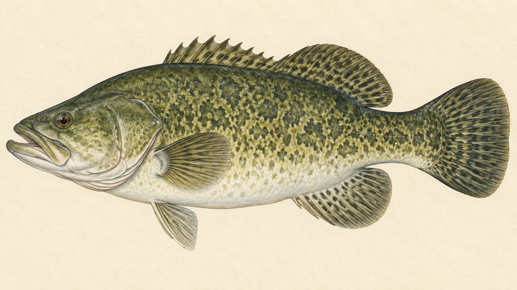
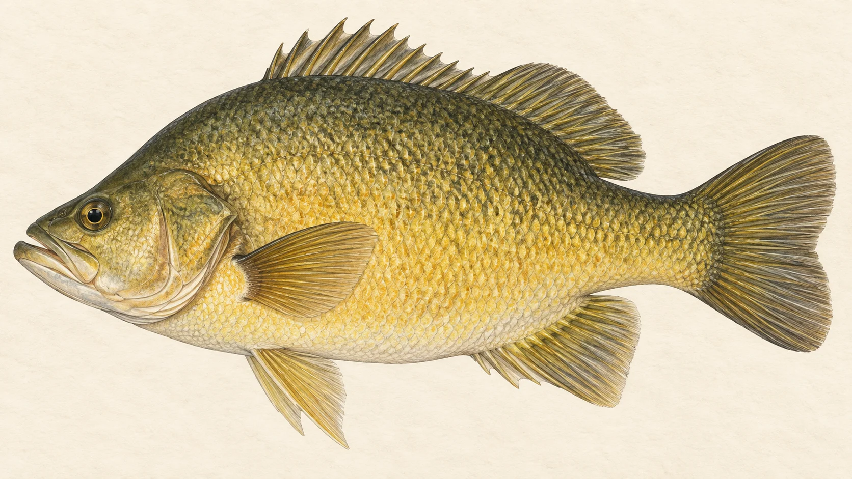
The Gwydir is a New England river where Murray cod, golden perch and freshwater catfish have all been recorded, and the reason to drive to it is a big native fish on a fly worked slowly through deep water.
One structure shapes the whole river. Copeton Dam sits across it and holds back a large lake, which cuts the river into two parts: the river above the lake's backed-up water, and the river below the dam wall, which carries on until it joins the Barwon.
That gives you two trips, and the one to start with is the natives. Cod, golden perch and catfish have all been recorded in the river, and NSW has put cod and golden perch into it over several recent seasons, which the stocking chart sets out. In our experience the warm months, roughly October to April, are the time to go, and a heavy streamer is the fly to carry. The access card shows one boat ramp; check its details there before you plan a launch. Read the current NSW fishing guide before you fish.
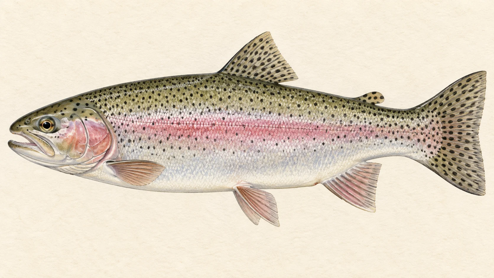
The second trip is trout. Rainbow trout have been recorded in the river, and NSW has stocked both rainbows and browns over recent seasons. In our experience trout in a New England river do best in the cooler, faster water higher in a system rather than in the warm lowland pools, so look for them where the river still has some pace. Check the current NSW fishing guide for the stretch you intend to fish before you drive up.
If you have one weekend, make it the natives: a dark streamer, the deepest water you can reach, and the last hour of light.
Water and habitat
The gradient chart shows how the river's fall changes along the mapped stretch, and the flow chart shows how often it runs high or low. Read them together before you pick a stretch. In our experience natives in a river like this sit in the deeper holes, beside fallen timber and along undercut banks, and move up onto shallower edges to feed as the light goes. Steeper, faster sections are where you would look for trout.
The bank cover chart gives a sense of how much shade and timber lines the water. Where there is cover, fish the shaded side first.
Fish and forage
Murray cod, golden perch and freshwater catfish are the natives worth a fly. Rainbow trout have been recorded, and brown trout have been stocked. River blackfish have been recorded too. Redfin and European carp are present, and you may meet either.
The small fish recorded here matter more for your fly box. Australian smelt, bony bream, carp gudgeons, spangled perch, rainbowfish and several hardyheads are all on the list, and in our experience they are the everyday food of the bigger natives. That points you at a streamer in dull, natural colours rather than anything bright.
When to fish it
For natives, the warm months from about October to April are the best bet in our experience, with the early morning and the last light usually the most productive times of day. In our experience cold water slows cod and golden perch right down. For trout, check the current NSW guide for any season that applies before you plan the trip. Before any visit, look at the live conditions card: a river running high and coloured fishes poorly for a fly.
How to fish it
For natives, a dark Woolly Bugger or a similar streamer in size 2 to 6, on an intermediate or sinking line, is a good start. Cast tight to timber, let the fly sink, and crawl it back with long, slow strips and pauses. Cod often take on the pause. A heavy tippet saves flies and fish around snags.
For trout, a 5 or 6 weight with a nymph under an indicator, or a hopper or beetle pattern on warm afternoons, is a sound approach in the faster water.
Access and safety
The access card shows one boat ramp. Treat it as a way to reach the water, not as permission to cross private ground. If you are unsure who owns a bank, ask before you walk it. As on any inland river, check the conditions before you set out and give a rising, coloured river a miss.
Regulations
Read the current NSW fishing guide from the Department of Primary Industries and Regional Development before you fish, and check what applies to the stretch and the species you are after.
1 named access site
These authority-listed points are separate from the mapped track intersections above. Some were inspected and some are public boat-ramp records; each row says which. A listing does not grant permission across private land, so check closures, signs and gates when you arrive.
Slow streamer through deep water for natives· Oct to AprA guide's read. A dark Woolly Bugger, size 2 to 6, crawled past timber and along the bottom of the deeper holes is a sound first fly for cod, golden perch or catfish.
Small native baitfish· Oct to AprAustralian smelt, bony bream, carp gudgeons, spangled perch and several hardyheads have been recorded in the river. In our experience small fish like these are what the bigger natives eat through the warm months.
What the record shows
Flows, river gradient, changing water levels, fish surveys and stocking
What the record shows
The river's year
Daily flow at Gwydir River at Pallamallawa, every year 1972 to 2026
Swipe to see the rest of the chart.
54 years of the gauge, week by week. The dark band is the middle half of all years, the pale band nine years in ten, the line the median. The shaded strip is the typical range: the band the river sits in about half of all days. In a typical year the river sits in it from early March to late November, and runs higher than that from early December through the turn of the year to late February. Whether a given day is one to wade is a call made at the bank, not a reading off this chart. Median flow peaks in mid January and bottoms out in late June. Flow and temperature are measured at different stations; this chart shows flow only.
19,648 days at Gwydir River at Pallamallawa, 1972 to 2026
Swipe to see the rest of the chart.
Read it left to right: the river runs above the flow on the left edge almost never, and above the flow on the right edge almost always. Half of all days sit below 6.8 m³/s. The shaded band is the typical range, where it sits about half the time; it runs higher than that one day in three and above the high-flow mark about one day in seven. These are frequency bands drawn from the record, not a measured limit — judge the water when you get there.
Gauge pins identify the monitoring stations. The slope shows how steeply the river falls; it does not show rapids or safe wading routes.
The banks, seen from space
Land cover in the 120 m beside the water, Landsat 2023 to 2024 to 2025
dense forestopen woodlandscattered trees and scrubnative grass and heathfarmed or clearedbare groundlake
Along the river itself about 21% of the bank is under trees, 76% is native grass or heath and 2% is farmed. The most wooded stretch is 20 to 20.5 km from the source; the most open is 0 to 5 km. A satellite reads the canopy, not the ground beneath it, so treat this as a read of the country, not a survey of every bank.
Capture records by decade — electrofishing, netting, trapping and rotenone surveys only; a sighting, an eDNA water sample or a stocking release is not a capture and is not counted here. A record is not an abundance estimate, and a decade with no bar is a decade with no capture survey on file, not evidence the water was empty.
Atlas of Living Australia — freshwater fish occurrence records (open licences, with coordinates). Occurrence records from the Atlas of Living Australia and its contributing datasets, including the Victorian Biodiversity Atlas, NSW BioNet Atlas, Sustainable Rivers Audit, Murray-Darling Basin fish monitoring programs, OZCAM museum collections and iNaturalist Australia. Each record carries its own licence and originating dataset. retrieved 2026-08-13.
Stocking on record
173,371 fish in 72 records, 2020 to 2026
Golden Perch, 54,239 across 31 recordsRainbow Trout, 48,000 across 8 recordsMurray Cod, 43,132 across 29 recordsBrown Trout, 28,000 across 4 records
Stocked in 7 of the 7 years from 2020 to 2026. These are site-by-year totals, which can combine more than one release. A record is not a promise that stocking continues, and not evidence of what is in the water now.
Source: NSW Department of Primary Industries and Regional Development (Fisheries). Source details and licence
NSW Fish Stocking — ArcGIS site markers and linked histories. retrieved 2026-08-29.
Conditions
What the gauges say
water_dropGwydir River at Pallamallawa
River flow
waves
m³/s
history
No reading shown: No reading has been captured for this gauge yet, so none is shown.
Gauge height
straighten
m
history
No reading shown: No reading has been captured for this gauge yet, so none is shown.
Water temperature
thermostat
°C
history
No reading shown: No reading has been captured for this gauge yet, so none is shown.
water_dropGwydir River at Yarraman Bridge
River flow
waves
m³/s
history
No reading shown: No reading has been captured for this gauge yet, so none is shown.
Gauge height
straighten
m
history
No reading shown: No reading has been captured for this gauge yet, so none is shown.
Water temperature
thermostat
°C
history
No reading shown: No reading has been captured for this gauge yet, so none is shown.
water_dropGwydir River at Bundarra
River flow
waves
m³/s
history
No reading shown: No reading has been captured for this gauge yet, so none is shown.
Gauge height
straighten
m
history
No reading shown: No reading has been captured for this gauge yet, so none is shown.
Water temperature
thermostat
°C
history
No reading shown: No reading has been captured for this gauge yet, so none is shown.
water_dropGwydir River at Pinegrove
River flow
waves
m³/s
history
No reading shown: No reading has been captured for this gauge yet, so none is shown.
Gauge height
straighten
m
history
No reading shown: No reading has been captured for this gauge yet, so none is shown.
water_dropGwydir River at Gravesend Road Bridge
River flow
waves
m³/s
history
No reading shown: No reading has been captured for this gauge yet, so none is shown.
Gauge height
straighten
m
history
No reading shown: No reading has been captured for this gauge yet, so none is shown.
water_dropGwydir River at Yarrowyck
River flow
waves
m³/s
history
No reading shown: No reading has been captured for this gauge yet, so none is shown.
Gauge height
straighten
m
history
No reading shown: No reading has been captured for this gauge yet, so none is shown.
water_dropGwydir River downstream Copeton Dam
River flow
waves
m³/s
history
No reading shown: No reading has been captured for this gauge yet, so none is shown.
Gauge height
straighten
m
history
No reading shown: No reading has been captured for this gauge yet, so none is shown.
water_dropGwydir River D/s Boolooroo Weir
River flow
waves
m³/s
history
No reading shown: No reading has been captured for this gauge yet, so none is shown.
Gauge height
straighten
m
history
No reading shown: No reading has been captured for this gauge yet, so none is shown.
water_dropGwydir River at D/s Tareelar0i Weir
River flow
waves
m³/s
history
No reading shown: No reading has been captured for this gauge yet, so none is shown.
Gauge height
straighten
m
history
No reading shown: No reading has been captured for this gauge yet, so none is shown.
water_dropGwydir River at Boolooroo Weir-storage Gauge
Water temperature
thermostat
°C
history
No reading shown: No reading has been captured for this gauge yet, so none is shown.
water_dropGwydir River at Brageen Crossing
River flow
waves
m³/s
history
No reading shown: No reading has been captured for this gauge yet, so none is shown.
Gauge height
straighten
m
history
No reading shown: No reading has been captured for this gauge yet, so none is shown.
water_dropGwydir River (South Arm) at D/s Tyreel Offtake Regulato
River flow
waves
m³/s
history
No reading shown: No reading has been captured for this gauge yet, so none is shown.
Gauge height
straighten
m
history
No reading shown: No reading has been captured for this gauge yet, so none is shown.
water_dropGwydir River at Tyreel Storage Gauge
River flow
waves
m³/s
history
No reading shown: No reading has been captured for this gauge yet, so none is shown.
Gauge height
straighten
m
history
No reading shown: No reading has been captured for this gauge yet, so none is shown.
water_dropGwydir River at Millewa
River flow
waves
m³/s
history
No reading shown: No reading has been captured for this gauge yet, so none is shown.
Gauge height
straighten
m
history
No reading shown: No reading has been captured for this gauge yet, so none is shown.
water_dropGwydir River at Allambie Bridge
River flow
waves
m³/s
history
No reading shown: No reading has been captured for this gauge yet, so none is shown.
Gauge height
straighten
m
history
No reading shown: No reading has been captured for this gauge yet, so none is shown.
Murray cod, golden perch and freshwater catfish have all been recorded, and NSW has stocked cod and golden perch as well as rainbow and brown trout. Redfin and carp are also present, so do not be surprised by either on a streamer.
When should I go?+
For the natives, the warmer months from about October to April are the best bet in our experience. Check the current NSW fishing guide for any season that applies before you plan a trip around a particular species.
Where do I get in?+
The access card shows one boat ramp. Treat it as a way to reach the water, not as permission to cross private ground along the banks.
What are the rules?+
Read the current NSW fishing guide before you fish, and check what applies to the stretch and the species you plan to fish.