Australia Fly Guide
NSW · Lachlan River

Lachlan River

Imagery © Esri

info

Before you rely on this page

  • Access here has not been confirmed on the ground — treat every way in as unverified.

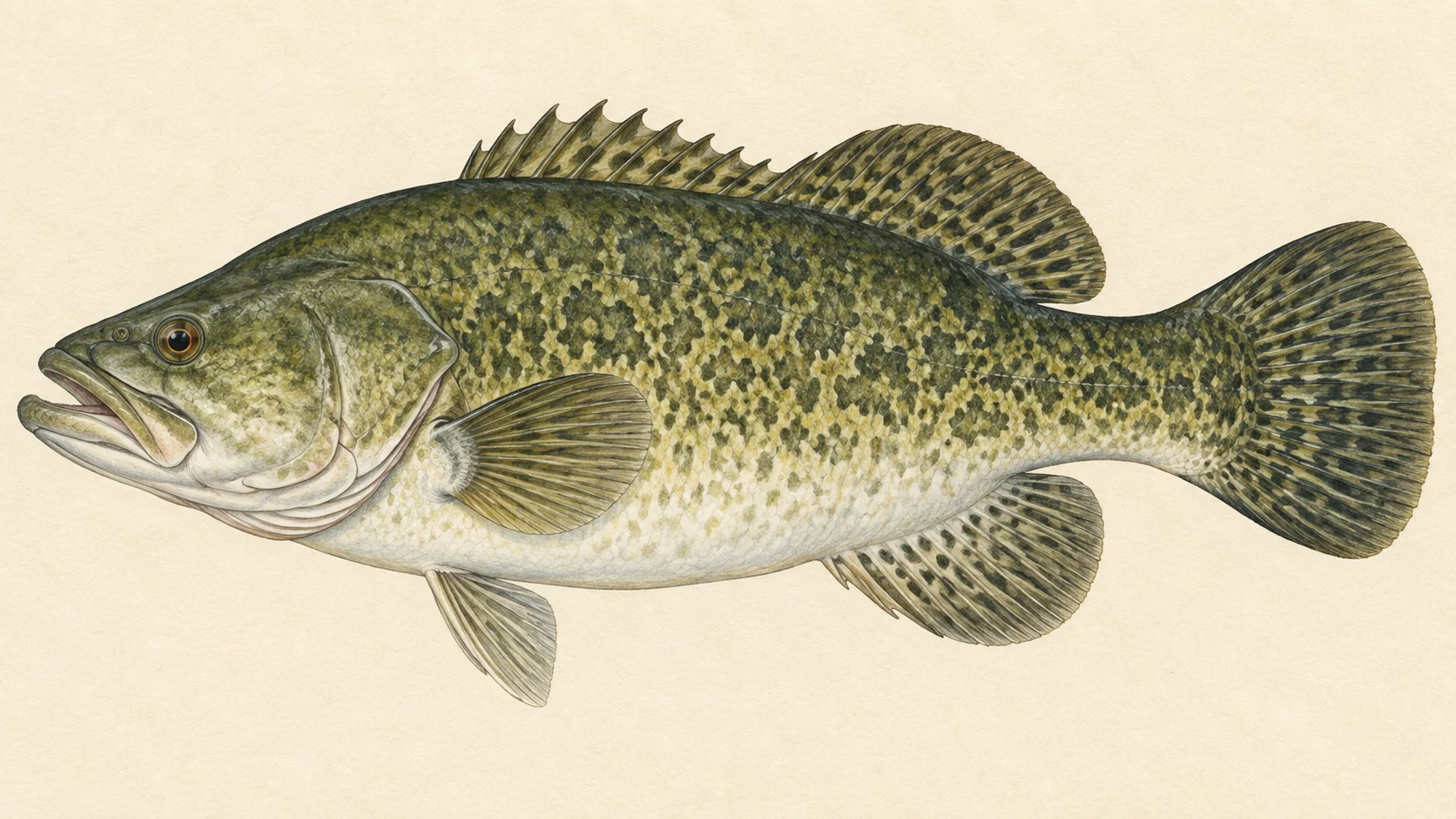
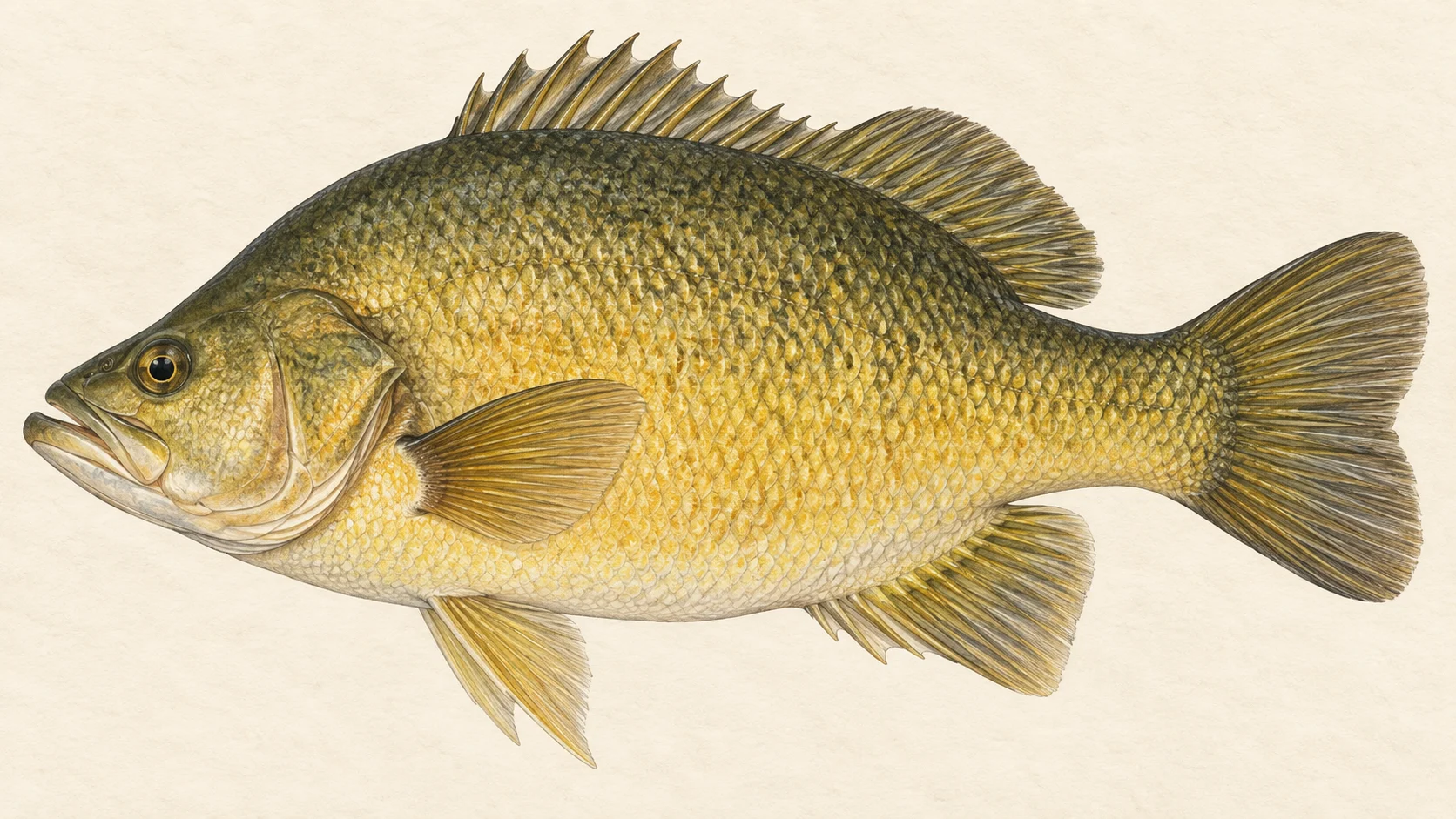
The Lachlan is a big inland river for Murray cod and golden perch, and it is stocked with both. If you want to fish for Australian natives on a fly in New South Wales, it belongs on your list.

Think of it as two rivers joined end to end. The higher, cooler water is, in our view, the trout water. The long, warm lowland river below it is native-fish country, held back along the way by a big dam, Wyangala, and by a series of weirs, before it finally runs into the Murrumbidgee.

The first trip, and the one we would start with, is for golden perch in summer. Choose an access site from the card, find a snag on the outside of a bend, and fish a Woolly Bugger or a hopper tight to the timber in the evening. The current NSW guide sets the rules for your trip, so read it before you drive out.

The second trip is for Murray cod, and it takes patience. Cod have been recorded in the river and are stocked, and they live in the same timber as the golden perch. Fish a bigger, darker fly slowly and deep, and use a leader heavy enough to drag a fish out of a snag. The NSW guide sets the rules for cod, so check it before you keep one.

The third is trout in the cooler water. Brown and rainbow trout are both stocked, but trout need cold water, so we would not expect them in the warm lowland reaches. Treat it as a side trip once you know the river, not a reason to come.

Carp have been recorded in the river, and they fill a quiet afternoon on a small nymph in the shallows.

Pick an access site, read the NSW guide, and go in summer.

Water and habitat

The Lachlan is a long river, and the gradient chart shows how it falls from the higher country into the flat inland. Along the way it is held back by Wyangala Dam and by several weirs, and it ends as a tributary of the Murrumbidgee.

In our experience a lowland river like this fishes as a chain of slow pools, bends and snags. Cod and golden perch are ambush feeders, so they sit where there is cover and depth: a fallen tree, a root ball on the outside of a bend, a deep hole below a bar. The inside of a bend is usually shallow and soft, and that is where carp cruise. In the cooler upper water any trout will hold where the current is quickest and the water coldest, at the heads of runs.

The flow chart shows how often the river runs high or low, and the bank cover chart shows what lines its banks. Check the live conditions panel before you go; a clearing river after a dry spell fishes very differently from a brown one after rain.

Fish and forage

The natives lead. Murray cod and golden perch have both been recorded in the river and both are stocked; the stocking chart shows which seasons they went in. Silver perch, Macquarie perch, river blackfish and trout cod have been recorded too, so learn to tell them apart and check their status in the current NSW guide.

Brown and rainbow trout are stocked. The introduced fish recorded in the river include carp, goldfish and tench, along with eastern gambusia.

The forage that matters to a fly box is small fish. Australian smelt, mountain galaxias, bony bream, carp gudgeons and two kinds of hardyhead have all been recorded, and in our experience a cod or a golden perch will eat any of them. In summer add grasshoppers blowing in off the banks. A dark streamer covers the baitfish and a hopper covers the rest.

When to fish it

Nothing specific to the Lachlan sets its calendar, so this is a guide's read.

Summer is the heart of it for natives. Warm water wakes golden perch and cod up, and the long evenings let you fish a hopper or a popper tight to the banks after dark falls. Spring, as the water warms, is a good bet for golden perch on a streamer and for carp feeding in the shallows.

Autumn stays worth a trip while the water holds its warmth. In winter the natives slow right down, and a fly fished slowly and deep is the only approach we would bother with. For trout, the cooler months in the cooler water make more sense than high summer. Whatever the month, look at the live river height first.

How to fish it

A seven or eight weight with a floating line covers most of it, with a sink tip on a spare spool for the deep holes. Use a heavier leader than you would for trout; cod live in timber and you get one chance to turn a fish.

A Woolly Bugger in olive or black, sizes 4 to 8, is the workhorse. Cast it past a snag, let it sink, and strip back in short pulls so it swims along the edge of the timber. Golden perch often take on the drop. Cod tend to hit hard and head straight back into the wood, so keep your rod low and your drag firm from the first second.

On summer evenings, go to the surface. A hopper or a popper dropped tight to a log or a grassy bank, left to sit, then twitched, is how you find golden perch. For carp, a small dark nymph such as a Hare's Ear put in front of a feeding fish in the shallows beats blind casting. For trout in the cooler water, a smaller Woolly Bugger or a nymph fished through the heads of runs is a sensible start.

Access and safety

The access card lists the sites where anglers get onto the river. Use it to pick a starting point. A listed site tells you where people fish, not what land you may cross, so treat the banks either side as somebody's property unless a sign or the land manager says otherwise.

As on any inland river, tell someone where you are going and when you will be back, carry more water than you think you need in summer, and keep clear of the bank edge where it is undercut. Stay well back from any dam wall or weir, and watch the live river height for a rise after rain upstream.

Regulations

Check the current NSW Department of Primary Industries and Regional Development recreational fishing guide before you fish, for the licence, the closed-waters listings near dams and weirs, the trout rules and the native fish closures and bag and size limits that apply. Check it too for the status of the rarer natives recorded here, including Macquarie perch, trout cod and silver perch.

76 named access sites

These authority-listed points are separate from the mapped track intersections above. Some were inspected and some are public boat-ramp records; each row says which. A listing does not grant permission across private land, so check closures, signs and gates when you arrive.

Showing the first 60 of 76 sites on this long river. Use the authority sources below for the complete lists.

Sources: NSW Department of Primary Industries and Regional Development.

When things happen

The guide's calendar for this water

When things happen

The year on this water

A year at a glance; check current rules

  • Woolly Bugger · Jan to Dec In our experience the one fly worth carrying every month here. Olive or black, sizes 4 to 8, fished slow past timber for cod and golden perch.
  • Hoppers and poppers for natives · Dec to Mar A guide's read, not a record. Warm evenings are the time to try a surface fly tight to a snag or a grassy bank for golden perch.
  • Grasshoppers on the banks · Dec to Mar Late-summer hoppers blowing in off the paddocks are a meal for golden perch and anything else near the edge.
  • Small native baitfish · Jan to Dec Australian smelt and mountain galaxias have both been recorded in the river. A slim streamer is the imitation.

What the record shows

Flows, river gradient, changing water levels, fish surveys and stocking

What the record shows

The river's year

Daily flow at Lake Brewster Conduit downstream Regulator, every year 2002 to 2026

0.5 1 2 5 typical range high-flow mark Jan Feb Mar Apr May Jun Jul Aug Sep Oct Nov Dec m³/s
24 years of the gauge, week by week. The dark band is the middle half of all years, the pale band nine years in ten, the line the median. The shaded strip is the typical range: the band the river sits in about half of all days. In a typical year the river sits in it all year. Whether a given day is one to wade is a call made at the bank, not a reading off this chart. Median flow peaks in late January and bottoms out in early April. Flow and temperature are measured at different stations; this chart shows flow only.
Source: Bureau of Meteorology.
Source details and licence

Bureau of Meteorology — Water Data Online series catalogue (Snowy/Monaro stations). Bureau of Meteorology, © Commonwealth of Australia. Licensed from the Commonwealth of Australia under a Creative Commons Attribution 4.0 International licence. retrieved 2026-08-12.

How often it runs this high

8,278 days at Lake Brewster Conduit downstream Regulator, 2002 to 2026

0.2 0.5 1 2 5 10 typical range 1.328 to 5.983 m³/s high-flow mark 7.321 m³/s 0% of days 25% of days 50% of days 75% of days 100% of days m³/s
Read it left to right: the river runs above the flow on the left edge almost never, and above the flow on the right edge almost always. Half of all days sit below 5 m³/s. The shaded band is the typical range, where it sits about half the time; it runs higher than that one day in three and above the high-flow mark about one day in seven. These are frequency bands drawn from the record, not a measured limit — judge the water when you get there.
Source: Bureau of Meteorology.
Source details and licence

Bureau of Meteorology — Water Data Online series catalogue (Snowy/Monaro stations). Bureau of Meteorology, © Commonwealth of Australia. Licensed from the Commonwealth of Australia under a Creative Commons Attribution 4.0 International licence. retrieved 2026-08-12.

The fall of the river

Elevation along the river, source to end

Falls 614 m over 1555.8 km, fine-grained bed, floodplain pockets for much of its length.

67 376 684 gauge 412065 gauge 412027 gauge 412067 gauge 412002 gauge 412057 gauge 412141 gauge 412901 gauge 412004 gauge 412024 gauge 412006 gauge 412011 · gauge 412101 gauge 412109 · gauge 412048 gauge 412038 gauge 412039 gauge 412078 gauge 412005 gauge 412045 gauge 412194 0 km from the source: 683 m · falling 3.8 m per km · fine-grained 5.2 km from the source: 684 m · falling 4.2 m per km · gravel, occasional floodplain 10.41 km from the source: 655 m · falling 4.5 m per km · gravel, occasional floodplain 15.61 km from the source: 587 m · falling 4.6 m per km · gravel, occasional floodplain 20.81 km from the source: 563 m · falling 4.3 m per km · gravel, discontinuous floodplain 26.02 km from the source: 551 m · falling 3.5 m per km · gravel, discontinuous floodplain 31.22 km from the source: 544 m · falling 2.5 m per km · gravel, discontinuous floodplain 36.42 km from the source: 537 m · falling 1.8 m per km · gravel, occasional floodplain 41.63 km from the source: 529 m · falling 1.6 m per km · gravel, occasional floodplain 46.83 km from the source: 516 m · falling 1.4 m per km · gravel, discontinuous floodplain 52.03 km from the source: 512 m · falling 1.3 m per km · gravel, discontinuous floodplain 57.23 km from the source: 504 m · falling 1.1 m per km · gravel, discontinuous floodplain 62.44 km from the source: 501 m · falling 0.9 m per km · gravel, discontinuous floodplain 67.64 km from the source: 498 m · falling 0.8 m per km · gravel, discontinuous floodplain 72.84 km from the source: 494 m · falling 0.8 m per km · gravel, discontinuous floodplain 78.05 km from the source: 490 m · falling 0.8 m per km · gravel, discontinuous floodplain 83.25 km from the source: 483 m · falling 0.9 m per km · gravel, discontinuous floodplain 88.45 km from the source: 480 m · falling 1 m per km · gravel, occasional floodplain 93.66 km from the source: 474 m · falling 1.1 m per km · gravel, discontinuous floodplain 98.86 km from the source: 471 m · falling 1.2 m per km · gravel, discontinuous floodplain 104.06 km from the source: 462 m · falling 1.3 m per km · gravel, occasional floodplain 109.27 km from the source: 451 m · falling 1.2 m per km · gravel, occasional floodplain 114.47 km from the source: 448 m · falling 1.2 m per km · gravel, occasional floodplain 119.67 km from the source: 445 m · falling 1.3 m per km · gravel, discontinuous floodplain 124.88 km from the source: 434 m · falling 1.2 m per km · gravel, occasional floodplain 130.08 km from the source: 433 m · falling 1.2 m per km · gravel, discontinuous floodplain 135.28 km from the source: 421 m · falling 1.2 m per km · gravel, discontinuous floodplain 140.49 km from the source: 415 m · falling 1.2 m per km · gravel, discontinuous floodplain 145.69 km from the source: 410 m · falling 1.1 m per km · gravel, discontinuous floodplain 150.89 km from the source: 409 m · falling 1.1 m per km · gravel, discontinuous floodplain 156.1 km from the source: 398 m · falling 1 m per km · gravel, discontinuous floodplain 161.3 km from the source: 394 m · falling 0.9 m per km · gravel, discontinuous floodplain 166.5 km from the source: 390 m · falling 0.8 m per km · gravel, discontinuous floodplain 171.7 km from the source: 387 m · falling 0.8 m per km · gravel, discontinuous floodplain 176.91 km from the source: 382 m · falling 0.6 m per km · gravel, occasional floodplain 182.11 km from the source: 377 m · falling 0.4 m per km · gravel, occasional floodplain 187.31 km from the source: 378 m · falling 0.2 m per km · water storage 192.52 km from the source: 376 m · falling 0.1 m per km · water storage 197.72 km from the source: 378 m · falling 0.6 m per km · water storage 202.92 km from the source: 378 m · falling 1.3 m per km · water storage 208.13 km from the source: 378 m · falling 2.1 m per km · water storage 213.33 km from the source: 378 m · falling 2.8 m per km · water storage 218.53 km from the source: 314 m · falling 3 m per km · gravel, discontinuous floodplain 223.74 km from the source: 302 m · falling 2.5 m per km · gravel, discontinuous floodplain 228.94 km from the source: 301 m · falling 1.9 m per km · sand, discontinuous floodplain 234.14 km from the source: 299 m · falling 1.3 m per km · sand, discontinuous floodplain 239.35 km from the source: 302 m · falling 0.7 m per km · sand, discontinuous floodplain 244.55 km from the source: 286 m · falling 0.6 m per km · sand, discontinuous floodplain 249.75 km from the source: 286 m · falling 0.6 m per km · sand, discontinuous floodplain 254.96 km from the source: 285 m · falling 0.4 m per km · sand, discontinuous floodplain 260.16 km from the source: 283 m · falling 0.4 m per km · sand, discontinuous floodplain 265.36 km from the source: 282 m · falling 0.2 m per km · sand, discontinuous floodplain 270.56 km from the source: 280 m · falling 0.3 m per km · sand, discontinuous floodplain 275.77 km from the source: 283 m · falling 0.3 m per km · sand, discontinuous floodplain 280.97 km from the source: 277 m · falling 0.3 m per km · sand, discontinuous floodplain 286.17 km from the source: 275 m · falling 0.4 m per km · sand, discontinuous floodplain 291.38 km from the source: 275 m · falling 0.4 m per km · sand, discontinuous floodplain 296.58 km from the source: 272 m · falling 0.4 m per km · sand, discontinuous floodplain 301.78 km from the source: 271 m · falling 0.4 m per km · sand, discontinuous floodplain 306.99 km from the source: 266 m · falling 0.4 m per km · sand, discontinuous floodplain 312.19 km from the source: 263 m · falling 0.3 m per km · sand, discontinuous floodplain 317.39 km from the source: 266 m · falling 0.3 m per km · sand, discontinuous floodplain 322.6 km from the source: 262 m · falling 0.3 m per km · sand, discontinuous floodplain 327.8 km from the source: 262 m · falling 0.3 m per km · sand, discontinuous floodplain 333 km from the source: 263 m · falling 0.4 m per km · sand, discontinuous floodplain 338.21 km from the source: 257 m · falling 0.4 m per km · sand, discontinuous floodplain 343.41 km from the source: 253 m · falling 0.3 m per km · sand, discontinuous floodplain 348.61 km from the source: 253 m · falling 0.3 m per km · sand, discontinuous floodplain 353.82 km from the source: 254 m · falling 0.3 m per km · sand, discontinuous floodplain 359.02 km from the source: 253 m · falling 0.2 m per km · sand, discontinuous floodplain 364.22 km from the source: 250 m · falling 0.2 m per km · sand, discontinuous floodplain 369.43 km from the source: 250 m · falling 0.2 m per km · fine-grained 374.63 km from the source: 248 m · falling 0.2 m per km · fine-grained 379.83 km from the source: 248 m · falling 0.2 m per km · fine-grained 385.03 km from the source: 245 m · falling 0.2 m per km · fine-grained 390.24 km from the source: 247 m · falling 0.2 m per km · fine-grained 395.44 km from the source: 245 m · falling 0.3 m per km · fine-grained 400.64 km from the source: 241 m · falling 0.3 m per km · fine-grained 405.85 km from the source: 241 m · falling 0.3 m per km · fine-grained 411.05 km from the source: 239 m · falling 0.2 m per km · fine-grained 416.25 km from the source: 237 m · falling 0.1 m per km · fine-grained 421.46 km from the source: 239 m · falling 0.1 m per km · fine-grained 426.66 km from the source: 237 m · falling 0.1 m per km · fine-grained 431.86 km from the source: 239 m · falling 0.2 m per km · fine-grained 437.07 km from the source: 237 m · falling 0.2 m per km · fine-grained 442.27 km from the source: 236 m · falling 0.3 m per km · fine-grained 447.47 km from the source: 233 m · falling 0.3 m per km · fine-grained 452.68 km from the source: 230 m · falling 0.3 m per km · fine-grained 457.88 km from the source: 230 m · falling 0.3 m per km · fine-grained 463.08 km from the source: 228 m · falling 0.3 m per km · fine-grained 468.29 km from the source: 225 m · falling 0.2 m per km · fine-grained 473.49 km from the source: 226 m · falling 0.2 m per km · fine-grained 478.69 km from the source: 227 m · falling 0.2 m per km · fine-grained 483.89 km from the source: 224 m · falling 0.2 m per km · fine-grained 489.1 km from the source: 222 m · falling 0.2 m per km · fine-grained 494.3 km from the source: 223 m · falling 0.2 m per km · fine-grained 499.5 km from the source: 222 m · falling 0.2 m per km · fine-grained 504.71 km from the source: 222 m · falling 0.2 m per km · fine-grained 509.91 km from the source: 219 m · falling 0.2 m per km · fine-grained 515.11 km from the source: 219 m · falling 0.2 m per km · fine-grained 520.32 km from the source: 218 m · falling 0.2 m per km · fine-grained 525.52 km from the source: 217 m · falling 0.2 m per km · fine-grained 530.72 km from the source: 219 m · falling 0.2 m per km · fine-grained 535.93 km from the source: 214 m · falling 0.2 m per km · fine-grained 541.13 km from the source: 215 m · falling 0.2 m per km · fine-grained 546.33 km from the source: 213 m · falling 0.2 m per km · fine-grained 551.54 km from the source: 213 m · falling 0.2 m per km · fine-grained 556.74 km from the source: 212 m · falling 0.2 m per km · fine-grained 561.94 km from the source: 212 m · falling 0.2 m per km · fine-grained 567.15 km from the source: 211 m · falling 0.2 m per km · fine-grained 572.35 km from the source: 209 m · falling 0.2 m per km · fine-grained 577.55 km from the source: 208 m · falling 0.2 m per km · fine-grained 582.76 km from the source: 207 m · falling 0.3 m per km · fine-grained 587.96 km from the source: 206 m · falling 0.3 m per km · fine-grained 593.16 km from the source: 205 m · falling 0.3 m per km · fine-grained, floodout 598.36 km from the source: 202 m · falling 0.3 m per km · fine-grained 603.57 km from the source: 201 m · falling 0.3 m per km · fine-grained 608.77 km from the source: 199 m · falling 0.3 m per km · fine-grained 613.97 km from the source: 198 m · falling 0.3 m per km · fine-grained 619.18 km from the source: 198 m · falling 0.3 m per km · fine-grained 624.38 km from the source: 195 m · falling 0.3 m per km · fine-grained 629.58 km from the source: 194 m · falling 0.3 m per km · fine-grained 634.79 km from the source: 195 m · falling 0.3 m per km · fine-grained 639.99 km from the source: 191 m · falling 0.3 m per km · fine-grained 645.19 km from the source: 188 m · falling 0.2 m per km · fine-grained 650.4 km from the source: 188 m · falling 0.2 m per km · fine-grained 655.6 km from the source: 188 m · falling 0.2 m per km · fine-grained 660.8 km from the source: 189 m · falling 0.1 m per km · fine-grained, discontinuous floodplain 666.01 km from the source: 186 m · falling 0.1 m per km · fine-grained 671.21 km from the source: 186 m · falling 0.2 m per km · fine-grained 676.41 km from the source: 185 m · falling 0.2 m per km · fine-grained 681.62 km from the source: 184 m · falling 0.2 m per km · fine-grained 686.82 km from the source: 184 m · falling 0.2 m per km · fine-grained 692.02 km from the source: 183 m · falling 0.2 m per km · fine-grained 697.22 km from the source: 182 m · falling 0.2 m per km · fine-grained 702.43 km from the source: 182 m · falling 0.2 m per km · fine-grained 707.63 km from the source: 180 m · falling 0.2 m per km · fine-grained 712.83 km from the source: 178 m · falling 0.2 m per km · fine-grained 718.04 km from the source: 176 m · falling 0.3 m per km · fine-grained 723.24 km from the source: 177 m · falling 0.3 m per km · fine-grained 728.44 km from the source: 176 m · falling 0.3 m per km · fine-grained 733.65 km from the source: 173 m · falling 0.3 m per km · fine-grained 738.85 km from the source: 171 m · falling 0.3 m per km · fine-grained 744.05 km from the source: 169 m · falling 0.3 m per km · fine-grained 749.26 km from the source: 167 m · falling 0.2 m per km · fine-grained 754.46 km from the source: 166 m · falling 0.2 m per km · fine-grained 759.66 km from the source: 167 m · falling 0.1 m per km · fine-grained 764.87 km from the source: 166 m · falling 0.1 m per km · fine-grained 770.07 km from the source: 166 m · falling 0.1 m per km · fine-grained 775.27 km from the source: 164 m · falling 0.1 m per km · fine-grained 780.48 km from the source: 165 m · falling 0.2 m per km · fine-grained 785.68 km from the source: 163 m · falling 0.2 m per km · fine-grained 790.88 km from the source: 160 m · falling 0.2 m per km · fine-grained 796.09 km from the source: 162 m · falling 0.1 m per km · fine-grained 801.29 km from the source: 161 m · falling 0.2 m per km · fine-grained 806.49 km from the source: 160 m · falling 0.2 m per km · fine-grained 811.69 km from the source: 159 m · falling 0.2 m per km · fine-grained 816.9 km from the source: 158 m · falling 0.3 m per km · fine-grained 822.1 km from the source: 155 m · falling 0.3 m per km · fine-grained 827.3 km from the source: 154 m · falling 0.3 m per km · fine-grained 832.51 km from the source: 152 m · falling 0.2 m per km · fine-grained 837.71 km from the source: 150 m · falling 0.1 m per km · fine-grained 842.91 km from the source: 151 m · falling 0.1 m per km · fine-grained, discontinuous floodplain 848.12 km from the source: 151 m · falling 0.1 m per km · fine-grained, discontinuous floodplain 853.32 km from the source: 150 m · falling 0 m per km · fine-grained, discontinuous floodplain 858.52 km from the source: 152 m · falling 0.1 m per km · fine-grained, discontinuous floodplain 863.73 km from the source: 150 m · falling 0.1 m per km · fine-grained 868.93 km from the source: 149 m · falling 0.1 m per km · fine-grained 874.13 km from the source: 149 m · falling 0.1 m per km · fine-grained 879.34 km from the source: 149 m · falling 0.1 m per km · fine-grained 884.54 km from the source: 149 m · falling 0.1 m per km · fine-grained 889.74 km from the source: 149 m · falling 0.2 m per km · fine-grained 894.95 km from the source: 148 m · falling 0.2 m per km · fine-grained 900.15 km from the source: 144 m · falling 0.2 m per km · fine-grained 905.35 km from the source: 143 m · falling 0.2 m per km · fine-grained 910.55 km from the source: 144 m · falling 0.2 m per km · fine-grained 915.76 km from the source: 144 m · falling 0.2 m per km · fine-grained 920.96 km from the source: 142 m · falling 0.2 m per km · fine-grained 926.16 km from the source: 140 m · falling 0.1 m per km · fine-grained 931.37 km from the source: 141 m · falling 0.2 m per km · fine-grained 936.57 km from the source: 140 m · falling 0.2 m per km · fine-grained 941.77 km from the source: 139 m · falling 0.2 m per km · fine-grained 946.98 km from the source: 138 m · falling 0.2 m per km · fine-grained 952.18 km from the source: 136 m · falling 0.2 m per km · fine-grained 957.38 km from the source: 135 m · falling 0.2 m per km · fine-grained 962.59 km from the source: 134 m · falling 0.2 m per km · fine-grained 967.79 km from the source: 134 m · falling 0.1 m per km · fine-grained 972.99 km from the source: 134 m · falling 0.1 m per km · fine-grained, discontinuous floodplain 978.2 km from the source: 132 m · falling 0.2 m per km · fine-grained, discontinuous floodplain 983.4 km from the source: 132 m · falling 0.2 m per km · fine-grained, discontinuous floodplain 988.6 km from the source: 130 m · falling 0.2 m per km · fine-grained 993.81 km from the source: 129 m · falling 0.2 m per km · fine-grained 999.01 km from the source: 128 m · falling 0.2 m per km · fine-grained 1004.21 km from the source: 130 m · falling 0.2 m per km · fine-grained 1009.41 km from the source: 126 m · falling 0.2 m per km · fine-grained 1014.62 km from the source: 127 m · falling 0.1 m per km · fine-grained 1019.82 km from the source: 124 m · falling 0.1 m per km · fine-grained 1025.02 km from the source: 124 m · falling 0.1 m per km · fine-grained, floodout 1030.23 km from the source: 125 m · falling 0.1 m per km · fine-grained 1035.43 km from the source: 125 m · falling 0.1 m per km · fine-grained 1040.63 km from the source: 122 m · falling 0.2 m per km · fine-grained 1045.84 km from the source: 122 m · falling 0.2 m per km · fine-grained 1051.04 km from the source: 122 m · falling 0.2 m per km · fine-grained 1056.24 km from the source: 121 m · falling 0.2 m per km · fine-grained, discontinuous floodplain 1061.45 km from the source: 119 m · falling 0.2 m per km · fine-grained, discontinuous floodplain 1066.65 km from the source: 119 m · falling 0.2 m per km · fine-grained, discontinuous floodplain 1071.85 km from the source: 118 m · falling 0.2 m per km · fine-grained, discontinuous floodplain 1077.06 km from the source: 116 m · falling 0.2 m per km · fine-grained, discontinuous floodplain 1082.26 km from the source: 115 m · falling 0.2 m per km · fine-grained 1087.46 km from the source: 114 m · falling 0.2 m per km · fine-grained 1092.67 km from the source: 114 m · falling 0.2 m per km · fine-grained 1097.87 km from the source: 114 m · falling 0.2 m per km · fine-grained 1103.07 km from the source: 111 m · falling 0.2 m per km · fine-grained 1108.28 km from the source: 110 m · falling 0.2 m per km · fine-grained 1113.48 km from the source: 109 m · falling 0.2 m per km · fine-grained 1118.68 km from the source: 108 m · falling 0.2 m per km · fine-grained 1123.88 km from the source: 107 m · falling 0.2 m per km · fine-grained 1129.09 km from the source: 106 m · falling 0.1 m per km · fine-grained 1134.29 km from the source: 105 m · falling 0.1 m per km · fine-grained 1139.49 km from the source: 105 m · falling 0.1 m per km · fine-grained 1144.7 km from the source: 104 m · falling 0 m per km · fine-grained 1149.9 km from the source: 106 m · falling 0 m per km · fine-grained 1155.1 km from the source: 105 m · falling 0 m per km · fine-grained 1160.31 km from the source: 105 m · falling 0.1 m per km · fine-grained 1165.51 km from the source: 105 m · falling 0.1 m per km · fine-grained 1170.71 km from the source: 103 m · falling 0.2 m per km · fine-grained 1175.92 km from the source: 103 m · falling 0.2 m per km · fine-grained 1181.12 km from the source: 101 m · falling 0.2 m per km · fine-grained 1186.32 km from the source: 99 m · falling 0.1 m per km · fine-grained 1191.53 km from the source: 100 m · falling 0.1 m per km · fine-grained 1196.73 km from the source: 99 m · falling 0.1 m per km · fine-grained 1201.93 km from the source: 101 m · falling 0.1 m per km · fine-grained 1207.14 km from the source: 98 m · falling 0.2 m per km · fine-grained 1212.34 km from the source: 97 m · falling 0.2 m per km · fine-grained 1217.54 km from the source: 96 m · falling 0.2 m per km · fine-grained 1222.74 km from the source: 95 m · falling 0.1 m per km · fine-grained 1227.95 km from the source: 95 m · falling 0.1 m per km · fine-grained 1233.15 km from the source: 95 m · falling 0.1 m per km · fine-grained 1238.35 km from the source: 93 m · falling 0.1 m per km · fine-grained 1243.56 km from the source: 94 m · falling 0.1 m per km · fine-grained 1248.76 km from the source: 94 m · falling 0.1 m per km · fine-grained 1253.96 km from the source: 93 m · falling 0.1 m per km · fine-grained 1259.17 km from the source: 93 m · falling 0.1 m per km · fine-grained 1264.37 km from the source: 91 m · falling 0.1 m per km · fine-grained 1269.57 km from the source: 90 m · falling 0.1 m per km · fine-grained 1274.78 km from the source: 91 m · falling 0.1 m per km · fine-grained 1279.98 km from the source: 90 m · falling 0.1 m per km · fine-grained 1285.18 km from the source: 90 m · falling 0.1 m per km · fine-grained 1290.39 km from the source: 88 m · falling 0.1 m per km · fine-grained 1295.59 km from the source: 89 m · falling 0.2 m per km · fine-grained 1300.79 km from the source: 88 m · falling 0.2 m per km · fine-grained 1306 km from the source: 87 m · falling 0.2 m per km · fine-grained 1311.2 km from the source: 83 m · falling 0.2 m per km · fine-grained 1316.4 km from the source: 83 m · falling 0.1 m per km · fine-grained 1321.61 km from the source: 82 m · falling 0.1 m per km · fine-grained 1326.81 km from the source: 83 m · falling 0 m per km · fine-grained 1332.01 km from the source: 85 m · falling 0 m per km · fine-grained 1337.21 km from the source: 83 m · falling 0 m per km · fine-grained 1342.42 km from the source: 82 m · falling 0 m per km · fine-grained 1347.62 km from the source: 84 m · falling 0 m per km · fine-grained 1352.82 km from the source: 84 m · falling 0.1 m per km · fine-grained 1358.03 km from the source: 82 m · falling 0.1 m per km · fine-grained 1363.23 km from the source: 81 m · falling 0.1 m per km · fine-grained 1368.43 km from the source: 83 m · falling 0.1 m per km · fine-grained 1373.64 km from the source: 81 m · falling 0 m per km · fine-grained 1378.84 km from the source: 81 m · falling 0 m per km · fine-grained 1384.04 km from the source: 82 m · falling 0 m per km · fine-grained 1389.25 km from the source: 82 m · falling 0.1 m per km · fine-grained 1394.45 km from the source: 82 m · falling 0.1 m per km · fine-grained 1399.65 km from the source: 80 m · falling 0.1 m per km · fine-grained 1404.86 km from the source: 80 m · falling 0.1 m per km · fine-grained 1410.06 km from the source: 79 m · falling 0.1 m per km · fine-grained 1415.26 km from the source: 79 m · falling 0.1 m per km · fine-grained 1420.47 km from the source: 78 m · falling 0.1 m per km · fine-grained 1425.67 km from the source: 78 m · falling 0.1 m per km · fine-grained 1430.87 km from the source: 77 m · falling 0 m per km · fine-grained 1436.07 km from the source: 78 m · falling 0 m per km · fine-grained 1441.28 km from the source: 78 m · falling 0 m per km · fine-grained 1446.48 km from the source: 76 m · falling 0.1 m per km · fine-grained 1451.68 km from the source: 78 m · falling 0.1 m per km · fine-grained 1456.89 km from the source: 77 m · falling 0.1 m per km · fine-grained 1462.09 km from the source: 76 m · falling 0.1 m per km · fine-grained 1467.29 km from the source: 75 m · falling 0.1 m per km · fine-grained 1472.5 km from the source: 75 m · falling 0.1 m per km · fine-grained 1477.7 km from the source: 73 m · falling 0.1 m per km · fine-grained 1482.9 km from the source: 76 m · falling 0.1 m per km · fine-grained 1488.11 km from the source: 75 m · falling 0.2 m per km · fine-grained 1493.31 km from the source: 73 m · falling 0.2 m per km · fine-grained 1498.51 km from the source: 70 m · falling 0.2 m per km · fine-grained 1503.72 km from the source: 70 m · falling 0.1 m per km · fine-grained 1508.92 km from the source: 70 m · falling 0.1 m per km · fine-grained 1514.12 km from the source: 69 m · falling 0 m per km · fine-grained 1519.33 km from the source: 71 m · falling 0 m per km · fine-grained 1524.53 km from the source: 71 m · falling 0.1 m per km · fine-grained 1529.73 km from the source: 68 m · falling 0.1 m per km · fine-grained 1534.94 km from the source: 68 m · falling 0.1 m per km · fine-grained 1540.14 km from the source: 68 m · falling 0.1 m per km · fine-grained, floodout 1545.34 km from the source: 67 m · falling 0 m per km · fine-grained, floodout 1550.54 km from the source: 68 m · falling 0 m per km · fine-grained, floodout 1555.75 km from the source: 69 m · falling 0 m per km · fine-grained, floodout 0 km 389 km 778 km 1167 km 1556 km
gravel · 12% sand · 9% fine-grained · 77% unstated · 2%
Headwater
683 m
Outlet
69 m
Typical drop
0.4 m/km
Steepest sampled stretch
4.6 m/km, near 15.61 km
Hover the profile for the reading at any kilometre.
Source: Geoscience Australia.
Source details and licence

Geoscience Australia — 1 second SRTM-derived DEM-H v1.0 (NCI tile store). Geoscience Australia, 1 second SRTM-derived DEM-H v1.0, © Commonwealth of Australia, CC BY 4.0. retrieved 2026-08-16.

Bed material: NSW Department of Climate Change, Energy, the Environment and Water (Water, Surface Water Science).
Source details and licence

NSW River Styles spatial dataset — geomorphic character and dominant bed material. NSW River Styles spatial dataset, © State Government of NSW and NSW Department of Climate Change, Energy, the Environment and Water 2023. retrieved 2026-08-21.

Gauge pins identify the monitoring stations. The slope shows how steeply the river falls; it does not show rapids or safe wading routes.

The banks, seen from space

Land cover in the 120 m beside the water, Landsat 2023 to 2024 to 2025

0 to 100 km: woody dense 0.4% 0 to 100 km: woody open 30.2% 0 to 100 km: woody sparse 1.8% 0 to 100 km: herbaceous native 58% 0 to 100 km: cultivated 9.4% 0 to 100 km: bare 0.2% 100 to 200 km: woody dense 2.4% 100 to 200 km: woody open 46% 100 to 200 km: woody sparse 2.1% 100 to 200 km: herbaceous native 30.6% 100 to 200 km: cultivated 18.7% 100 to 200 km: bare 0.2% 200 to 300 km: woody dense 7.9% 200 to 300 km: woody open 31.2% 200 to 300 km: woody sparse 0.9% 200 to 300 km: herbaceous native 15% 200 to 300 km: cultivated 44.7% 200 to 300 km: bare 0.2% 200 to 300 km: artificial 0.1% 300 to 400 km: woody dense 4.4% 300 to 400 km: woody open 38% 300 to 400 km: woody sparse 0.2% 300 to 400 km: herbaceous native 5.3% 300 to 400 km: cultivated 51.8% 300 to 400 km: bare 0.3% 400 to 500 km: woody dense 7.5% 400 to 500 km: woody open 39.7% 400 to 500 km: woody sparse 1% 400 to 500 km: herbaceous native 7.7% 400 to 500 km: cultivated 43.8% 400 to 500 km: bare 0.2% 400 to 500 km: artificial 0.1% 500 to 600 km: woody dense 15.3% 500 to 600 km: woody open 40.3% 500 to 600 km: woody sparse 1.2% 500 to 600 km: herbaceous native 18.3% 500 to 600 km: cultivated 24.9% 600 to 700 km: woody dense 5% 600 to 700 km: woody open 60.4% 600 to 700 km: woody sparse 1.4% 600 to 700 km: herbaceous native 20.6% 600 to 700 km: cultivated 12.1% 600 to 700 km: bare 0.4% 600 to 700 km: artificial 0.1% 700 to 800 km: woody dense 18.8% 700 to 800 km: woody open 62.4% 700 to 800 km: woody sparse 1.7% 700 to 800 km: herbaceous native 13.4% 700 to 800 km: cultivated 3.5% 700 to 800 km: bare 0.2% 800 to 900 km: woody dense 2.9% 800 to 900 km: woody open 68.1% 800 to 900 km: woody sparse 3.7% 800 to 900 km: herbaceous native 18.9% 800 to 900 km: cultivated 6.3% 800 to 900 km: bare 0.1% 900 to 1000 km: woody dense 8.5% 900 to 1000 km: woody open 73.8% 900 to 1000 km: woody sparse 2.3% 900 to 1000 km: herbaceous native 8.6% 900 to 1000 km: cultivated 6.7% 900 to 1000 km: bare 0.1% 1000 to 1100 km: woody dense 6.3% 1000 to 1100 km: woody open 72.9% 1000 to 1100 km: woody sparse 1% 1000 to 1100 km: herbaceous native 14.4% 1000 to 1100 km: cultivated 5.2% 1000 to 1100 km: bare 0.2% 1100 to 1200 km: woody dense 7.2% 1100 to 1200 km: woody open 75.9% 1100 to 1200 km: woody sparse 0.3% 1100 to 1200 km: herbaceous native 10.5% 1100 to 1200 km: cultivated 6.1% 1200 to 1300 km: woody dense 1% 1200 to 1300 km: woody open 66% 1200 to 1300 km: woody sparse 2.8% 1200 to 1300 km: herbaceous native 24.9% 1200 to 1300 km: cultivated 5.3% 1300 to 1400 km: woody dense 1.2% 1300 to 1400 km: woody open 80.6% 1300 to 1400 km: woody sparse 2.4% 1300 to 1400 km: herbaceous native 11.5% 1300 to 1400 km: cultivated 4.3% 1400 to 1500 km: woody dense 1% 1400 to 1500 km: woody open 77.9% 1400 to 1500 km: woody sparse 7.5% 1400 to 1500 km: herbaceous native 10.8% 1400 to 1500 km: cultivated 2.8% 1500 to 1560.5 km: woody dense 3% 1500 to 1560.5 km: woody open 68% 1500 to 1560.5 km: woody sparse 5.3% 1500 to 1560.5 km: herbaceous native 8.3% 1500 to 1560.5 km: cultivated 15.4% 0 km 50 km 100 km 150 km 200 km 250 km 300 km 350 km 400 km 450 km 500 km 550 km 600 km 650 km 700 km 750 km 800 km 850 km 900 km 950 km 1000 km 1050 km 1100 km 1150 km 1200 km 1250 km 1300 km 1350 km 1400 km 1450 km 1500 km 1550 km
dense forest open woodland scattered trees and scrub native grass and heath farmed or cleared bare ground lake
Along the river itself about 66% of the bank is under trees, 18% is native grass or heath and 16% is farmed. The most wooded stretch is 1400 to 1500 km from the source; the most open is 0 to 100 km. A satellite reads the canopy, not the ground beneath it, so treat this as a read of the country, not a survey of every bank.
Source: Geoscience Australia / Digital Earth Australia.
Source details and licence

DEA Land Cover (Landsat) — Level 4 classification, continental mosaics. © Commonwealth of Australia (Geoscience Australia). DEA Land Cover (Landsat), Digital Earth Australia. retrieved 2026-08-19.

How well this water has been surveyed

186 capture records, 2 decades of 2 on file

0 50 100 150 2000s: 106 capture records 2000s: 17 capture records 2000s: 2 capture records 2000s: 6 capture records 2000s: 8 capture records 2010s: 19 capture records 2010s: 28 capture records 2000s 2010s
electrofishing (boat), 125 records electrofishing (backpack), 17 records electrofishing (other), 2 records fyke netting, 6 records seine netting, 28 records trapping, 8 records
Capture records by decade — electrofishing, netting, trapping and rotenone surveys only; a sighting, an eDNA water sample or a stocking release is not a capture and is not counted here. A record is not an abundance estimate, and a decade with no bar is a decade with no capture survey on file, not evidence the water was empty.
Source: Atlas of Living Australia.
Source details and licence

Atlas of Living Australia — freshwater fish occurrence records (open licences, with coordinates). Occurrence records from the Atlas of Living Australia and its contributing datasets, including the Victorian Biodiversity Atlas, NSW BioNet Atlas, Sustainable Rivers Audit, Murray-Darling Basin fish monitoring programs, OZCAM museum collections and iNaturalist Australia. Each record carries its own licence and originating dataset. retrieved 2026-08-13.

Stocking on record

237,777 fish in 41 records, 2020 to 2026

0 10k 20k 30k 40k 50k 2020: 12,000 rainbow trout in 2 records 2020: 10,000 murray cod in 1 record 2020: 12,000 brown trout in 2 records 2020: 7,500 golden perch in 2 records 2021: 12,000 rainbow trout in 2 records 2021: 9,000 murray cod in 4 records 2021: 8,000 brown trout in 2 records 2021: 10,000 golden perch in 2 records 2022: 16,000 rainbow trout in 2 records 2022: 6,935 murray cod in 1 record 2022: 4,000 brown trout in 1 record 2023: 12,000 rainbow trout in 2 records 2023: 12,000 brown trout in 2 records 2024: 12,000 rainbow trout in 2 records 2024: 10,227 murray cod in 1 record 2024: 12,000 brown trout in 2 records 2024: 7,500 golden perch in 1 record 2025: 12,000 rainbow trout in 2 records 2025: 10,000 murray cod in 1 record 2026: 12,000 rainbow trout in 2 records 2026: 9,782 murray cod in 2 records 2026: 20,833 golden perch in 3 records 2020 2021 2022 2023 2024 2025 2026
Rainbow Trout, 88,000 across 14 records Murray Cod, 55,944 across 10 records Brown Trout, 48,000 across 9 records Golden Perch, 45,833 across 8 records
Stocked in 7 of the 7 years from 2020 to 2026. These are site-by-year totals, which can combine more than one release. A record is not a promise that stocking continues, and not evidence of what is in the water now.
Source: NSW Department of Primary Industries and Regional Development (Fisheries).
Source details and licence

NSW Fish Stocking — ArcGIS site markers and linked histories. retrieved 2026-08-29.

Conditions

What the gauges say

Lachlan River at Cowra

River flow

No reading shown: No reading has been captured for this gauge yet, so none is shown.

Gauge height

No reading shown: No reading has been captured for this gauge yet, so none is shown.

Water temperature

No reading shown: No reading has been captured for this gauge yet, so none is shown.

Lachlan River at Forbes (Cottons Weir)

River flow

No reading shown: No reading has been captured for this gauge yet, so none is shown.

Gauge height

No reading shown: No reading has been captured for this gauge yet, so none is shown.

Water temperature

No reading shown: No reading has been captured for this gauge yet, so none is shown.

Lachlan River at Booligal

River flow

No reading shown: No reading has been captured for this gauge yet, so none is shown.

Gauge height

No reading shown: No reading has been captured for this gauge yet, so none is shown.

Water temperature

No reading shown: No reading has been captured for this gauge yet, so none is shown.

Lachlan River at Condobolin Bridge

River flow

No reading shown: No reading has been captured for this gauge yet, so none is shown.

Gauge height

No reading shown: No reading has been captured for this gauge yet, so none is shown.

Water temperature

No reading shown: No reading has been captured for this gauge yet, so none is shown.

Lachlan River at Lake Cargelligo Weir

River flow

No reading shown: No reading has been captured for this gauge yet, so none is shown.

Gauge height

No reading shown: No reading has been captured for this gauge yet, so none is shown.

Water temperature

No reading shown: No reading has been captured for this gauge yet, so none is shown.

Lachlan River at Mulgutherie

River flow

No reading shown: No reading has been captured for this gauge yet, so none is shown.

Gauge height

No reading shown: No reading has been captured for this gauge yet, so none is shown.

Lachlan River at Reids Flat

River flow

No reading shown: No reading has been captured for this gauge yet, so none is shown.

Gauge height

No reading shown: No reading has been captured for this gauge yet, so none is shown.

Water temperature

No reading shown: No reading has been captured for this gauge yet, so none is shown.

Lachlan River U/s Willandra Weir

River flow

No reading shown: No reading has been captured for this gauge yet, so none is shown.

Gauge height

No reading shown: No reading has been captured for this gauge yet, so none is shown.

Water temperature

No reading shown: No reading has been captured for this gauge yet, so none is shown.

Lachlan River at Hillston Weir

River flow

No reading shown: No reading has been captured for this gauge yet, so none is shown.

Gauge height

No reading shown: No reading has been captured for this gauge yet, so none is shown.

Water temperature

No reading shown: No reading has been captured for this gauge yet, so none is shown.

Lachlan River at Corrong

River flow

No reading shown: No reading has been captured for this gauge yet, so none is shown.

Gauge height

No reading shown: No reading has been captured for this gauge yet, so none is shown.

Lachlan River at Lake Brewster Weir

River flow

No reading shown: No reading has been captured for this gauge yet, so none is shown.

Gauge height

No reading shown: No reading has been captured for this gauge yet, so none is shown.

Lachlan River at Nanami

River flow

No reading shown: No reading has been captured for this gauge yet, so none is shown.

Gauge height

No reading shown: No reading has been captured for this gauge yet, so none is shown.

Lachlan River at Narrawa

River flow

No reading shown: No reading has been captured for this gauge yet, so none is shown.

Gauge height

No reading shown: No reading has been captured for this gauge yet, so none is shown.

Lachlan River downstream Wyangala Dam

River flow

No reading shown: No reading has been captured for this gauge yet, so none is shown.

Gauge height

No reading shown: No reading has been captured for this gauge yet, so none is shown.

Water temperature

No reading shown: No reading has been captured for this gauge yet, so none is shown.

Lachlan River at Whealbah

River flow

No reading shown: No reading has been captured for this gauge yet, so none is shown.

Gauge height

No reading shown: No reading has been captured for this gauge yet, so none is shown.

Lake Cargelligo Intake upstream Lake Cargelligo Weir

River flow

No reading shown: No reading has been captured for this gauge yet, so none is shown.

Gauge height

No reading shown: No reading has been captured for this gauge yet, so none is shown.

Water temperature

No reading shown: No reading has been captured for this gauge yet, so none is shown.

Lake Brewster Conduit downstream Regulator

River flow

No reading shown: No reading has been captured for this gauge yet, so none is shown.

Gauge height

No reading shown: No reading has been captured for this gauge yet, so none is shown.

Lachlan River at Mulyandry Creek

River flow

No reading shown: No reading has been captured for this gauge yet, so none is shown.

Gauge height

No reading shown: No reading has been captured for this gauge yet, so none is shown.

Cumbung Swamp at Sw Floodplain Levee at Wetspot

Gauge height

No reading shown: No reading has been captured for this gauge yet, so none is shown.

Lachlan River at Four Mile Weir

River flow

No reading shown: No reading has been captured for this gauge yet, so none is shown.

Gauge height

No reading shown: No reading has been captured for this gauge yet, so none is shown.

Water temperature

No reading shown: No reading has been captured for this gauge yet, so none is shown.

Lachlan River downstream Ganowlia Weir (Lanes Bridge)

Gauge height

No reading shown: No reading has been captured for this gauge yet, so none is shown.

Lachlan River at Forbes Iron Bridge

River flow

No reading shown: No reading has been captured for this gauge yet, so none is shown.

Gauge height

No reading shown: No reading has been captured for this gauge yet, so none is shown.

Lachlan River Wetland - Robsar Lagoon

Gauge height

No reading shown: No reading has been captured for this gauge yet, so none is shown.

Readings from the Bureau of Meteorology's Water Data Online, © Commonwealth of Australia, licensed CC BY 4.0. Nothing here is a forecast. Check the gauge before you rely on it.

Weather

What the sky is doing

Live weather for Lachlan River at Condobolin Bridge loads here. If it does not, check the Bureau of Meteorology forecast before you go.

Weather data by Open-Meteo.com

Questions anglers ask

What is the main fish here?

Murray cod and golden perch. Both have been recorded in the river and both are stocked, so for most visitors this is native-fish water first. Carp have been recorded too, and trout are stocked.

Where do I start?

Pick one of the access sites on the access card and look for timber and depth: a fallen tree on the outside of a bend, or a deep pool with snags in it. That is where cod and golden perch sit.

Can I catch a trout in the Lachlan?

Possibly. Brown and rainbow trout are both stocked. Trout want cool water, so in our view the higher, cooler parts of the river are the place to look, not the warm lowland reaches.

Is there a closed season or a special rule here?

Check the current NSW Department of Primary Industries and Regional Development fishing guide before you fish, including its closed-waters listings and its trout and native fish rules.

Are there protected fish in the river?

Macquarie perch, trout cod and silver perch have all been recorded here. Check the current NSW guide for their status and learn to tell them from a golden perch or a Murray cod before you keep anything.
Behind this page