Australia Fly Guide
NSW · Snowy River

Wullwye Creek

Imagery © Esri

info

Before you rely on this page

  • Access here has not been confirmed on the ground — treat every way in as unverified.

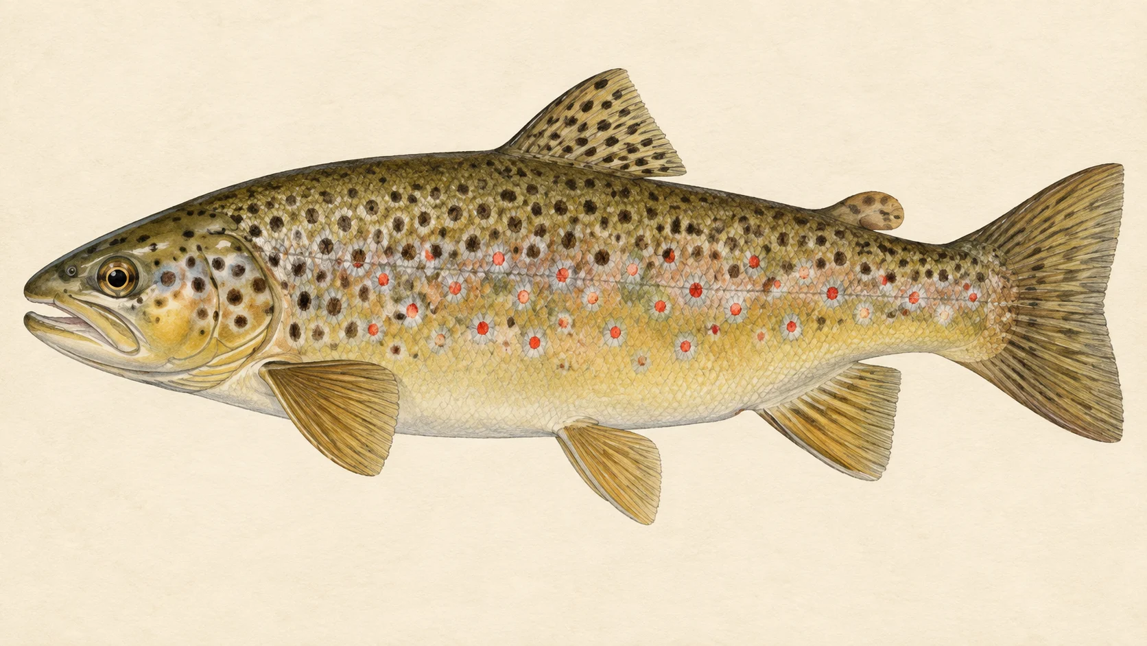
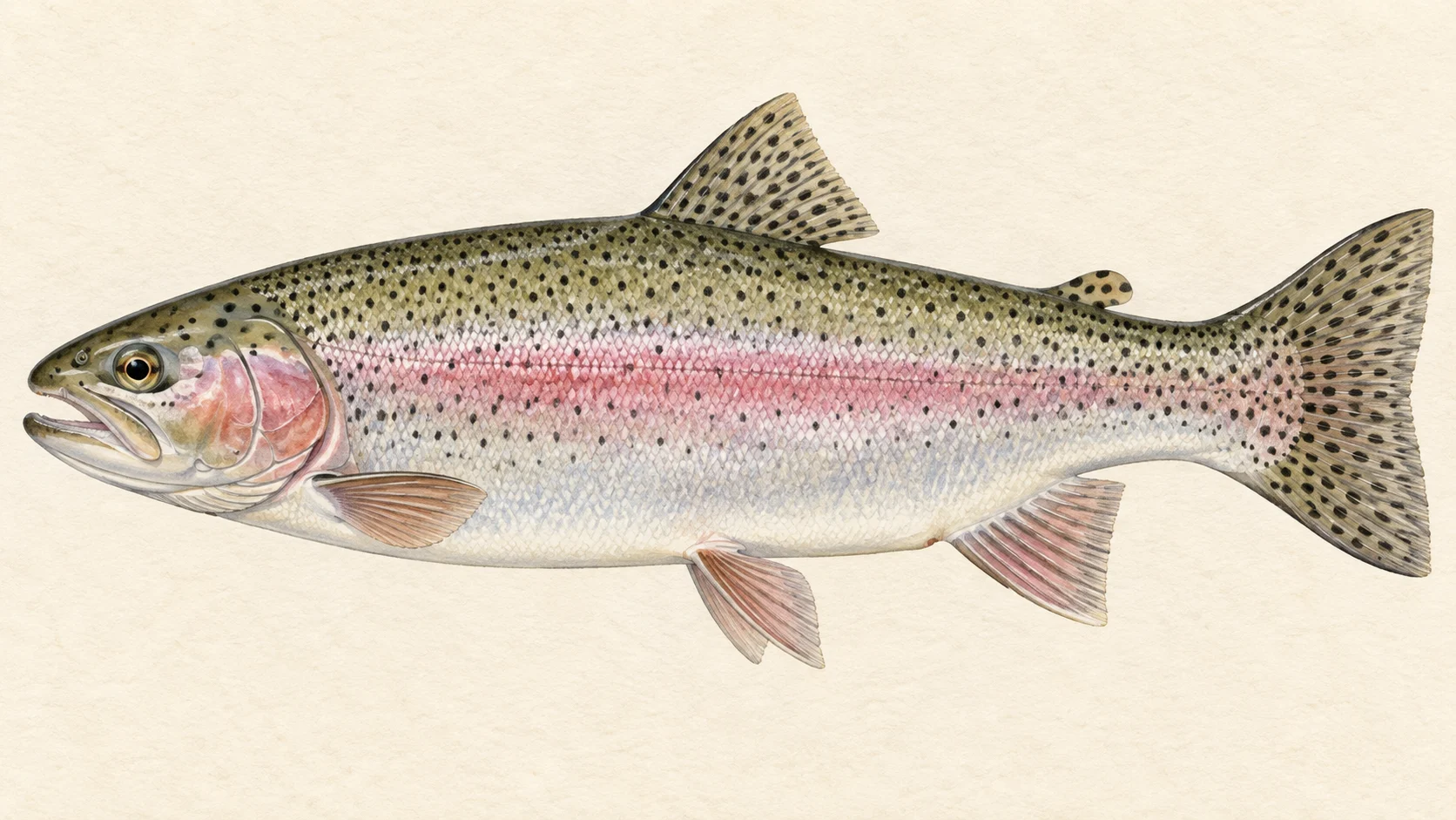
Wullwye Creek is a small stream that runs into the Snowy River in NSW, and the reason to make the trip is stocked trout: NSW stocking records show brown trout released into it in most recent seasons, with rainbows added once.

Choose one of the access points on the access card, walk to the water and fish upstream with a dry and a small nymph under it. The current NSW trout guide and its trout-water lists decide when you can fish and what you can keep, so read them before you settle on a date. Spend your time on the pools and the deeper runs, and walk quickly past thin, even water where a trout has nowhere to hide.

Do not treat the creek as a reason to drive a long way on its own.

Pack a 3 or 4 weight and a box of small dries and nymphs.

Water and habitat

A small creek running down to a big river. On water this size, cover matters more than almost anything else. Where the banks are open, trout see you coming across the grass; where they are shaded, overhanging growth gives fish somewhere to sit and drops food into the water. The bank cover chart shows how much of each kind the creek has, so read it before you choose where to walk.

In our experience, trout in a creek like this hold in the deeper water: the head of a pool where the run tips in, the seam beside faster current, an undercut bank, the slack behind a log or a boulder. Shallow, even-bottomed stretches hold fewer fish and spook them first. The gradient chart shows where the creek steepens; a good bet is that the flatter sections are where pools form.

Fish and forage

NSW stocking records list brown trout released into the creek in most recent seasons, and rainbow trout in a single earlier season. The stocking chart shows the pattern. For the fishing, that likely means young stocked browns in most years, with the odd fish that has survived long enough to learn caution. Rainbows are a bonus, not the plan. A stream this size usually keeps most trout modest.

The rest of the fly box is a guide's read. Small-stream trout feed mostly on nymphs drifting along the bottom and on whatever lands on the surface, and in warm weather that includes grasshoppers, beetles and ants off the bank. A few buoyant dries, a hopper and some bead-head nymphs in sizes 12 to 16 cover most of it.

When to fish it

Settle the rules first: take any season for the creek from the current NSW trout guide. Within whatever it allows, a small NSW trout stream usually fishes best from late spring into autumn. Late spring brings the first steady hatches and water with some push in it. Summer is the time for hoppers and terrestrials along the banks, fished early and late when the light is off the water. Autumn often brings cooler, clearer days when browns get busier. After heavy rain, give a small creek a day or two to drop and clear.

How to fish it

Travel light and fish upstream. A 3 or 4 weight rod of around 8 feet, a floating line and a 9 foot leader tapered to 5X is plenty. Keep low, stay back from the edge, and make short casts with as little line on the water as you can.

Start with a dry and dropper: a size 12 to 14 Royal Wulff with a size 14 to 16 bead-head Hare's Ear or Pheasant Tail under it on a short tippet. Put it in the head of each pool and let it ride down the seam. Two or three good drifts tell you whether a fish is home; then move up. In summer, swap the dry for a hopper and land it close to the bank wherever grass meets the water. In the deeper, slower pools, a small Woolly Bugger stripped past cover can move a brown that will not come up.

Access and safety

The access card names the access points. Treat them as locations, not a statement of permission, and respect any fence or sign you meet on the ground.

As on any bush stream, tell someone where you are going and when you expect to be back, carry water and a small first-aid kit, and watch your footing on wet rock and undercut banks. A small creek can rise quickly after rain, so keep an eye on the sky and never wade a crossing you are unsure of.

Regulations

Before you fish, read the current NSW Department of Primary Industries and Regional Development trout guide, check its trout-water lists and closed-waters list for the creek, and take any season, bag and size limits and licence requirements from it.
8 named access sites

These authority-listed points are separate from the mapped track intersections above. Some were inspected and some are public boat-ramp records; each row says which. A listing does not grant permission across private land, so check closures, signs and gates when you arrive.

  • Arable Rd Authority-listed access site · 2WD · Public Road
  • Bobundara Rd Authority-listed access site · 2WD · Public Road
  • Cowbed Tsr Authority-listed access site · AWD · TSR
  • Dalgety Rd Authority-listed access site · 2WD · Public Road
  • Dalgety Rd Authority-listed access site · 2WD · Public Road
  • Kosciuszko Rd Authority-listed access site · 2WD · Public Road
  • Middilingbank Rd Inspected access site · 2WD · Public Road
  • Snowy Junction Authority-listed access site · 2WD · Public Reserve

Sources: NSW Department of Primary Industries and Regional Development.

When things happen

The guide's calendar for this water

When things happen

The year on this water

A year at a glance; check current rules

  • Dry and dropper through the pools · Nov to Mar A guide's read, not a record. A size 12 to 14 Royal Wulff with a small bead-head nymph under it is a good first rig on a small trout creek once the weather warms. Take any season for the creek from the current NSW trout guide before you plan the trip.
  • Hoppers along grassy banks · Dec to Mar In our experience late summer on a small creek is hopper time wherever grass meets the water. Land it tight to the bank and let it sit.
  • Nymphs when nothing is rising · Oct to Apr A size 14 to 16 Pheasant Tail or Hare's Ear fished short and upstream through the deeper runs is the fallback on a cool or bright day.

What the record shows

Flows, river gradient, changing water levels, fish surveys and stocking

What the record shows

The river's year

Daily flow at Wullwye Creek at Woolway, every year 1949 to 2026

0.05 0.1 0.2 0.5 1 2 typical range high-flow mark Jan Feb Mar Apr May Jun Jul Aug Sep Oct Nov Dec m³/s
77 years of the gauge, week by week. The dark band is the middle half of all years, the pale band nine years in ten, the line the median. The shaded strip is the typical range: the band the river sits in about half of all days. In a typical year the river sits in it from early September through the turn of the year to late July, and runs higher than that from late August to early September. Whether a given day is one to wade is a call made at the bank, not a reading off this chart. Median flow peaks in late August and bottoms out in early March.
Source: Bureau of Meteorology.
Source details and licence

Bureau of Meteorology — Water Data Online series catalogue (Snowy/Monaro stations). Bureau of Meteorology, © Commonwealth of Australia. Licensed from the Commonwealth of Australia under a Creative Commons Attribution 4.0 International licence. retrieved 2026-08-12.

How often it runs this high

28,255 days at Wullwye Creek at Woolway, 1949 to 2026

0.05 0.1 0.2 0.5 1 2 5 10 20 typical range 0.004 to 0.173 m³/s high-flow mark 0.562 m³/s 0% of days 25% of days 50% of days 75% of days 100% of days m³/s
Read it left to right: the river runs above the flow on the left edge almost never, and above the flow on the right edge almost always. Half of all days sit below 0.1 m³/s. The shaded band is the typical range, where it sits about half the time; it runs higher than that one day in three and above the high-flow mark about one day in seven. These are frequency bands drawn from the record, not a measured limit — judge the water when you get there.
Source: Bureau of Meteorology.
Source details and licence

Bureau of Meteorology — Water Data Online series catalogue (Snowy/Monaro stations). Bureau of Meteorology, © Commonwealth of Australia. Licensed from the Commonwealth of Australia under a Creative Commons Attribution 4.0 International licence. retrieved 2026-08-12.

The fall of the river

Elevation along the river, source to end

Falls 495 m over 66 km, gravel bed, floodplain pockets for much of its length.

748 996 1,243 gauge 222007 0 km from the source: 1243 m · falling 13.6 m per km · fine-grained, valley fill 1 km from the source: 1223 m · falling 16.7 m per km · gravel, occasional floodplain 2 km from the source: 1180 m · falling 17.5 m per km · gravel, occasional floodplain 3 km from the source: 1159 m · falling 17.2 m per km · fine-grained, valley fill 4 km from the source: 1136 m · falling 17.5 m per km · fine-grained, valley fill 5 km from the source: 1129 m · falling 15 m per km · fine-grained, valley fill 6 km from the source: 1124 m · falling 13.5 m per km · variable 7 km from the source: 1115 m · falling 14 m per km · gravel, occasional floodplain 8 km from the source: 1087 m · falling 14 m per km · fine-grained, discontinuous floodplain 9 km from the source: 1072 m · falling 13.6 m per km · fine-grained, discontinuous floodplain 10 km from the source: 1061 m · falling 13 m per km · fine-grained, discontinuous floodplain 11 km from the source: 1049 m · falling 11.9 m per km · fine-grained, discontinuous floodplain 12 km from the source: 1043 m · falling 10.8 m per km · fine-grained, discontinuous floodplain 13 km from the source: 1030 m · falling 10.6 m per km · fine-grained, discontinuous floodplain 14 km from the source: 1016 m · falling 10.4 m per km · fine-grained, discontinuous floodplain 15 km from the source: 1009 m · falling 10.2 m per km · fine-grained, discontinuous floodplain 16 km from the source: 999 m · falling 11.3 m per km · gravel, occasional floodplain 17 km from the source: 989 m · falling 12.4 m per km · gravel, occasional floodplain 18 km from the source: 978 m · falling 13.5 m per km · fine-grained, discontinuous floodplain 19 km from the source: 968 m · falling 15.6 m per km · gravel, occasional floodplain 20 km from the source: 936 m · falling 16.2 m per km · gravel, occasional floodplain 21 km from the source: 924 m · falling 15.3 m per km · gravel, occasional floodplain 22 km from the source: 915 m · falling 14.8 m per km · gravel, discontinuous floodplain 23 km from the source: 889 m · falling 13.4 m per km · gravel, discontinuous floodplain 24 km from the source: 883 m · falling 10.9 m per km · gravel, discontinuous floodplain 25 km from the source: 878 m · falling 9.8 m per km · gravel, discontinuous floodplain 26 km from the source: 861 m · falling 8.4 m per km · gravel, discontinuous floodplain 27 km from the source: 854 m · falling 6.2 m per km · gravel, discontinuous floodplain 28 km from the source: 853 m · falling 5.2 m per km · gravel, discontinuous floodplain 29 km from the source: 847 m · falling 4.2 m per km · gravel, discontinuous floodplain 30 km from the source: 844 m · falling 3.2 m per km · gravel, discontinuous floodplain 31 km from the source: 844 m · falling 3 m per km · gravel 32 km from the source: 838 m · falling 3 m per km · gravel 33 km from the source: 836 m · falling 2.7 m per km · gravel 34 km from the source: 833 m · falling 2.6 m per km · gravel 35 km from the source: 830 m · falling 2.4 m per km · gravel 36 km from the source: 828 m · falling 2.2 m per km · gravel 37 km from the source: 828 m · falling 2.1 m per km · gravel 38 km from the source: 825 m · falling 2.1 m per km · gravel, discontinuous floodplain 39 km from the source: 822 m · falling 2.1 m per km · gravel, discontinuous floodplain 40 km from the source: 820 m · falling 2 m per km · gravel, discontinuous floodplain 41 km from the source: 819 m · falling 2 m per km · gravel, discontinuous floodplain 42 km from the source: 816 m · falling 2 m per km · gravel, discontinuous floodplain 43 km from the source: 814 m · falling 2.1 m per km · gravel, discontinuous floodplain 44 km from the source: 813 m · falling 2.2 m per km · gravel, discontinuous floodplain 45 km from the source: 811 m · falling 2.4 m per km · gravel, discontinuous floodplain 46 km from the source: 808 m · falling 2.5 m per km · gravel, discontinuous floodplain 47 km from the source: 805 m · falling 2.4 m per km · gravel, discontinuous floodplain 48 km from the source: 803 m · falling 2.4 m per km · gravel, discontinuous floodplain 49 km from the source: 799 m · falling 2.2 m per km · gravel, discontinuous floodplain 50 km from the source: 798 m · falling 2 m per km · gravel, discontinuous floodplain 51 km from the source: 797 m · falling 2 m per km · gravel, discontinuous floodplain 52 km from the source: 795 m · falling 2.1 m per km · gravel, discontinuous floodplain 53 km from the source: 793 m · falling 2.1 m per km · gravel, discontinuous floodplain 54 km from the source: 790 m · falling 2.5 m per km · gravel, discontinuous floodplain 55 km from the source: 787 m · falling 2.8 m per km · gravel, discontinuous floodplain 56 km from the source: 786 m · falling 3.2 m per km · gravel, discontinuous floodplain 57 km from the source: 784 m · falling 3.7 m per km · gravel, discontinuous floodplain 58 km from the source: 776 m · falling 4 m per km · gravel, discontinuous floodplain 59 km from the source: 774 m · falling 4 m per km · gravel, discontinuous floodplain 60 km from the source: 768 m · falling 4 m per km · gravel, discontinuous floodplain 61 km from the source: 765 m · falling 3.8 m per km · gravel, discontinuous floodplain 62 km from the source: 762 m · falling 3.5 m per km · gravel, discontinuous floodplain 63 km from the source: 759 m · falling 3.1 m per km · gravel, discontinuous floodplain 64 km from the source: 754 m · falling 2.6 m per km · gravel, discontinuous floodplain 65 km from the source: 751 m · falling 2.4 m per km · gravel, discontinuous floodplain 66 km from the source: 748 m · falling 1.9 m per km · gravel, discontinuous floodplain 0 km 17 km 33 km 50 km 66 km
gravel · 79% fine-grained · 19% variable · 1%
Headwater
1243 m
Outlet
748 m
Typical drop
7.5 m/km
Steepest sampled stretch
17.5 m/km, near 4 km
Hover the profile for the reading at any kilometre.
Source: Geoscience Australia.
Source details and licence

Geoscience Australia — 1 second SRTM-derived DEM-H v1.0 (NCI tile store). Geoscience Australia, 1 second SRTM-derived DEM-H v1.0, © Commonwealth of Australia, CC BY 4.0. retrieved 2026-08-16.

Bed material: NSW Department of Climate Change, Energy, the Environment and Water (Water, Surface Water Science).
Source details and licence

NSW River Styles spatial dataset — geomorphic character and dominant bed material. NSW River Styles spatial dataset, © State Government of NSW and NSW Department of Climate Change, Energy, the Environment and Water 2023. retrieved 2026-08-21.

Gauge pins identify the monitoring stations. The slope shows how steeply the river falls; it does not show rapids or safe wading routes.

The banks, seen from space

Land cover in the 120 m beside the water, Landsat 2023 to 2024 to 2025

0 to 5 km: woody open 25% 0 to 5 km: herbaceous native 21.9% 0 to 5 km: cultivated 53.1% 5 to 10 km: woody open 5.6% 5 to 10 km: herbaceous native 38.8% 5 to 10 km: cultivated 55.6% 10 to 15 km: woody open 17.5% 10 to 15 km: herbaceous native 56.2% 10 to 15 km: cultivated 26.3% 15 to 20 km: woody open 20% 15 to 20 km: woody sparse 0.6% 15 to 20 km: herbaceous native 77.5% 15 to 20 km: cultivated 1.9% 20 to 25 km: woody open 5% 20 to 25 km: woody sparse 1.3% 20 to 25 km: herbaceous native 93.7% 25 to 30 km: woody open 2.5% 25 to 30 km: woody sparse 3.8% 25 to 30 km: herbaceous native 93.7% 30 to 35 km: herbaceous native 83.7% 30 to 35 km: cultivated 16.3% 35 to 40 km: herbaceous native 85% 35 to 40 km: cultivated 15% 40 to 45 km: herbaceous native 95.6% 40 to 45 km: cultivated 4.4% 45 to 50 km: herbaceous native 80.6% 45 to 50 km: cultivated 19.4% 50 to 55 km: woody open 1.3% 50 to 55 km: herbaceous native 94.9% 50 to 55 km: cultivated 3.8% 55 to 60 km: woody open 0.6% 55 to 60 km: woody sparse 0.6% 55 to 60 km: herbaceous native 95.7% 55 to 60 km: cultivated 3.1% 60 to 65 km: woody open 10% 60 to 65 km: woody sparse 2.5% 60 to 65 km: herbaceous native 86.9% 60 to 65 km: cultivated 0.6% 65 to 66 km: woody open 14.6% 65 to 66 km: herbaceous native 85.4% 0 km 20 km 40 km 60 km
dense forest open woodland scattered trees and scrub native grass and heath farmed or cleared bare ground lake
Along the river itself about 8% of the bank is under trees, 77% is native grass or heath and 15% is farmed. The most wooded stretch is 0 to 5 km from the source; the most open is 30 to 35 km.
Source: Geoscience Australia / Digital Earth Australia.
Source details and licence

DEA Land Cover (Landsat) — Level 4 classification, continental mosaics. © Commonwealth of Australia (Geoscience Australia). DEA Land Cover (Landsat), Digital Earth Australia. retrieved 2026-08-19.

Stocking on record

8,300 fish in 25 records, 2020 to 2026

0 500 1k 1,500 2k 2020: 2,000 brown trout in 4 records 2021: 1,600 brown trout in 4 records 2022: 1,000 brown trout in 4 records 2022: 1,000 rainbow trout in 1 record 2023: 1,000 brown trout in 4 records 2024: 1,000 brown trout in 4 records 2026: 700 brown trout in 4 records 2020 2021 2022 2023 2024 2025 2026
Brown Trout, 7,300 across 24 records Rainbow Trout, 1,000 across 1 record
Stocked in 6 of the 7 years from 2020 to 2026. These are site-by-year totals, which can combine more than one release. A record is not a promise that stocking continues, and not evidence of what is in the water now.
Source: NSW Department of Primary Industries and Regional Development (Fisheries).
Source details and licence

NSW Fish Stocking — ArcGIS site markers and linked histories. retrieved 2026-08-29.

Conditions

What the gauges say

Wullwye Creek at Woolway

River flow

No reading shown: No reading has been captured for this gauge yet, so none is shown.

Gauge height

No reading shown: No reading has been captured for this gauge yet, so none is shown.

Readings from the Bureau of Meteorology's Water Data Online, © Commonwealth of Australia, licensed CC BY 4.0. Nothing here is a forecast. Check the gauge before you rely on it.

Weather

What the sky is doing

Live weather for Wullwye Creek at Woolway loads here. If it does not, check the Bureau of Meteorology forecast before you go.

Weather data by Open-Meteo.com

Questions anglers ask

What will I catch?

NSW stocking records list brown trout released into the creek in most recent seasons and rainbow trout in one, so browns are the fish to plan for. The stocking chart shows which seasons they went in.

Is there a closed season?

Check the current NSW Department of Primary Industries and Regional Development trout guide, including its trout-water lists and closed-waters list, and take any season, bag and size limits from it before you fish.

Where do I start?

Pick one of the access points on the access card, walk to the water and fish upstream from there. Treat those points as locations only, and read the signs and fences on the ground.

What rod should I bring?

A 3 or 4 weight of around 8 feet suits a small creek. Short, accurate casts matter more here than distance.

Behind this page