Australia Fly Guide
ACT · Murrumbidgee River

Cotter River

Imagery © Esri

Close to Canberra there is a proper trout river, and almost nobody outside the territory believes it. The Cotter is one of the ACT's classified trout waters, a snowmelt stream off the Brindabella Range with rainbow trout, deep-nymphing water in spring and, later in the season, big bends to polaroid from a high bank.

Before any place names, the shape of it. The river runs about eighty-five kilometres from the tussock marshes of Namadgi to the Murrumbidgee, and three dams cut it into pieces that the law treats very differently. The classified trout water runs from Bendora Dam downstream to the Condor Creek junction. The reservoirs and their protected catchment waters are closed to fishing. Below Cotter Dam a short open-water run joins the big river.

The trip is the trout water: the river between Bendora Dam and the junction with Condor Creek. At the October opening it can be running hard and icy with the melt. That is deep-nymphing weather. Get off the main current into the slower runs and let a heavy rig plummet. If a warm afternoon brings duns on, a good bet is to move to the tail-outs and change to a dry. Later in the season, in low clear water, it is a polaroiding river: the larger fish hold off the back of the big deep bends, and a high bank is worth more than a long cast.

The rules are the other half of the trip and they are simple. This stretch is trout water, which means a season that runs from the October Labour Day long weekend to the end of the June King's Birthday long weekend, fly and lure only, no bait at all, and one rod. The reservoirs and the water above them are off limits, full stop.

Do this river second, after you have seen how the season is running on the smaller water, or first if the melt has passed and the afternoons are warm. Do not drive up to the reservoirs expecting to fish them. The stretch pages carry the detail: the trout water between Bendora Dam and Condor Creek is the one to read.

Choose your stretch

Numbered from the source; each opens its own guide

Choose your stretch of the Cotter River

  1. Stretch 1 · 25.7 km Headwaters to Corin Dam The Cotter's snow-fed headwaters above Corin Dam, tussock marsh creeks under the Brindabella Range in a catchment where the ACT prohibits fishing at all times. Brown Trout Rainbow Trout European CarpLive gauge
  2. Stretch 2 · 21.7 km Bendora Dam to Condor Creek The Cotter's classified trout water between Bendora Dam and the Condor Creek junction, with rainbow trout, deep-nymphing runs in the early-season melt and big deep bends to polaroid once the water clears. Brown Trout Rainbow TroutLive gauge
  3. Stretch 3 · 6.6 km Condor Creek to Cotter Dam The Cotter between the Condor Creek junction and Cotter Dam, the second closed stretch of the river, where the trout water ends and fishing is prohibited at all times down to and including the Cotter Reservoir. Brown Trout Rainbow Trout European Carp
  4. water
    Stretch 4 · 1.4 km Cotter Dam to the Murrumbidgee The last run of the Cotter below the dam wall to the Murrumbidgee, open water under the ACT rules. Brown Trout Rainbow Trout European Carp

River map & ways in

The water from source to end, with mapped tracks and walking lines

River map and ways in to Cotter River

Murrumbidgee River Porcupine Creek Dry Creek Mosquito Creek Kangaroo Creek Jacks Creek Stockyard Creek Bushrangers Creek Collins Creek Long Creek Franklin Creek Paddys River Burkes Creek Pierces Creek Clear Hills Creek Gingera Creek Cow Flat Creek Snowy Flat Creek Little Bimberi Creek White Sands Creek De Salis Creek Mckeahnie Creek Pond Creek Condor Creek Cribbs Creek Bullock Head Creek Licking Hole Creek Corin Dam Bendora Dam Cotter Dam Headwaters to Corin Dam Bendora Dam to Condor Creek Condor Creek to Cotter Dam Cotter Dam to the Murrumbidgee Headwaters to Corin Dam — no angling at any time Condor Creek to Cotter Dam — no angling at any time Corin Dam — no angling at any time Bendora Dam — no angling at any time Cotter Dam — no angling at any time Corin Dam to Bendora Dam — no angling at any time Cotter River Murrumbidgee Riveropen_in_new Porcupine Creek Dry Creek Mosquito Creek Kangaroo Creek Jacks Creek Stockyard Creek Bushrangers Creek Collins Creek Long Creek Franklin Creek Paddys Riveropen_in_new Burkes Creek Pierces Creek Clear Hills Creek Gingera Creek Cow Flat Creek Snowy Flat Creek Little Bimberi Creek White Sands Creek De Salis Creek Mckeahnie Creek Pond Creek Condor Creek Cribbs Creek Bullock Head Creek Licking Hole Creek Walk in along Yaouk Trail Walk in along Australian Alps Walking Track Walk in along Cotter Hut Road Walk in along Lick Hole Road Walk in along Bendora Break Walk in along Bendora Road Walk in along Pipeline Road Walk in along Vanitys Crossing Road Walk in along Yellow Rabbit Road Walk in along Sinclair Circuit Walk in along Concrete Road Walk in along Bracks Hole Road Walk in along Bfg Road Walk in along Bullen Range Road Walk in along Priors Road Leave Murray Gap Trail here Yaouk Trail Leave Yaouk Trail here Australian Alps Walking Track Leave Yaouk Trail here Cotter Hut Road Leave Cotter Hut Road here Lick Hole Road Leave Lick Hole Road here Unnamed track off Lick Hole Road Corin Road Leave Bendora Road here Unnamed track off Bendora Road Leave Bendora Road here Unnamed track off Bendora Road Leave Wombat Road here Bendora Break Leave Bendora Break here Bendora Road Leave Pipeline Road here Unnamed track off Pipeline Road Leave Bendora Road here Pipeline Road Leave Pipeline Road here Unnamed track off Pipeline Road Leave Yellow Rabbit Road here Unnamed track off Yellow Rabbit Road Leave Yellow Rabbit Road here Vanitys Crossing Road Leave Lightning Ridge Road here Yellow Rabbit Road Leave Sinclair Circuit here Unnamed track off Sinclair Circuit Leave Sinclair Circuit here Unnamed track off Sinclair Circuit Leave Nine Mile Track here Unnamed track off Nine Mile Track Leave Sinclair Circuit here Unnamed track off Sinclair Circuit Leave Bullock Paddock Road here Sinclair Circuit Leave Sinclair Circuit here Unnamed track off Sinclair Circuit Leave Dry Creek Road here Concrete Road Leave Concrete Road here Unnamed track off Concrete Road Leave Boggy Road here Bracks Hole Road Leave Concrete Road here Unnamed track off Concrete Road Leave Boggy Road here Unnamed track off Boggy Road Leave Concrete Road here Unnamed track off Concrete Road Leave Priors Road here Unnamed track off Priors Road Leave Paddys River Road here Bfg Road Leave Old Mine Road here Bullen Range Road Cotter Road Paddys River Road Leave Priors Road here Unnamed track off Priors Road Brindabella Road Leave Crusher Road here Priors Road Leave Cotter Road here Unnamed track off Cotter Road Source Source Into Corin Dam Into Corin Dam Corin Dam wall Corin Dam wall Into Bendora Dam Into Bendora Dam Bendora Dam wall Bendora Dam wall Condor Creek Condor Creek Into Cotter Dam Into Cotter Dam Cotter Dam wall Cotter Dam wall Murrumbidgee River Murrumbidgee River 1 Headwaters to Corin Dam Reach 1: Headwaters to Corin Dam 2 Bendora Dam to Condor Creek Reach 2: Bendora Dam to Condor Creek 3 Condor Creek to Cotter Dam Reach 3: Condor Creek to Cotter Dam 4 Cotter Dam to the Murrumbidgee Reach 4: Cotter Dam to the Murrumbidgee
permanent no-angling water numbered fishing stretch river landmark sealed road unsealed 4WD walking track and walk-in leave the road listed way in named nearby, not confirmed mapped approach, not confirmed access

Numbers identify fishing stretches, not access points. Tap an access diamond, its walking line, or a cross-hatched no-angling section, to open the details on the map. Nearby items within the same click range open together. Unmarked water is not a guarantee that fishing is allowed; seasonal and other rules still apply.

A track shown here is not a guarantee of access — check current closures and gate status with the land manager before you rely on it, and ask where the way in crosses private ground. A meeting is counted where the mapped track comes within 250 m of the mapped channel.

When things happen

The guide's calendar for this water

When things happen

The year on this water

A year at a glance; check current rules

  • Early-season high water · Sep to Nov Snowmelt off the Brindabellas can have the river haring past at the opening. Fish the slower water off the main current and go deep.
  • Afternoon duns · Oct to Dec In our read, a warm mid-afternoon is a good bet for duns, even early. Move off the flow to the tail-outs and change to a dry.
  • Dry fly and terrestrials · Dec to Mar Later in the season, in low clear water, a dry fly is a good bet, and ants and other terrestrials are worth carrying.
  • Polaroiding the big bends · Nov to Apr Clear, low water. Find a high bank above a deep bend and hunt the larger fish before you cast.

Water and habitat

The mapped river is about eighty-five kilometres of mainstem, and it earns that length slowly. It begins as creeks draining tussock marshland, fed from the snow on the Brindabellas, and early in the season a large volume of cold water comes down those drainages at once. The river runs through Namadgi National Park before it reaches the Murrumbidgee.

Three dams sit on it. From the top: Corin, then Bendora, then Cotter Dam near the bottom. The territory's rules name those dams as the boundaries of what may be fished, and they also shape the river's behaviour, because the trout water sits below one storage and above another. The flow in the river's year and the flow-duration chart comes from the gauge below Bendora Dam, so it reads the release into the trout water; the fall of the river and the bank survey cover the whole mainstem. Each stretch has its own page, and the river map draws the four of them with the three reservoirs as the stops between. In our read, the character is a cold, clear stream of runs, bends and pools, heavy enough to need a proper nymph rig in spring and readable enough to sight-fish by summer.

Fish and forage

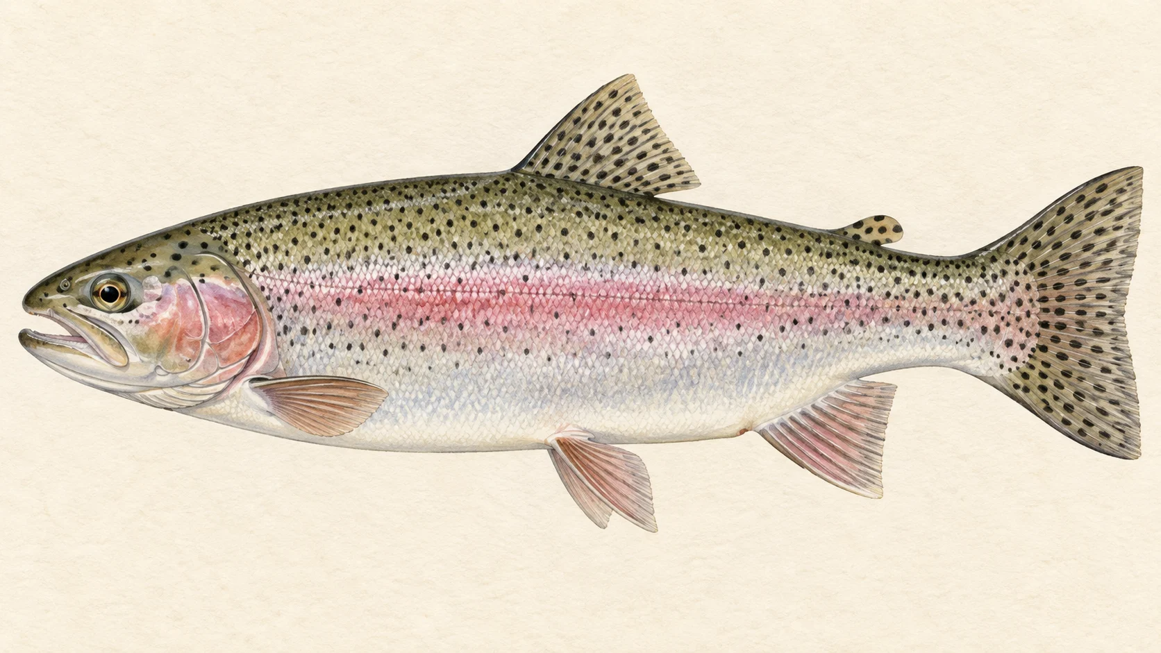
Rainbow trout are the fish most firmly reported from the Cotter. Brown trout are named in the territory's trout-water rules, but reports of them from the river itself are thin, and neither tells you that a particular pool in the Bendora-to-Condor reach holds one. Treat rainbows as the main expectation and a brown as possible.

For fly choice, think of a cold clear upland river. In our read, a warm afternoon is a good bet for mayfly duns, even early in the season, and through summer ants and other terrestrials are worth carrying. Where the banks run to tussock, a hopper is a fair bet from midsummer.

The Cotter also holds native fish. Macquarie perch, trout cod and two-spined blackfish have all been recorded here. Check the current ACT fishing brochure for which species are protected, and if you catch a fish you are not sure of, release it with as little handling as you can.

When to fish it

The season opens on the October Labour Day long weekend and runs to the end of the June King's Birthday long weekend; those dates move with the calendar, so check the current brochure. Within that window the river has three moods.

Spring is the melt. The river can be heavy and freezing at the opening, and the fishing is deep nymphs in the slower water off the main current, with an afternoon dun hatch as the reward if the sun comes through. Summer is, in our read, the dry-fly season: lower, clearer water, sighted fish on the big bends, ants and hoppers on the tussock banks. Autumn is a good bet for deliberate fish in low water until the season closes after the June long weekend.

How to fish it

Two rigs cover the river. In heavy water, a deep nymph rig under an indicator, fished in the slower, less turbulent runs beside the current so the flies get down. Work the runs one at a time; in our experience the take often comes at the tail-out as the drift straightens. In clear water, a single dry or a dry-dropper, and before you cast, a look. Find a high vantage point above a deep bend and watch the mottled shapes that were rocks a moment ago turn into fish. Take your time in those places and hunt one fish rather than covering the pool.

The ACT rule on gear is worth knowing before you rig up: in trout water the rod may carry no more than two flies, or one lure, and you may fish only one rod at a time.

Access and safety

The river runs through Namadgi National Park. For the trout water, use formed public roads and tracks, obey signs, and check the current ACT Parks information before you go. A line on a map is not permission to walk it.

The Cotter above Bendora Dam wall, and from Cotter Dam wall up to the Condor Creek junction, is closed to fishing at all times.

Early-season flows are the safety point. The melt can run the river heavy and icy, and a fish hooked in that current will use it. As on any cold mountain river, wade with care, or do not wade, and come back in a month if the river is high.

Regulations

The ACT publishes its rules in an annual recreational fishing brochure and on the territory's fishing pages; check the current brochure for licence requirements. Three classifications touch this river.

The Cotter between Bendora Dam and the Condor Creek junction is Trout Water. In trout water, fishing is open from the start of the October Labour Day long weekend to the end of the June King's Birthday long weekend; only artificial fly and lure fishing is allowed in the open season; bait fishing is prohibited; you may use one rod at a time and a landing net; the rod may carry no more than two flies or one artificial lure; and it is an offence to possess a handline, more than two rods, a rod rigged for bait, or any net other than a landing net in or beside the water.

The Cotter above Cotter Dam wall to the junction of Condor Creek, including the Cotter Reservoir, and the Cotter and its catchment above Bendora Dam wall, including Bendora and Corin reservoirs, are Prohibited Waters. Fishing there is not allowed at any time.

The Cotter below Cotter Dam is Open Water, with the more permissive open-water gear rules.

Take any size and bag limits from the current ACT recreational fishing brochure before you fish. The rules are made under the Fisheries Act 2000.
What the record shows

Flows, river gradient, changing water levels, fish surveys and stocking

What the record shows

The river's year

Daily flow at Cotter River below Bendora Dam, every year 1975 to 2026

0.05 0.1 0.2 0.5 1 2 5 typical range high-flow mark Jan Feb Mar Apr May Jun Jul Aug Sep Oct Nov Dec m³/s
51 years of the gauge, week by week. The dark band is the middle half of all years, the pale band nine years in ten, the line the median. The shaded strip is the typical range: the band the river sits in about half of all days. In a typical year the river sits in it from late November through the turn of the year to late July, and runs higher than that from early August to mid November. Whether a given day is one to wade is a call made at the bank, not a reading off this chart. Median flow peaks in mid September and bottoms out in late February. Flow and temperature are measured at different stations; this chart shows flow only.
Source: Bureau of Meteorology.
Source details and licence

Bureau of Meteorology — Water Data Online series catalogue (Snowy/Monaro stations). Bureau of Meteorology, © Commonwealth of Australia. Licensed from the Commonwealth of Australia under a Creative Commons Attribution 4.0 International licence. retrieved 2026-08-12.

How often it runs this high

17,408 days at Cotter River below Bendora Dam, 1975 to 2026

0.05 0.1 0.2 0.5 1 2 5 10 20 typical range 0.015 to 0.608 m³/s high-flow mark 2.313 m³/s 0% of days 25% of days 50% of days 75% of days 100% of days m³/s
Read it left to right: the river runs above the flow on the left edge almost never, and above the flow on the right edge almost always. Half of all days sit below 0.3 m³/s. The shaded band is the typical range, where it sits about half the time; it runs higher than that one day in three and above the high-flow mark about one day in seven. These are frequency bands drawn from the record, not a measured limit — judge the water when you get there.
Source: Bureau of Meteorology.
Source details and licence

Bureau of Meteorology — Water Data Online series catalogue (Snowy/Monaro stations). Bureau of Meteorology, © Commonwealth of Australia. Licensed from the Commonwealth of Australia under a Creative Commons Attribution 4.0 International licence. retrieved 2026-08-12.

The fall of the river

Elevation along the river, source to end

Falls 1287 m over 84 km, gravel bed, floodplain pockets for much of its length.

469 1,112 1,755 Corin Dam, 24.5 to 31.1 km, about 953 m Corin Dam Bendora Dam, 46.6 to 51.5 km, about 792 m Bendora Dam Cotter Dam, 79.6 to 83.1 km, about 496 m Cotter Dam gauge 410730 gauge 410752 gauge 410747 gauge 410725 gauge 410700 0 km from the source: 1755 m · falling 48.5 m per km · sand, valley fill 1 km from the source: 1654 m · falling 64.9 m per km · bedrock, headwater 2 km from the source: 1556 m · falling 72.8 m per km · variable 3 km from the source: 1467 m · falling 83.3 m per km · gravel, discontinuous floodplain 4 km from the source: 1358 m · falling 89.6 m per km · gravel, discontinuous floodplain 5 km from the source: 1267 m · falling 78.8 m per km · gravel, discontinuous floodplain 6 km from the source: 1172 m · falling 64.5 m per km · gravel, discontinuous floodplain 7 km from the source: 1112 m · falling 47.9 m per km · gravel, discontinuous floodplain 8 km from the source: 1091 m · falling 32 m per km · gravel, discontinuous floodplain 9 km from the source: 1084 m · falling 20.7 m per km · gravel, discontinuous floodplain 10 km from the source: 1072 m · falling 13.3 m per km · sand, discontinuous floodplain 11 km from the source: 1060 m · falling 9.9 m per km · gravel, floodplain 12 km from the source: 1052 m · falling 9 m per km · gravel, floodplain 13 km from the source: 1043 m · falling 8.5 m per km · gravel, discontinuous floodplain 14 km from the source: 1039 m · falling 8 m per km · gravel, discontinuous floodplain 15 km from the source: 1026 m · falling 7.7 m per km · gravel 16 km from the source: 1019 m · falling 7.2 m per km · gravel, discontinuous floodplain 17 km from the source: 1014 m · falling 7 m per km · gravel, discontinuous floodplain 18 km from the source: 1006 m · falling 6.8 m per km · gravel, discontinuous floodplain 19 km from the source: 1001 m · falling 6.6 m per km · gravel, discontinuous floodplain 20 km from the source: 994 m · falling 6.9 m per km · gravel, discontinuous floodplain 21 km from the source: 986 m · falling 6.9 m per km · gravel, discontinuous floodplain 22 km from the source: 981 m · falling 6.5 m per km · gravel, discontinuous floodplain 23 km from the source: 972 m · falling 5.9 m per km · gravel, occasional floodplain 24 km from the source: 963 m · falling 4.5 m per km · gravel, occasional floodplain 25 km from the source: 961 m · falling 3 m per km · water storage 26 km from the source: 961 m · falling 1.7 m per km · water storage 27 km from the source: 961 m · falling 3.4 m per km · water storage 28 km from the source: 961 m · falling 5.7 m per km · water storage 29 km from the source: 961 m · falling 9.2 m per km · water storage 30 km from the source: 961 m · falling 13.1 m per km · water storage 31 km from the source: 906 m · falling 14.6 m per km · gravel, discontinuous floodplain 32 km from the source: 902 m · falling 13.4 m per km · gravel, discontinuous floodplain 33 km from the source: 890 m · falling 11.9 m per km · gravel, discontinuous floodplain 34 km from the source: 884 m · falling 10.4 m per km · gravel, discontinuous floodplain 35 km from the source: 876 m · falling 8 m per km · gravel, discontinuous floodplain 36 km from the source: 872 m · falling 8.3 m per km · gravel, discontinuous floodplain 37 km from the source: 861 m · falling 8.3 m per km · gravel, discontinuous floodplain 38 km from the source: 844 m · falling 8 m per km · gravel, discontinuous floodplain 39 km from the source: 845 m · falling 7.3 m per km · gravel, discontinuous floodplain 40 km from the source: 837 m · falling 6.9 m per km · gravel, discontinuous floodplain 41 km from the source: 829 m · falling 6.3 m per km · gravel, discontinuous floodplain 42 km from the source: 821 m · falling 5.4 m per km · gravel, discontinuous floodplain 43 km from the source: 820 m · falling 4.8 m per km · gravel, occasional floodplain 44 km from the source: 812 m · falling 4.4 m per km · gravel, occasional floodplain 45 km from the source: 807 m · falling 4.2 m per km · gravel, occasional floodplain 46 km from the source: 809 m · falling 4.2 m per km · gravel, occasional floodplain 47 km from the source: 809 m · falling 4.8 m per km · water storage 48 km from the source: 795 m · falling 6.4 m per km · water storage 49 km from the source: 787 m · falling 8.1 m per km · water storage 50 km from the source: 786 m · falling 10.4 m per km · water storage 51 km from the source: 784 m · falling 12.7 m per km · water storage 52 km from the source: 752 m · falling 13.5 m per km · gravel, occasional floodplain 53 km from the source: 736 m · falling 12.7 m per km · gravel, occasional floodplain 54 km from the source: 721 m · falling 11 m per km · gravel, occasional floodplain 55 km from the source: 714 m · falling 9.3 m per km · gravel, occasional floodplain 56 km from the source: 711 m · falling 7.7 m per km · gravel, occasional floodplain 57 km from the source: 708 m · falling 7.4 m per km · gravel, occasional floodplain 58 km from the source: 705 m · falling 8.2 m per km · gravel, occasional floodplain 59 km from the source: 682 m · falling 8.6 m per km · gravel, occasional floodplain 60 km from the source: 675 m · falling 8.3 m per km · gravel, occasional floodplain 61 km from the source: 673 m · falling 8.4 m per km · gravel, occasional floodplain 62 km from the source: 661 m · falling 8.2 m per km · gravel, occasional floodplain 63 km from the source: 658 m · falling 7.7 m per km · gravel, occasional floodplain 64 km from the source: 648 m · falling 8.2 m per km · gravel, occasional floodplain 65 km from the source: 633 m · falling 8.4 m per km · gravel, occasional floodplain 66 km from the source: 630 m · falling 7.7 m per km · gravel, occasional floodplain 67 km from the source: 625 m · falling 7.5 m per km · gravel, discontinuous floodplain 68 km from the source: 614 m · falling 7.7 m per km · gravel, discontinuous floodplain 69 km from the source: 602 m · falling 7.5 m per km · gravel, discontinuous floodplain 70 km from the source: 605 m · falling 7.7 m per km · gravel, discontinuous floodplain 71 km from the source: 598 m · falling 8.2 m per km · gravel, occasional floodplain 72 km from the source: 579 m · falling 8.2 m per km · gravel, occasional floodplain 73 km from the source: 572 m · falling 8.7 m per km · gravel, discontinuous floodplain 74 km from the source: 569 m · falling 10.1 m per km · gravel, discontinuous floodplain 75 km from the source: 563 m · falling 11.1 m per km · gravel, occasional floodplain 76 km from the source: 551 m · falling 11.8 m per km · bedrock, gorge 77 km from the source: 525 m · falling 11.4 m per km · water storage 78 km from the source: 512 m · falling 9.8 m per km · water storage 79 km from the source: 506 m · falling 8.5 m per km · water storage 80 km from the source: 503 m · falling 7.3 m per km · water storage 81 km from the source: 506 m · falling 5.9 m per km · water storage 82 km from the source: 497 m · falling 6 m per km · water storage 83 km from the source: 477 m · falling 5.7 m per km · gravel, discontinuous floodplain 84 km from the source: 469 m · falling 4.7 m per km · gravel, discontinuous floodplain 0 km 21 km 42 km 63 km 84 km
bedrock · 2% gravel · 74% sand · 2% variable · 1% unstated · 20% lake the river runs through
Headwater
1755 m
Outlet
469 m
Typical drop
15.3 m/km
Steepest sampled stretch
89.6 m/km, near 4 km
The flat shelves are the lakes the river runs through: Corin Dam, Bendora Dam and Cotter Dam. Hover the profile for the reading at any kilometre.
Source: Geoscience Australia.
Source details and licence

Geoscience Australia — 1 second SRTM-derived DEM-H v1.0 (NCI tile store). Geoscience Australia, 1 second SRTM-derived DEM-H v1.0, © Commonwealth of Australia, CC BY 4.0. retrieved 2026-08-16.

Bed material: NSW Department of Climate Change, Energy, the Environment and Water (Water, Surface Water Science).
Source details and licence

NSW River Styles spatial dataset — geomorphic character and dominant bed material. NSW River Styles spatial dataset, © State Government of NSW and NSW Department of Climate Change, Energy, the Environment and Water 2023. retrieved 2026-08-21.

Gauge pins identify the monitoring stations. The slope shows how steeply the river falls; it does not show rapids or safe wading routes.

The banks, seen from space

Land cover in the 120 m beside the water, Landsat 2023 to 2024 to 2025

0 to 5 km: woody open 92.4% 0 to 5 km: woody sparse 1.3% 0 to 5 km: herbaceous native 6.3% 5 to 10 km: woody open 94.9% 5 to 10 km: woody sparse 1.3% 5 to 10 km: herbaceous native 3.8% 10 to 15 km: woody open 91.2% 10 to 15 km: herbaceous native 7.5% 10 to 15 km: cultivated 1.3% 15 to 20 km: woody open 87.5% 15 to 20 km: woody sparse 0.6% 15 to 20 km: herbaceous native 10.6% 15 to 20 km: cultivated 1.3% 20 to 25 km: woody open 98.7% 20 to 25 km: woody sparse 1.3% 30 to 35 km: woody dense 18.8% 30 to 35 km: woody open 81.2% 35 to 40 km: woody dense 16.9% 35 to 40 km: woody open 83.1% 40 to 45 km: woody dense 38.1% 40 to 45 km: woody open 61.9% 50 to 55 km: woody dense 39.2% 50 to 55 km: woody open 60.8% 55 to 60 km: woody dense 30% 55 to 60 km: woody open 70% 60 to 65 km: woody dense 14.4% 60 to 65 km: woody open 85.6% 65 to 70 km: woody dense 13.1% 65 to 70 km: woody open 86.9% 70 to 75 km: woody dense 3.1% 70 to 75 km: woody open 94.3% 70 to 75 km: woody sparse 1.3% 70 to 75 km: herbaceous native 1.3% 75 to 80 km: woody open 54.8% 75 to 80 km: woody sparse 9.7% 75 to 80 km: herbaceous native 35.5% Corin Dam: the river runs through a lake here, so there is no riverbank to read Bendora Dam: the river runs through a lake here, so there is no riverbank to read Cotter Dam: the river runs through a lake here, so there is no riverbank to read Corin Dam Bendora Dam Cotter Dam 0 km 20 km 40 km 60 km 80 km
dense forest open woodland scattered trees and scrub native grass and heath farmed or cleared bare ground lake
Along the river itself about 97% of the bank is under trees, 3% is native grass or heath and 0% is farmed. The most wooded stretch is 20 to 25 km from the source; the most open is 75 to 80 km.
Source: Geoscience Australia / Digital Earth Australia.
Source details and licence

DEA Land Cover (Landsat) — Level 4 classification, continental mosaics. © Commonwealth of Australia (Geoscience Australia). DEA Land Cover (Landsat), Digital Earth Australia. retrieved 2026-08-19.

How well this water has been surveyed

19 capture records, 2 decades of 2 on file

0 5 10 15 20 2000s: 15 capture records 2000s: 1 capture record 2010s: 1 capture record 2010s: 2 capture records 2000s 2010s
electrofishing (backpack), 16 records electrofishing (other), 2 records trapping, 1 record
Capture records by decade — electrofishing, netting, trapping and rotenone surveys only; a sighting, an eDNA water sample or a stocking release is not a capture and is not counted here. A record is not an abundance estimate, and a decade with no bar is a decade with no capture survey on file, not evidence the water was empty.
Source: Atlas of Living Australia.
Source details and licence

Atlas of Living Australia — freshwater fish occurrence records (open licences, with coordinates). Occurrence records from the Atlas of Living Australia and its contributing datasets, including the Victorian Biodiversity Atlas, NSW BioNet Atlas, Sustainable Rivers Audit, Murray-Darling Basin fish monitoring programs, OZCAM museum collections and iNaturalist Australia. Each record carries its own licence and originating dataset. retrieved 2026-08-13.

park

Namadgi National Park sets the rules here

Park roads and tracks can close at short notice for weather, fire or maintenance. Obey signs and locked gates, and check current alerts before you go: Parks ACT alerts. The notes below describe the country; they do not guarantee that a road or track is open today.

Questions anglers ask

Which part of the Cotter can I actually fish?

The territory's rules split the river into three. Everything above Cotter Dam up to the Condor Creek junction, including the reservoir, and everything above Bendora Dam, including Bendora and Corin reservoirs, is prohibited water where fishing is not allowed at any time. The river between Bendora Dam and the Condor Creek junction is classified trout water. Below Cotter Dam, the short run to the Murrumbidgee is open water. The Regulations section states what each classification means.

Do I need a licence?

Check the current ACT recreational fishing brochure for licence requirements before you go. The rules on this river are made under the Fisheries Act 2000, and the trout-water rules are stricter than the open-water ones.

Is there a gauge?

Yes, several gauges sit on the river. The flow in the river's year and the flow-duration chart comes from the Cotter River below Bendora Dam gauge, which sits below the dam and so reads what comes out of it; the water temperature line comes from a different gauge further down the river. The early-season warning is the practical one: snowmelt off the Brindabellas can make the river heavy and cold in spring, and the dams above the trout water can change how the river runs. Look at it before you commit to wading.

Behind this page