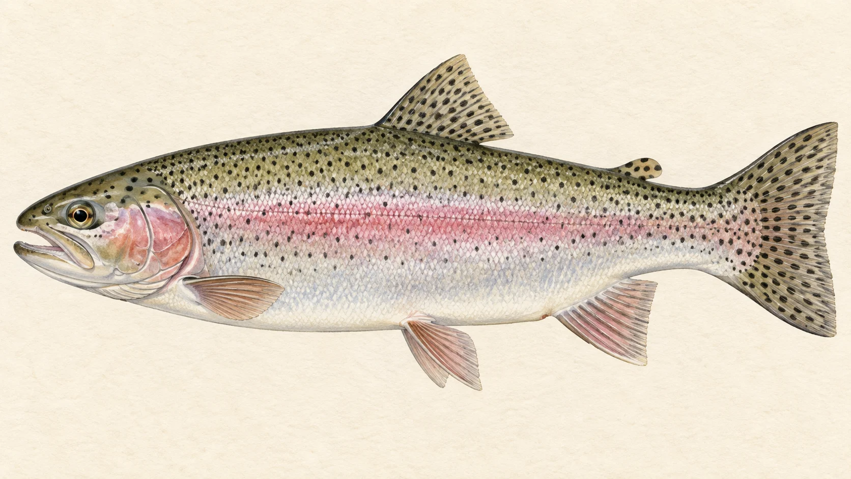
This is the Cotter's trout water: the classified stretch from the wall of Bendora Dam down to where Condor Creek comes in, cold river inside Namadgi National Park with rainbow trout in it.
The stretch has a simple shape. It leaves the dam as a tailwater and ends at a creek junction that the rules use as a line. Above it, and below it as far as Cotter Dam, the river is closed to fishing, so on this part of the Cotter this is the water you can fish.
Early in the season snowmelt off the Brindabella Range can have the river running heavy and icy. That is deep-nymphing water: get off the main current into the slower runs and let a heavy rig plummet away from the flow. Once the water drops and clears, the larger fish hold off the back of the big deep bends, where a high bank and a careful look are worth more than a long cast.
The rules are the trout-water set: open from the October Labour Day long weekend to the end of the June King's Birthday long weekend, fly and lure only, no bait, one rod. Take the size and bag limits from the current ACT fishing guide.
If you have one ACT trout day, this stretch is a good bet. Do not go looking for the reservoirs: Bendora above and Cotter below are both prohibited water.
River map & ways in
The water from source to end, with mapped tracks and walking lines
River map and ways in to Cotter River
permanent no-angling water numbered fishing stretchriver landmarksealed roadunsealed4WDwalking track and walk-inleave the roadlisted way innamed nearby, not confirmedmapped approach, not confirmed accessthis stretch
Numbers identify fishing stretches, not access points. Tap an access diamond, its walking line, or a cross-hatched no-angling section, to open the details on the map. Nearby items within the same click range open together. Unmarked water is not a guarantee that fishing is allowed; seasonal and other rules still apply.
Permanent no angling
Headwaters to Corin Dam
Fishing is not allowed at any time in the ACT's listed prohibited waters. On the Cotter River that is two separate stretches: the river upstream of the new Cotter Dam wall as far as the junction with Condor Creek, including Cotter Reservoir; and the river and its catchment upstream of Bendora Dam wall, including Bendora and Corin Reservoirs. The Cotter between the Condor Creek junction and Bendora Dam is not prohibited water: the ACT lists it as Trout Waters, open in season under the trout-water rules. The same list closes the Murrumbidgee River downstream of Angle Crossing to its junction with the Gudgenby River, and the Tidbinbilla River and its catchment within the Tidbinbilla Nature Reserve.
Hatching marks the mapped river section, not the boundary of the surrounding land or catchment.
Fishing is not allowed at any time in the ACT's listed prohibited waters. On the Cotter River that is two separate stretches: the river upstream of the new Cotter Dam wall as far as the junction with Condor Creek, including Cotter Reservoir; and the river and its catchment upstream of Bendora Dam wall, including Bendora and Corin Reservoirs. The Cotter between the Condor Creek junction and Bendora Dam is not prohibited water: the ACT lists it as Trout Waters, open in season under the trout-water rules. The same list closes the Murrumbidgee River downstream of Angle Crossing to its junction with the Gudgenby River, and the Tidbinbilla River and its catchment within the Tidbinbilla Nature Reserve.
Hatching marks the mapped river section, not the boundary of the surrounding land or catchment.
Fishing is not allowed at any time in the ACT's listed prohibited waters. On the Cotter River that is two separate stretches: the river upstream of the new Cotter Dam wall as far as the junction with Condor Creek, including Cotter Reservoir; and the river and its catchment upstream of Bendora Dam wall, including Bendora and Corin Reservoirs. The Cotter between the Condor Creek junction and Bendora Dam is not prohibited water: the ACT lists it as Trout Waters, open in season under the trout-water rules. The same list closes the Murrumbidgee River downstream of Angle Crossing to its junction with the Gudgenby River, and the Tidbinbilla River and its catchment within the Tidbinbilla Nature Reserve.
Hatching follows the mapped shoreline; it does not show the boundary of the surrounding Special Area or catchment.
Fishing is not allowed at any time in the ACT's listed prohibited waters. On the Cotter River that is two separate stretches: the river upstream of the new Cotter Dam wall as far as the junction with Condor Creek, including Cotter Reservoir; and the river and its catchment upstream of Bendora Dam wall, including Bendora and Corin Reservoirs. The Cotter between the Condor Creek junction and Bendora Dam is not prohibited water: the ACT lists it as Trout Waters, open in season under the trout-water rules. The same list closes the Murrumbidgee River downstream of Angle Crossing to its junction with the Gudgenby River, and the Tidbinbilla River and its catchment within the Tidbinbilla Nature Reserve.
Hatching follows the mapped shoreline; it does not show the boundary of the surrounding Special Area or catchment.
Fishing is not allowed at any time in the ACT's listed prohibited waters. On the Cotter River that is two separate stretches: the river upstream of the new Cotter Dam wall as far as the junction with Condor Creek, including Cotter Reservoir; and the river and its catchment upstream of Bendora Dam wall, including Bendora and Corin Reservoirs. The Cotter between the Condor Creek junction and Bendora Dam is not prohibited water: the ACT lists it as Trout Waters, open in season under the trout-water rules. The same list closes the Murrumbidgee River downstream of Angle Crossing to its junction with the Gudgenby River, and the Tidbinbilla River and its catchment within the Tidbinbilla Nature Reserve.
Hatching follows the mapped shoreline; it does not show the boundary of the surrounding Special Area or catchment.
Fishing is not allowed at any time in the ACT's listed prohibited waters. On the Cotter River that is two separate stretches: the river upstream of the new Cotter Dam wall as far as the junction with Condor Creek, including Cotter Reservoir; and the river and its catchment upstream of Bendora Dam wall, including Bendora and Corin Reservoirs. The Cotter between the Condor Creek junction and Bendora Dam is not prohibited water: the ACT lists it as Trout Waters, open in season under the trout-water rules. The same list closes the Murrumbidgee River downstream of Angle Crossing to its junction with the Gudgenby River, and the Tidbinbilla River and its catchment within the Tidbinbilla Nature Reserve.
Hatching marks the mapped river section, not the boundary of the surrounding land or catchment.
Vehicle track — high-clearance/4WD, about 0.5 km on foot from Bendora Road. The mapped track comes within about 1 m of the channel. Nobody has described this as a way in; it is what the road layer shows, and it may end at a fence.
Vehicle track — high-clearance/4WD, about 0.2 km on foot from Bendora Road. The mapped track comes within about 11 m of the channel. Nobody has described this as a way in; it is what the road layer shows, and it may end at a fence.
Vehicle track — high-clearance/4WD, about 2 km on foot from Wombat Road. The mapped track comes within about 166 m of the channel. Nobody has described this as a way in; it is what the road layer shows, and it may end at a fence.
Vehicle track — high-clearance/4WD, about 0.5 km on foot from Bendora Break. The mapped track comes within about 0 m of the channel. Nobody has described this as a way in; it is what the road layer shows, and it may end at a fence.
Vehicle track — high-clearance/4WD, about 0.1 km on foot from Pipeline Road. The mapped track comes within about 23 m of the channel. Nobody has described this as a way in; it is what the road layer shows, and it may end at a fence.
Vehicle track — high-clearance/4WD, about 0.6 km on foot from Bendora Road. The mapped track comes within about 1 m of the channel. Nobody has described this as a way in; it is what the road layer shows, and it may end at a fence.
Vehicle track — high-clearance/4WD, about 0.4 km on foot from Pipeline Road. The mapped track comes within about 6 m of the channel. Nobody has described this as a way in; it is what the road layer shows, and it may end at a fence.
Vehicle track — high-clearance/4WD, about 0.5 km on foot from Yellow Rabbit Road. The mapped track comes within about 32 m of the channel. Nobody has described this as a way in; it is what the road layer shows, and it may end at a fence.
Vehicle track — high-clearance/4WD, about 0.4 km on foot from Yellow Rabbit Road. The mapped track comes within about 0 m of the channel. Nobody has described this as a way in; it is what the road layer shows, and it may end at a fence.
Vehicle track — high-clearance/4WD, about 2.5 km on foot from Lightning Ridge Road. The mapped track comes within about 181 m of the channel. Nobody has described this as a way in; it is what the road layer shows, and it may end at a fence.
Vehicle track — high-clearance/4WD, about 0.8 km on foot from Sinclair Circuit. The mapped track comes within about 216 m of the channel. Nobody has described this as a way in; it is what the road layer shows, and it may end at a fence.
A track shown here is not a guarantee of access — check current closures and gate status with the land manager before you rely on it, and ask where the way in crosses private ground. A meeting is counted where the mapped track comes within 250 m of the mapped channel.
Conditions
What the gauges say
water_dropCotter River at Vanity's Crossing
River flow
wavesAbove the seasonal median
3.12 m³/s
historyrecorded 2026-09-08 18:00
Above the seasonal median
For the same week of the year
Lowest recorded
0.109 m³/s
Typical (median)
2.71 m³/s
Highest recorded
31.883 m³/s
About this readingchevron_right
m³/s is the volume of water passing the gauge each second. A flow reading does not establish safe wading or a flood warning.
Daily averages for the same week of the year, from 1987-11-19 to 2026-08-22, across 38 years. The median is the middle reading: half are below it and half above. Recorded extremes are not safe-flow limits. The flow scale is compressed using log(1 + flow) so very large peaks and zero readings fit together.
straightenGauge height0.952 mDetails
Height above the gauge's reference mark, not the depth where you will fish.
recorded 2026-09-08 18:00
Water temperature
thermostat
°C
history
No reading shown: This gauge has published no reading in the last P30D.
These are automatic readings that have not been quality-checked, so treat them as a guide to the trend rather than exact figures.
Early-season high water· Oct to NovSnowmelt off the Brindabellas can have the river running heavy and icy early in the season. Deep nymphs in the slower water off the main current.
Polaroiding the big bends· Nov to AprA good bet once the water clears. Find a high bank over a deep bend and hunt the larger fish.
Water and habitat
The stretch begins as a tailwater below Bendora Dam and ends at the Condor Creek junction. Live conditions for the Cotter show under Conditions when the live service is up. The fall of the river and the bank survey are drawn below.
The Cotter rises as small creeks draining tussock marshland and is fed by snowmelt off the Brindabella Range, which is why it runs heavy and icy early in the season. The larger trout sit off the back of big, deep bends, and you find them by polaroiding from a high vantage point.
Fish and forage
Fish surveys have found rainbow trout on this stretch, and the territory classes it as trout water. Brown trout have turned up in surveys here too, though not since the mid-1990s; that means the surveys have been quiet on them, not that the fish have gone.
When to fish it
Open from the October Labour Day long weekend to the end of the June King's Birthday long weekend; the dates move with the calendar. Early season is the melt and the deep rig. Once the water drops and clears, it is sighted fish off the deep bends until the close.
How to fish it
Heavy water: an indicator and a heavy nymph rig in the slower runs beside the flow, one run at a time. Clear water: a look first from a high vantage point above a deep bend, then a single dry or a dry-dropper to the fish you have found. In trout water the rod may carry no more than two flies or one lure, and you fish one rod at a time.
Access and safety
The stretch lies inside Namadgi National Park. The access map shows where tracks meet the river; that is not permission to use them. Use formed public roads and tracks, obey signs and gates, and check the ACT Parks nature park finder before you go. Early in the season the river can run heavy and icy, so look before you wade.
Regulations
The ACT lists the Cotter River between Bendora Dam and the Condor Creek junction as Trout Water. In trout water, fishing is open from the start of the October Labour Day long weekend to the end of the June King's Birthday long weekend; only artificial fly and lure fishing is allowed in the open season; bait fishing is prohibited; you may use one rod at a time and a landing net; the rod may carry no more than two flies or one artificial lure; and it is an offence to possess a handline, more than two rods, a rod rigged for bait, or any net other than a landing net in or beside the water.
For size limits, bag limits and licence requirements, check the current ACT recreational fishing guide before you fish.
What the record shows
Flows, river gradient, changing water levels, fish surveys and stocking
What the record shows
More river dataThe fall of the whole Cotter River, its bank survey and its wider record, with this stretch markedchevron_right
The fall of the river
Elevation along the river, source to end
Falls 1287 m over 84 km, gravel bed, floodplain pockets for much of its length.
bedrock · 2%gravel · 74%sand · 2%variable · 1%unstated · 20%lake the river runs through
Headwater
1755 m
Outlet
469 m
Typical drop
15.3 m/km
Steepest sampled stretch
89.6 m/km, near 4 km
The flat shelves are the lakes the river runs through: Corin Dam, Bendora Dam and Cotter Dam. Hover the profile for the reading at any kilometre.
Gauge pins identify the monitoring stations. The slope shows how steeply the river falls; it does not show rapids or safe wading routes.
The banks, seen from space
Land cover in the 120 m beside the water, Landsat 2023 to 2024 to 2025
dense forestopen woodlandscattered trees and scrubnative grass and heathfarmed or clearedbare groundlake
Along the river itself about 97% of the bank is under trees, 3% is native grass or heath and 0% is farmed. The most wooded stretch is 20 to 25 km from the source; the most open is 75 to 80 km.
electrofishing (backpack), 16 recordselectrofishing (other), 2 recordstrapping, 1 record
Capture records by decade — electrofishing, netting, trapping and rotenone surveys only; a sighting, an eDNA water sample or a stocking release is not a capture and is not counted here. A record is not an abundance estimate, and a decade with no bar is a decade with no capture survey on file, not evidence the water was empty.
Atlas of Living Australia — freshwater fish occurrence records (open licences, with coordinates). Occurrence records from the Atlas of Living Australia and its contributing datasets, including the Victorian Biodiversity Atlas, NSW BioNet Atlas, Sustainable Rivers Audit, Murray-Darling Basin fish monitoring programs, OZCAM museum collections and iNaturalist Australia. Each record carries its own licence and originating dataset. retrieved 2026-08-13.
park
Namadgi National Park sets the rules here
Park roads and tracks can close at short notice for weather, fire or maintenance. Obey signs and locked gates, and check current alerts before you go: Parks ACT alerts. The notes below describe the country; they do not guarantee that a road or track is open today.
Questions anglers ask
Where exactly does the trout water start and finish?+
At the Bendora Dam wall at the top and the junction with Condor Creek at the bottom. Above the wall, and below the junction down to Cotter Dam, is prohibited water. The river map shows where each piece starts and stops.
Can I fish bait here?+
No. Bait fishing is prohibited in ACT trout waters, and it is an offence to have a rod rigged for bait beside the water.