Australia Fly Guide
NSW · Macquarie-Bogan Rivers

Campbells River

Imagery © Esri

The Campbells River is a small tableland trout stream in the country around Bathurst that holds some very large brown and rainbow trout, and the reason to drive to it is a big brown from the Swallows Nest stretch in the week after rain.

Think of it as a river in two parts, cut by a dam. It rises in forest and farm country, gathers a handful of small creeks, and is caught by Ben Chifley Dam. Below the wall a short reach runs down to meet the Fish River, and the two together become the Macquarie. This page is about the river, not the dam.

Its character is set by rain. The river is often in drought, and after about two months without a good fall it breaks into isolated pools, at times with long dry stretches between stagnant ones. So the first decision is not where but when: watch the weather and go in the week or two after a decent fall, whatever the month.

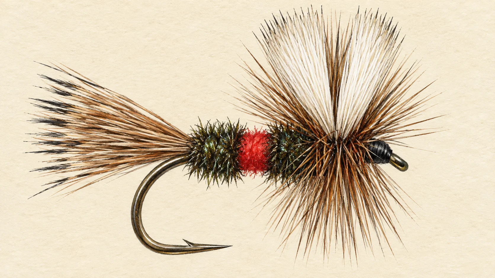
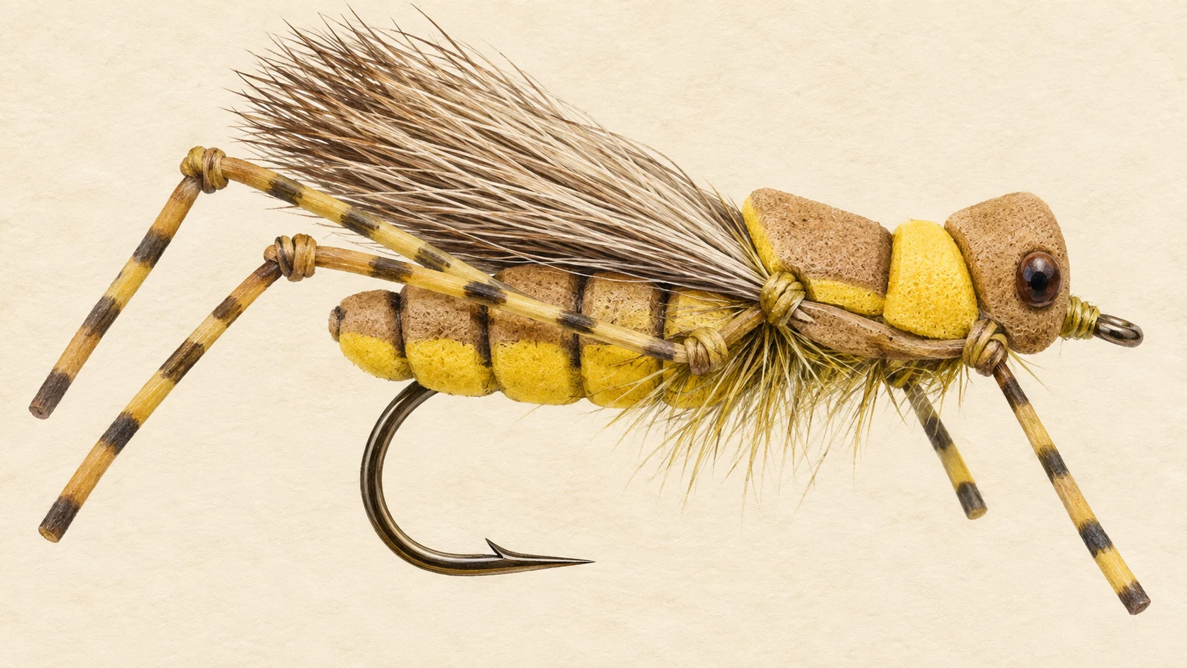
There is one named way in. The local fishing website reaches the river from Swallows Nest Road, which leaves Mount David Road on the southern edge of Dog Rocks State Forest, and that is the stretch it names for very large browns. In the warm months the fish are looking up for beetles, hoppers and ants, so a Royal Wulff or a red tag along the grass edge is the way to start. At the cool ends of the season fish a small nymph through the runs, especially after a little rain. That route is the website writers' route and much of the river is farmland, so stay off private land.

The river has a past. A magazine writer recalls a time when a day on the Campbells meant a dozen browns of fifty centimetres, and the same magazine names it with the Fish, the Turon and the Duckmaloi among the rivers of this country that have fished well. That is the memory; the present is a small river that rewards timing.

No water-specific rule was found for the Campbells, and trout streams in NSW commonly carry a classification that closes them through winter and sets size and bag limits, so read the current NSW fishing guide before you go.

Watch the rain, read the guide, and go in the week after a fresh.

Water and habitat

The Campbells drains forest and farmland in the country around Bathurst, fed by small creeks, and is held by Ben Chifley Dam before the short reach below the wall joins the Fish River to form the Macquarie. The gradient chart on this page shows the fall from the headwater country to the junction, and the bank cover chart shows how much of the river runs under trees rather than open paddock.

This is a river that shrinks. When the rain stops the runs go first, then the shallow pools, until the river is a string of deep holes joined by dry gravel. The fish that live through a dry spell are in the deepest, shadiest pools, under the banks and the fallen timber, and they are wary because they have nowhere else to be. When the rain comes back the river reconnects, the fish spread into the runs and the pool heads to feed, and that is the river you want to meet.

Read the river accordingly. In good water fish the heads of the pools and the runs between them. In low water leave the shallow pools alone and spend your time on the deep ones, approaching from below and low to the ground.

Fish and forage

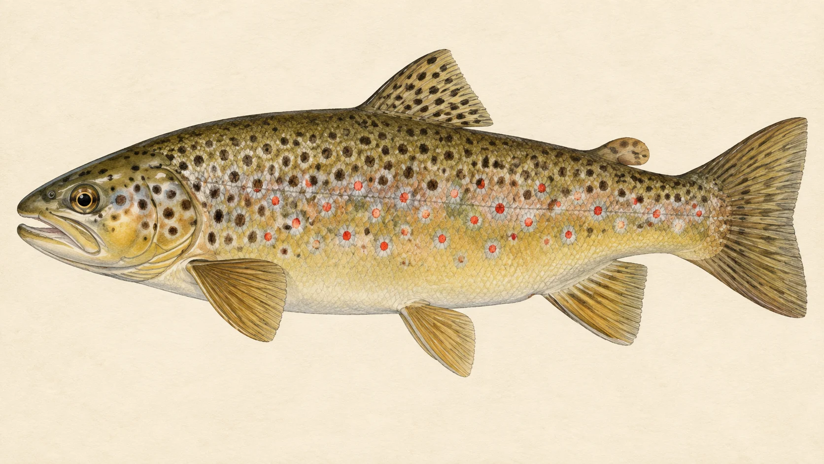
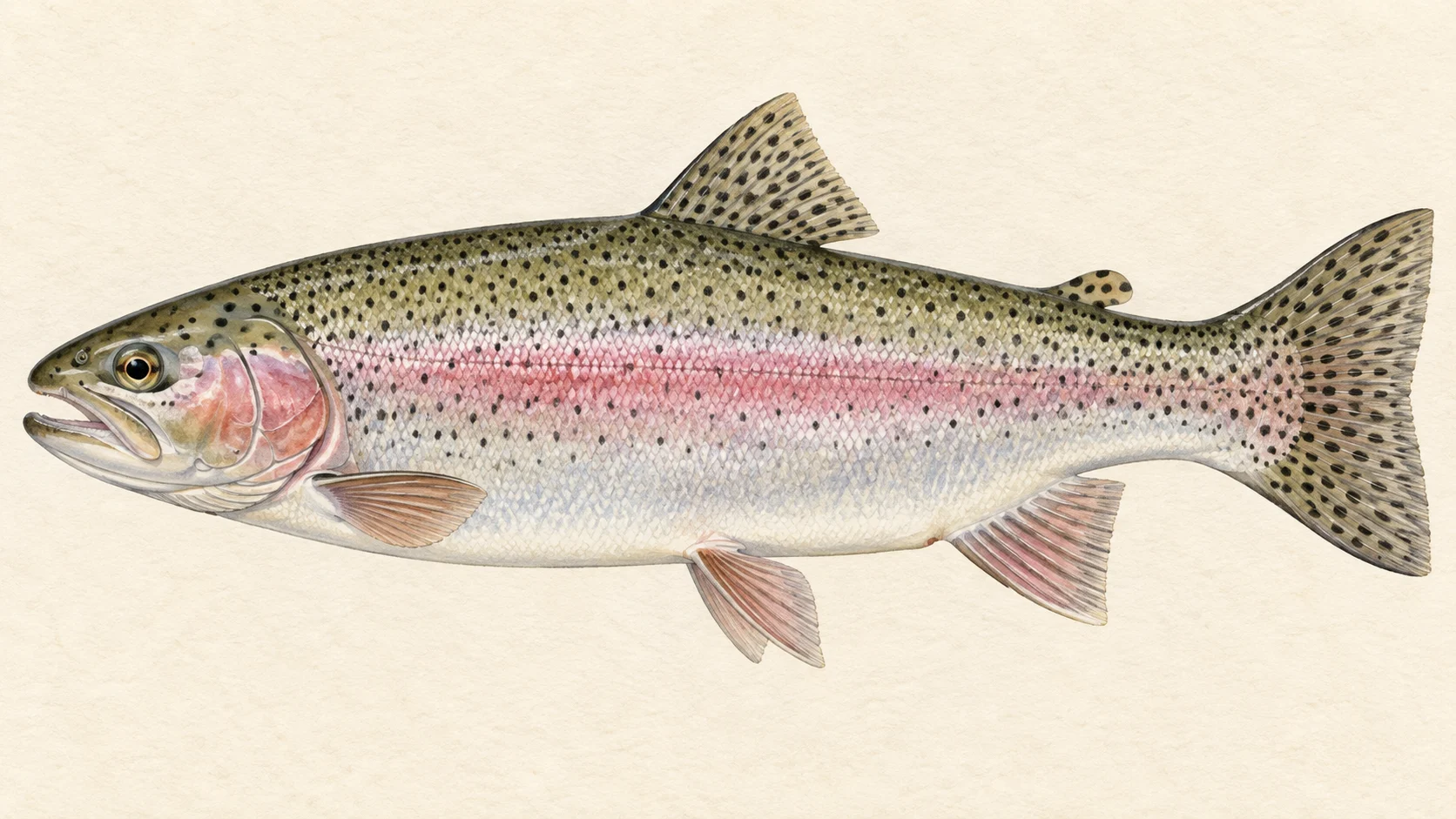
The river is described as holding some very large brown and rainbow trout, and the Swallows Nest stretch is named for very large browns in particular. Rainbows are recorded in the river with high confidence. So are redfin, carp, goldfish and eastern gambusia, none of which you will be pleased to meet, and mountain galaxias, the small native fish that a big brown eats between hatches.

Above the water the food is terrestrial. The local website's warm-months list is beetles, hoppers, ants, Royal Wulffs and red tags, which tells you the fish are looking up for whatever falls off the grass and the trees from late spring to early autumn. At the cool ends of the season the website fishes nymphs, especially after a little rain, which is when the runs are moving and the fish are back in them.

For a fly box that means a Royal Wulff and a red tag in a couple of sizes, a beetle pattern, a hopper for late summer and a small black ant. Add a Pheasant Tail and a Hare's Ear with a bead for the runs, and a small olive or black Woolly Bugger to swim past the deep holes as a galaxias. Whether the trout population still runs to the size the old accounts describe is not something this page can say; fish it as though it does.

When to fish it

Nobody has written down when this river fishes best, so what follows is a guide's judgement built on the flies the local website fishes by season and on how the river behaves in drought.

The calendar is written by the rain. Whatever the month, the river fishes in the week or two after a decent fall, when the pools are joined and the fish are in the runs, and it goes dead again after a couple of months without one. Plan around the forecast, not the diary.

Late spring through summer is the dry-fly time: beetles and ants early, hoppers along the grass once the paddocks dry off in late summer. Fish the mornings and the last light in the hot weeks, because a small tableland river warms quickly.

Autumn and the start of the season are nymph time, through the runs and the pool heads, and the first good rain of autumn is the trip to book. The website's talk of early and late season implies a trout-stream season applies here; whether it does, and what it closes, is for the current NSW guide.

How to fish it

Fish a four-weight, or a five if you want a little more authority over a big brown in timber, with a floating line and a leader longer than the river looks like it needs. The water is small and the fish that survive its dry spells are wary, so the first cast to each pool is the one that counts. Approach from downstream, stay low, and use the bank cover.

In the warm months tie on a Royal Wulff or a red tag and work upstream, dropping the fly along the grass edge and under the overhanging branches where beetles and ants land. When the hoppers are thick, a hopper pattern slapped down hard near the bank draws fish from a long way off. Give a dry-fly presentation this simple a good drag-free drift and the fish will do the rest.

At the cool ends of the season fish a small bead-head nymph, a Pheasant Tail or a Hare's Ear, through the runs and the heads of the pools. A dry-dropper rig with a Royal Wulff on top covers both jobs when you are not sure which the fish want.

For the big browns of the Swallows Nest stretch, fish the deep holes at first light and last light with a small Woolly Bugger swum slowly along the timber and the undercut bank. In low water they will not move far for a fly, so put it in front of them.

Carry a net big enough for the fish you are hoping for, keep a big brown in the water while you unhook it, and put it back.

Access and safety

There is no signposted angler access here. The notes below describe how the local website's writers reach the river; they are not a statement that any route is open to you, and much of the river runs through private farmland.

The one entry the website names is Swallows Nest Road, which leaves Mount David Road along the southern edge of Dog Rocks State Forest. Treat the state forest as public and the paddocks beside the river as private unless you have asked. Check for logging and fire closures in the forest before you drive in.

The river itself is small and will not drown you in ordinary conditions, but any small tableland river can come up after a storm, so do not camp in the bed. Treat it in summer as you would any bush water: watch for snakes in the long grass, and remember that the stagnant pools of a dry spell are not drinking water; carry your own. Do not count on phone coverage; tell someone where you are going.

Regulations

No water-specific rule was found for the Campbells. Trout streams in New South Wales commonly carry a classification that sets a winter closure and size and bag limits, and the Campbells may be one of them; whether it is, and what applies where, is a question for the fishing department, not this page.

Before you fish, read the current NSW fishing rules and regulations, the freshwater bag and size limits and the general freshwater closures, and confirm the fishing fee.
When things happen

The guide's calendar for this water

When things happen

The year on this water

A year at a glance; check current rules

  • Terrestrial dries · Nov to Mar Through the warm months the fish are looking up for beetles, hoppers and ants. A Royal Wulff, a red tag or a small hopper drifted along the grass edge covers most of it.
  • Nymphs early and late · Apr to Oct At the cool ends of the year fish a small nymph through the runs and the heads of the pools, especially in the days after a little rain has lifted the river.
  • Fish after rain · Jan to Dec This river dries to isolated pools after about two months without good rain. Watch the weather, and plan the trip for the week or two after a decent fall, whatever the month.

What the record shows

Flows, river gradient, changing water levels, fish surveys and stocking

What the record shows

The fall of the river

Elevation along the river, source to end

Falls 574 m over 115 km, gravel bed, floodplain pockets for much of its length.

667 954 1,241 0 km from the source: 1241 m · falling 8.3 m per km 1 km from the source: 1213 m · falling 11.3 m per km 2 km from the source: 1192 m · falling 12.2 m per km · sand, valley fill 3 km from the source: 1179 m · falling 12.9 m per km · sand, valley fill 4 km from the source: 1169 m · falling 14 m per km · fine-grained, discontinuous floodplain 5 km from the source: 1154 m · falling 12.5 m per km · fine-grained, discontinuous floodplain 6 km from the source: 1139 m · falling 11.2 m per km · fine-grained, discontinuous floodplain 7 km from the source: 1132 m · falling 10.1 m per km · fine-grained, discontinuous floodplain 8 km from the source: 1120 m · falling 8.9 m per km · fine-grained, discontinuous floodplain 9 km from the source: 1112 m · falling 7.4 m per km · fine-grained, discontinuous floodplain 10 km from the source: 1107 m · falling 6.4 m per km · fine-grained, discontinuous floodplain 11 km from the source: 1102 m · falling 6.3 m per km · fine-grained, discontinuous floodplain 12 km from the source: 1096 m · falling 6.4 m per km · fine-grained, discontinuous floodplain 13 km from the source: 1093 m · falling 6.9 m per km · fine-grained, discontinuous floodplain 14 km from the source: 1083 m · falling 7.6 m per km · fine-grained, discontinuous floodplain 15 km from the source: 1072 m · falling 7.4 m per km · fine-grained, discontinuous floodplain 16 km from the source: 1063 m · falling 7.2 m per km · fine-grained, discontinuous floodplain 17 km from the source: 1060 m · falling 6.7 m per km · fine-grained, discontinuous floodplain 18 km from the source: 1052 m · falling 5.6 m per km · gravel, occasional floodplain 19 km from the source: 1052 m · falling 5.3 m per km · gravel, occasional floodplain 20 km from the source: 1038 m · falling 5 m per km · bedrock, gorge 21 km from the source: 1037 m · falling 5 m per km · bedrock, gorge 22 km from the source: 1039 m · falling 5.6 m per km · bedrock, gorge 23 km from the source: 1027 m · falling 6.2 m per km · bedrock, gorge 24 km from the source: 1024 m · falling 6 m per km · bedrock, gorge 25 km from the source: 1012 m · falling 6.2 m per km · gravel, occasional floodplain 26 km from the source: 1005 m · falling 6.2 m per km · gravel, occasional floodplain 27 km from the source: 1003 m · falling 5.9 m per km · gravel, occasional floodplain 28 km from the source: 1002 m · falling 7.6 m per km · bedrock, gorge 29 km from the source: 994 m · falling 9.4 m per km · bedrock, gorge 30 km from the source: 980 m · falling 11.1 m per km · bedrock, gorge 31 km from the source: 975 m · falling 12.9 m per km · gravel, occasional floodplain 32 km from the source: 944 m · falling 13.1 m per km · bedrock, gorge 33 km from the source: 936 m · falling 11.8 m per km · bedrock, gorge 34 km from the source: 928 m · falling 9.8 m per km · bedrock, gorge 35 km from the source: 913 m · falling 7.8 m per km · gravel, discontinuous floodplain 36 km from the source: 912 m · falling 4.9 m per km · gravel, discontinuous floodplain 37 km from the source: 903 m · falling 3.5 m per km · gravel, discontinuous floodplain 38 km from the source: 911 m · falling 3.1 m per km · gravel, discontinuous floodplain 39 km from the source: 901 m · falling 2.9 m per km · gravel, discontinuous floodplain 40 km from the source: 907 m · falling 3.8 m per km · gravel, discontinuous floodplain 41 km from the source: 900 m · falling 4.5 m per km · bedrock, gorge 42 km from the source: 886 m · falling 5.4 m per km · bedrock, gorge 43 km from the source: 887 m · falling 5.8 m per km · bedrock, gorge 44 km from the source: 877 m · falling 7.2 m per km · bedrock, gorge 45 km from the source: 882 m · falling 8.2 m per km · bedrock, gorge 46 km from the source: 865 m · falling 9.3 m per km · bedrock, gorge 47 km from the source: 854 m · falling 10 m per km · bedrock, gorge 48 km from the source: 836 m · falling 9.3 m per km · gravel, discontinuous floodplain 49 km from the source: 832 m · falling 8.1 m per km · gravel, discontinuous floodplain 50 km from the source: 825 m · falling 6.1 m per km · gravel, discontinuous floodplain 51 km from the source: 819 m · falling 4.4 m per km · gravel, discontinuous floodplain 52 km from the source: 817 m · falling 2.9 m per km · gravel, discontinuous floodplain 53 km from the source: 814 m · falling 2.3 m per km · fine-grained, discontinuous floodplain 54 km from the source: 813 m · falling 1.9 m per km · fine-grained, discontinuous floodplain 55 km from the source: 814 m · falling 2 m per km · fine-grained, discontinuous floodplain 56 km from the source: 812 m · falling 2.3 m per km · fine-grained, discontinuous floodplain 57 km from the source: 806 m · falling 2.6 m per km · fine-grained, discontinuous floodplain 58 km from the source: 805 m · falling 2.9 m per km · fine-grained, discontinuous floodplain 59 km from the source: 801 m · falling 3 m per km · fine-grained, discontinuous floodplain 60 km from the source: 800 m · falling 2.8 m per km · fine-grained, discontinuous floodplain 61 km from the source: 797 m · falling 2.9 m per km · fine-grained, discontinuous floodplain 62 km from the source: 791 m · falling 3 m per km · fine-grained, discontinuous floodplain 63 km from the source: 789 m · falling 2.8 m per km · fine-grained, discontinuous floodplain 64 km from the source: 791 m · falling 3 m per km · fine-grained, discontinuous floodplain 65 km from the source: 783 m · falling 3.1 m per km · fine-grained, discontinuous floodplain 66 km from the source: 779 m · falling 2.7 m per km · gravel, discontinuous floodplain 67 km from the source: 779 m · falling 2.6 m per km · gravel, discontinuous floodplain 68 km from the source: 777 m · falling 2.5 m per km · gravel, discontinuous floodplain 69 km from the source: 773 m · falling 2.2 m per km · gravel, discontinuous floodplain 70 km from the source: 773 m · falling 2.2 m per km · gravel, discontinuous floodplain 71 km from the source: 768 m · falling 2.2 m per km · gravel, discontinuous floodplain 72 km from the source: 768 m · falling 2.1 m per km · gravel, discontinuous floodplain 73 km from the source: 764 m · falling 2.1 m per km · gravel, discontinuous floodplain 74 km from the source: 764 m · falling 2.3 m per km · bedrock, gorge 75 km from the source: 761 m · falling 2.5 m per km · bedrock, gorge 76 km from the source: 760 m · falling 2.8 m per km · gravel, discontinuous floodplain 77 km from the source: 754 m · falling 2.9 m per km · gravel, discontinuous floodplain 78 km from the source: 752 m · falling 3 m per km · gravel, discontinuous floodplain 79 km from the source: 748 m · falling 2.9 m per km · gravel, discontinuous floodplain 80 km from the source: 747 m · falling 2.8 m per km · gravel, discontinuous floodplain 81 km from the source: 743 m · falling 2.7 m per km · gravel, discontinuous floodplain 82 km from the source: 741 m · falling 2.4 m per km · gravel, discontinuous floodplain 83 km from the source: 738 m · falling 2.2 m per km · gravel, discontinuous floodplain 84 km from the source: 736 m · falling 2.1 m per km · gravel, discontinuous floodplain 85 km from the source: 733 m · falling 2.1 m per km · bedrock, gorge 86 km from the source: 737 m · falling 2.6 m per km · bedrock, gorge 87 km from the source: 730 m · falling 3.2 m per km · bedrock, gorge 88 km from the source: 729 m · falling 3.8 m per km · bedrock, gorge 89 km from the source: 721 m · falling 4 m per km · bedrock, gorge 90 km from the source: 715 m · falling 3.7 m per km · water storage 91 km from the source: 714 m · falling 3.2 m per km · water storage 92 km from the source: 710 m · falling 2.8 m per km · water storage 93 km from the source: 710 m · falling 2.2 m per km · water storage 94 km from the source: 708 m · falling 1.9 m per km · water storage 95 km from the source: 703 m · falling 1.6 m per km · water storage 96 km from the source: 702 m · falling 1 m per km · water storage 97 km from the source: 703 m · falling 1.3 m per km · water storage 98 km from the source: 702 m · falling 1.7 m per km · water storage 99 km from the source: 703 m · falling 2.3 m per km · water storage 100 km from the source: 703 m · falling 3.2 m per km · water storage 101 km from the source: 689 m · falling 3.6 m per km · gravel, discontinuous floodplain 102 km from the source: 688 m · falling 3.2 m per km · gravel, discontinuous floodplain 103 km from the source: 685 m · falling 2.8 m per km · gravel, discontinuous floodplain 104 km from the source: 684 m · falling 2.3 m per km · gravel, discontinuous floodplain 105 km from the source: 683 m · falling 1.7 m per km · gravel, discontinuous floodplain 106 km from the source: 681 m · falling 1.7 m per km · gravel, discontinuous floodplain 107 km from the source: 678 m · falling 1.7 m per km · gravel, discontinuous floodplain 108 km from the source: 677 m · falling 1.7 m per km · gravel, discontinuous floodplain 109 km from the source: 677 m · falling 1.5 m per km · gravel, discontinuous floodplain 110 km from the source: 673 m · falling 1.4 m per km · gravel, discontinuous floodplain 111 km from the source: 672 m · falling 1.4 m per km · gravel, discontinuous floodplain 112 km from the source: 670 m · falling 1.1 m per km · gravel, discontinuous floodplain 113 km from the source: 673 m · falling 1 m per km · gravel, discontinuous floodplain 114 km from the source: 668 m · falling 0.7 m per km · gravel, discontinuous floodplain 115 km from the source: 667 m · falling 0.4 m per km · gravel, discontinuous floodplain 0 km 29 km 58 km 86 km 115 km
bedrock · 22% gravel · 42% sand · 2% fine-grained · 23% unstated · 9% not surveyed · 2%
Headwater
1241 m
Outlet
667 m
Typical drop
5 m/km
Steepest sampled stretch
14 m/km, near 4 km
Hover the profile for the reading at any kilometre.
Source: Geoscience Australia.
Source details and licence

Geoscience Australia — 1 second SRTM-derived DEM-H v1.0 (NCI tile store). Geoscience Australia, 1 second SRTM-derived DEM-H v1.0, © Commonwealth of Australia, CC BY 4.0. retrieved 2026-08-16.

Bed material: NSW Department of Climate Change, Energy, the Environment and Water (Water, Surface Water Science).
Source details and licence

NSW River Styles spatial dataset — geomorphic character and dominant bed material. NSW River Styles spatial dataset, © State Government of NSW and NSW Department of Climate Change, Energy, the Environment and Water 2023. retrieved 2026-08-21.

Gauge pins identify the monitoring stations. The slope shows how steeply the river falls; it does not show rapids or safe wading routes.

The banks, seen from space

Land cover in the 120 m beside the water, Landsat 2023 to 2024 to 2025

0 to 10 km: woody dense 9.4% 0 to 10 km: woody open 12.5% 0 to 10 km: herbaceous native 17.5% 0 to 10 km: cultivated 60.6% 10 to 20 km: woody dense 0.3% 10 to 20 km: woody open 8.4% 10 to 20 km: herbaceous native 20.6% 10 to 20 km: cultivated 70.7% 20 to 30 km: woody open 45.3% 20 to 30 km: herbaceous native 28.1% 20 to 30 km: cultivated 26.6% 30 to 40 km: woody open 15% 30 to 40 km: woody sparse 0.6% 30 to 40 km: herbaceous native 31.3% 30 to 40 km: cultivated 53.1% 40 to 50 km: woody dense 12.5% 40 to 50 km: woody open 17.2% 40 to 50 km: herbaceous native 20.9% 40 to 50 km: cultivated 49.4% 50 to 60 km: woody dense 1.6% 50 to 60 km: woody open 17.5% 50 to 60 km: herbaceous native 8.8% 50 to 60 km: cultivated 72.1% 60 to 70 km: woody open 5.3% 60 to 70 km: herbaceous native 17.8% 60 to 70 km: cultivated 76.9% 70 to 80 km: woody open 10.9% 70 to 80 km: herbaceous native 20.6% 70 to 80 km: cultivated 68.5% 80 to 90 km: woody dense 1.6% 80 to 90 km: woody open 31.3% 80 to 90 km: woody sparse 0.9% 80 to 90 km: herbaceous native 32.8% 80 to 90 km: cultivated 33.4% 90 to 100 km: woody open 20.7% 90 to 100 km: woody sparse 0.5% 90 to 100 km: herbaceous native 44.1% 90 to 100 km: cultivated 34.7% 100 to 110 km: woody dense 0.9% 100 to 110 km: woody open 18.3% 100 to 110 km: woody sparse 2.2% 100 to 110 km: herbaceous native 32.5% 100 to 110 km: cultivated 46.1% 110 to 115 km: woody open 15.3% 110 to 115 km: herbaceous native 19.9% 110 to 115 km: cultivated 64.8% 0 km 20 km 40 km 60 km 80 km 100 km
dense forest open woodland scattered trees and scrub native grass and heath farmed or cleared bare ground lake
Along the river itself about 21% of the bank is under trees, 24% is native grass or heath and 55% is farmed. The most wooded stretch is 20 to 30 km from the source; the most open is 60 to 70 km. A satellite reads the canopy, not the ground beneath it, so treat this as a read of the country, not a survey of every bank.
Source: Geoscience Australia / Digital Earth Australia.
Source details and licence

DEA Land Cover (Landsat) — Level 4 classification, continental mosaics. © Commonwealth of Australia (Geoscience Australia). DEA Land Cover (Landsat), Digital Earth Australia. retrieved 2026-08-19.

How well this water has been surveyed

32 capture records, 2 decades of 2 on file

0 5 10 15 20 25 2000s: 8 capture records 2000s: 11 capture records 2000s: 5 capture records 2010s: 4 capture records 2010s: 3 capture records 2010s: 1 capture record 2000s 2010s
electrofishing (boat), 12 records electrofishing (backpack), 14 records trapping, 6 records
Capture records by decade — electrofishing, netting, trapping and rotenone surveys only; a sighting, an eDNA water sample or a stocking release is not a capture and is not counted here. A record is not an abundance estimate, and a decade with no bar is a decade with no capture survey on file, not evidence the water was empty.
Source: Atlas of Living Australia.
Source details and licence

Atlas of Living Australia — freshwater fish occurrence records (open licences, with coordinates). Occurrence records from the Atlas of Living Australia and its contributing datasets, including the Victorian Biodiversity Atlas, NSW BioNet Atlas, Sustainable Rivers Audit, Murray-Darling Basin fish monitoring programs, OZCAM museum collections and iNaturalist Australia. Each record carries its own licence and originating dataset. retrieved 2026-08-13.

Conditions

What the gauges say

Check the water operator or jurisdiction authority for current conditions, and read the water yourself when you arrive.

Questions anglers ask

Where should I start on the Campbells River?

At the one entry the local fishing website names, Swallows Nest Road off Mount David Road, on the southern edge of Dog Rocks State Forest. That is the stretch named for very large brown trout. Much of the river runs through farmland, so treat the route as the website writers' route, not as permission, and stay off private land.

Is it worth going in a dry spell?

Usually not. After about two months without good rain the river breaks into isolated pools, and at times there are long dry stretches between stagnant ones. The fish that remain are crowded into the deepest holes and are hard to approach. Wait for rain and go in the week or two after it.

Are the big trout still there?

The river is described as holding some very large brown and rainbow trout, and the Swallows Nest stretch is named for very large browns in particular. A magazine writer recalls days when a dozen browns of fifty centimetres was an ordinary visit. Treat that as history and the first as the present; the river can still produce a very good fish for someone who fishes it in the right week.

Is there a closed season?

No water-specific rule was found for the Campbells, and trout streams in NSW commonly carry a classification that brings a winter closure and size and bag limits with it. Read the current NSW freshwater fishing guide before you go and fish only when it says you may.

What else will I hook?

Redfin and carp are both recorded in the river, along with goldfish. None of them is a reason to drive here, and a redfin should not go back. The small native fish, mountain galaxias, are part of what the big browns eat and are the reason a small streamer works.

Behind this page